The Planet Information Platform: Mapping Earth with Satellites, AI, and Big Data
Strategic MappingThe Planet Information Platform: Mapping Earth with Satellites, AI, and Big Data
:warning: WARNING: This content was generated using Generative AI. While efforts have been made to ensure accuracy and coherence, readers should approach the material with critical thinking and verify important information from authoritative sources.
Table of Contents
- The Planet Information Platform: Mapping Earth with Satellites, AI, and Big Data
- Introduction: A New Era of Planetary Observation
- Fundamentals of Earth Observation Technologies
- AI and Machine Learning for Satellite Data Analysis
- The Planet Information Platform: Architecture and Implementation
- Applications and Impact
- Ethical Considerations and Policy Implications
- Conclusion: The Future of Planetary Intelligence
Introduction: A New Era of Planetary Observation
The Vision of a Global Information Platform
Defining the Planet Information Platform
The Planet Information Platform represents a paradigm shift in our ability to observe, analyse, and understand the Earth on a global scale. As we embark on this new era of planetary observation, it is crucial to establish a clear definition of what this platform entails and its potential to revolutionise our approach to global challenges.
At its core, the Planet Information Platform is an integrated system that combines cutting-edge Earth observation satellites, advanced machine learning algorithms, big data analytics, and generative AI to create a comprehensive, real-time digital representation of our planet. This platform aims to identify, categorise, and monitor everything on Earth's surface and in its atmosphere, providing unprecedented insights into global processes, patterns, and changes.
The Planet Information Platform is not just a technological marvel; it's a transformative tool that will reshape how we understand and interact with our world. It has the potential to become the most comprehensive and dynamic atlas of Earth ever created.
To fully grasp the concept of the Planet Information Platform, it is essential to break it down into its key components and understand how they synergise to create a powerful global monitoring system:
- Earth Observation Satellites: A constellation of advanced satellites equipped with various sensors, including optical, radar, and multispectral instruments, continuously orbiting and imaging the Earth's surface.
- Data Collection and Transmission: A robust infrastructure for acquiring, downlinking, and storing vast amounts of raw satellite data from multiple sources.
- Machine Learning and AI Algorithms: Sophisticated algorithms capable of processing and analysing satellite imagery to extract meaningful information, detect patterns, and identify objects and phenomena on a global scale.
- Big Data Analytics: Advanced data processing capabilities to handle the enormous volume, velocity, and variety of data generated by Earth observation satellites and other sources.
- Generative AI: Cutting-edge AI models that can enhance image quality, fill data gaps, and even generate predictive scenarios based on historical and real-time data.
- Integration Platform: A unified system that combines data from satellites with other sources, such as ground-based sensors, social media, and historical records, to create a comprehensive view of the planet.
- User Interface and Visualisation Tools: Intuitive and powerful tools that allow users to interact with the platform, query data, and visualise complex information in accessible formats.
The Planet Information Platform goes beyond mere data collection; it is designed to transform raw satellite imagery and sensor data into actionable intelligence. By leveraging the power of AI and machine learning, the platform can automatically identify and classify features on the Earth's surface, from individual buildings and vehicles to large-scale phenomena like deforestation or urban expansion.
One of the key attributes that sets the Planet Information Platform apart is its ability to provide near real-time monitoring of global events and changes. This capability is crucial for applications such as disaster response, where timely information can save lives and resources. For instance, the platform could detect and alert authorities to the early signs of a wildfire, allowing for rapid response and containment.
The real power of the Planet Information Platform lies in its ability to turn the vast amounts of data we collect about our planet into knowledge that can drive informed decision-making at all levels, from local communities to global governance.
Another defining feature of the Planet Information Platform is its scalability and adaptability. As new satellites are launched and sensor technologies improve, the platform can seamlessly integrate these additional data sources, continuously enhancing its capabilities and resolution. This scalability ensures that the platform remains at the cutting edge of Earth observation technology, providing ever more detailed and accurate information about our planet.
The platform's use of generative AI introduces a new dimension to Earth observation. These advanced models can not only enhance the quality and resolution of satellite imagery but also generate synthetic data to fill gaps in coverage or predict future scenarios. This capability is particularly valuable for modelling complex systems like climate patterns or urban development, allowing policymakers and researchers to explore potential outcomes and make more informed decisions.
![Draft Wardley Map: [Insert Wardley Map illustrating the evolution and dependencies of key components in the Planet Information Platform]](https://images.wardleymaps.ai/wardleymaps/map_0d264afc-cacb-438d-8155-b209fd3e393b.png)
It is important to note that the Planet Information Platform is not just a technological solution; it represents a new approach to global governance and decision-making. By providing a shared, objective view of the Earth, the platform has the potential to foster international cooperation on global challenges such as climate change, resource management, and disaster mitigation.
However, with great power comes great responsibility. The development and deployment of such a comprehensive global monitoring system raise significant ethical and privacy concerns. Striking the right balance between the platform's capabilities and the protection of individual and national privacy rights will be crucial to its acceptance and success.
As we develop the Planet Information Platform, we must remain vigilant about its ethical implications. Our goal should be to create a tool that empowers humanity to better understand and protect our planet, not one that infringes on fundamental rights or exacerbates existing inequalities.
In conclusion, the Planet Information Platform represents a revolutionary approach to Earth observation and global monitoring. By combining advanced satellite technology, AI, and big data analytics, it promises to provide unprecedented insights into our planet's systems and processes. As we continue to refine and expand this platform, it has the potential to become an invaluable tool for addressing some of the most pressing challenges facing humanity, from climate change to sustainable development. The journey towards a truly comprehensive Planet Information Platform is just beginning, and its full impact on our understanding and stewardship of Earth is yet to be realised.
Historical Context and Technological Evolution
The vision of a global information platform, capable of identifying and monitoring everything on planet Earth, has its roots in the early days of space exploration and remote sensing. This ambitious concept has evolved dramatically over the decades, driven by technological advancements in satellite technology, data processing capabilities, and artificial intelligence. To fully appreciate the transformative potential of the Planet Information Platform, it is crucial to understand its historical context and the technological evolution that has made it possible.
The journey towards a comprehensive planetary observation system began with the launch of the first Earth observation satellites in the 1960s. These early missions, such as the Landsat programme initiated by NASA and the U.S. Department of the Interior, marked the beginning of a new era in Earth science and environmental monitoring. However, the limitations of these early systems in terms of resolution, coverage, and data processing capabilities meant that the dream of a truly global information platform remained out of reach.
The launch of the first Landsat satellite in 1972 was a watershed moment in Earth observation. It opened our eyes to the possibility of monitoring our planet from space, but we could scarcely imagine the comprehensive global monitoring systems we're developing today.
As satellite technology advanced, so did the vision of what could be achieved. The 1980s and 1990s saw the launch of more sophisticated Earth observation satellites, including those with synthetic aperture radar (SAR) capabilities, which could penetrate cloud cover and operate at night. This period also witnessed the emergence of commercial satellite operators, broadening the scope and availability of Earth observation data.
The turn of the millennium brought about a paradigm shift in Earth observation with the advent of high-resolution commercial satellites. These systems, capable of capturing images with sub-metre resolution, revolutionised the field and opened up new possibilities for detailed planetary monitoring. Concurrently, advances in computing power and data storage technologies began to address the challenge of handling the vast amounts of data generated by these satellite systems.
- 1960s-1970s: First-generation Earth observation satellites (e.g., Landsat)
- 1980s-1990s: Advanced sensors and SAR satellites
- 2000s: High-resolution commercial satellites and improved data processing
- 2010s: Big data analytics and machine learning applications
- 2020s: AI-driven analysis and integration of multiple data sources
The rapid advancement of artificial intelligence and machine learning in the 2010s marked another crucial milestone in the evolution of planetary observation. These technologies enabled the automated analysis of satellite imagery at unprecedented scales, allowing for the detection and classification of objects, monitoring of changes over time, and prediction of future trends. The integration of AI with Earth observation data has been a game-changer, bringing us closer to the vision of a comprehensive Planet Information Platform.
The convergence of big data analytics and artificial intelligence with Earth observation technologies has fundamentally altered our ability to monitor and understand our planet. We are now on the cusp of realising a truly global information platform that can provide insights at scales and speeds previously unimaginable.
In recent years, the concept of the Planet Information Platform has been further enhanced by the integration of multiple data sources beyond satellite imagery. Ground-based sensors, social media feeds, and other forms of crowdsourced data are now being combined with satellite observations to create a more comprehensive and nuanced understanding of global phenomena. This fusion of data sources, coupled with advanced AI algorithms, is enabling near-real-time monitoring and analysis of complex environmental and social systems.
The emergence of small satellite constellations and CubeSats has also played a significant role in the evolution of global Earth observation capabilities. These systems, often deployed in large numbers, offer frequent revisit times and can provide continuous monitoring of specific areas of interest. The democratisation of space technology has allowed smaller nations and even private companies to contribute to the global Earth observation effort, further expanding the scope and diversity of available data.
![Draft Wardley Map: [Insert Wardley Map illustrating the evolution of Earth observation technologies and their components, from satellite hardware to data analytics and AI applications]](https://images.wardleymaps.ai/wardleymaps/map_a24d443e-c36b-4ea1-8edc-5690192ef895.png)
Looking ahead, the vision of the Planet Information Platform continues to evolve. The integration of quantum computing, edge processing capabilities on satellites, and advanced generative AI models promises to further enhance our ability to monitor and understand Earth systems. As we move towards this future, it is crucial to consider the ethical implications and potential societal impacts of such a comprehensive global monitoring system.
The historical context and technological evolution of the Planet Information Platform underscore the remarkable progress we have made in our ability to observe and understand our planet. From the early days of grainy satellite images to today's AI-driven analysis of multi-source data, we have come a long way in realising the vision of a global information platform. As we continue to push the boundaries of what is possible, it is clear that the Planet Information Platform will play an increasingly critical role in addressing global challenges, from climate change and environmental conservation to disaster response and sustainable development.
Potential Impact on Global Challenges
The vision of a Global Information Platform, leveraging Earth observation satellites, machine learning algorithms, and generative AI to identify and analyse everything on our planet, holds immense potential to address some of the most pressing global challenges of our time. This revolutionary approach to planetary observation and data analysis promises to transform our understanding of Earth's systems and our ability to respond to complex issues ranging from climate change to resource management.
As we delve into the potential impact of this platform, it's crucial to recognise the unprecedented scale and scope of information it aims to provide. By integrating diverse data sources and applying advanced analytics, the Global Information Platform has the capacity to offer real-time, comprehensive insights into the state of our planet, enabling more informed decision-making and targeted interventions across various sectors.
The Global Information Platform represents a paradigm shift in how we observe, understand, and interact with our planet. It's not just about collecting data; it's about creating a living, breathing digital twin of Earth that can guide us towards a more sustainable future.
Let's explore the key areas where this platform could have a transformative impact:
- Climate Change Mitigation and Adaptation
- Environmental Conservation and Biodiversity
- Disaster Risk Reduction and Response
- Sustainable Urban Development
- Global Food Security and Agriculture
- Water Resource Management
- Energy Transition and Renewable Resources
- Public Health and Disease Surveillance
Climate Change Mitigation and Adaptation: The Global Information Platform offers unprecedented capabilities for monitoring and predicting climate change impacts. By integrating satellite data with ground-based sensors and advanced climate models, the platform can provide high-resolution, real-time insights into greenhouse gas emissions, deforestation rates, sea level rise, and extreme weather patterns. This comprehensive view enables policymakers to develop more effective mitigation strategies and adapt to changing environmental conditions with greater agility.
Environmental Conservation and Biodiversity: The platform's ability to map and monitor ecosystems at a global scale can revolutionise conservation efforts. By tracking changes in habitat extent, species distribution, and ecosystem health, conservationists can identify critical areas for protection, detect illegal activities such as poaching or logging, and assess the effectiveness of conservation measures. The use of AI and machine learning algorithms can also help in discovering new species and understanding complex ecological relationships.
Disaster Risk Reduction and Response: With its capacity for real-time monitoring and predictive analytics, the Global Information Platform can significantly enhance disaster preparedness and response. Early warning systems for natural disasters such as hurricanes, floods, and wildfires can be greatly improved, allowing for more timely evacuations and resource allocation. In the aftermath of disasters, the platform can provide rapid damage assessments, guiding recovery efforts and informing long-term resilience planning.
The integration of Earth observation data with AI-driven predictive models is transforming our ability to anticipate and respond to natural disasters. We're moving from reactive to proactive disaster management, potentially saving countless lives and billions in economic losses.
Sustainable Urban Development: As urbanisation continues to accelerate globally, the platform can play a crucial role in promoting sustainable city planning and management. By analysing urban growth patterns, traffic flows, energy consumption, and air quality, city planners can make data-driven decisions to optimise infrastructure, reduce pollution, and improve quality of life for residents. The platform's ability to simulate future scenarios can also help in designing more resilient and sustainable urban environments.
Global Food Security and Agriculture: The Global Information Platform has the potential to revolutionise agriculture and bolster food security worldwide. Through precise monitoring of crop health, soil moisture, and weather patterns, farmers can optimise irrigation, fertiliser use, and pest control, leading to increased yields and reduced environmental impact. On a larger scale, the platform can help predict and mitigate food shortages, inform agricultural policy, and support sustainable farming practices.
Water Resource Management: With water scarcity becoming an increasingly critical issue, the platform's ability to monitor global water resources is invaluable. By tracking surface water levels, groundwater depletion, and water quality, policymakers can develop more effective strategies for water conservation and equitable distribution. The platform can also help in identifying and addressing sources of water pollution, protecting this vital resource for future generations.
Energy Transition and Renewable Resources: The Global Information Platform can accelerate the transition to renewable energy by identifying optimal locations for solar, wind, and hydroelectric installations. By analysing factors such as solar irradiance, wind patterns, and land use, the platform can guide investment in renewable energy infrastructure. Additionally, it can monitor the performance and environmental impact of existing energy systems, supporting the optimisation of the global energy mix.
Public Health and Disease Surveillance: While not traditionally associated with Earth observation, the platform's capabilities can significantly contribute to public health efforts. By monitoring environmental factors that influence disease spread, such as temperature, humidity, and land use changes, health authorities can better predict and respond to disease outbreaks. The platform can also help in assessing air and water quality, identifying pollution hotspots that may impact public health.
![Draft Wardley Map: [Insert Wardley Map illustrating the evolution of global challenge response capabilities enabled by the Global Information Platform]](https://images.wardleymaps.ai/wardleymaps/map_7904047b-b6b0-4e7f-89d2-75d6a37b0ad0.png)
The potential impact of the Global Information Platform on these global challenges is profound. However, realising this potential requires overcoming significant technical, ethical, and governance challenges. Issues of data privacy, equitable access to information, and the responsible use of AI must be carefully addressed to ensure that the benefits of this powerful tool are shared globally and ethically.
The Global Information Platform is not just a technological achievement; it's a call to action for global cooperation. To truly address our planet's challenges, we must ensure that this wealth of information is accessible to all and used for the common good.
As we move forward, the development and implementation of the Global Information Platform must be guided by a commitment to transparency, collaboration, and sustainable development. By harnessing the power of Earth observation, AI, and big data analytics, we have an unprecedented opportunity to create a more resilient, equitable, and sustainable world. The vision of a comprehensive planetary information system is within our grasp; the challenge now lies in translating this vision into meaningful action and lasting positive impact on a global scale.
Overview of Key Technologies
Earth Observation Satellites
Earth Observation Satellites (EOS) form the cornerstone of the Planet Information Platform, serving as the primary data collection mechanism for global-scale monitoring and analysis. These sophisticated space-based systems have revolutionised our ability to observe, measure, and understand Earth's complex systems with unprecedented detail and frequency. As we embark on this new era of planetary observation, it is crucial to comprehend the fundamental technologies that underpin these remarkable tools.
EOS can be broadly categorised into several types, each designed to capture specific aspects of our planet's surface, atmosphere, and oceans. These categories include:
- Optical imaging satellites
- Synthetic Aperture Radar (SAR) satellites
- Atmospheric and meteorological satellites
- Oceanographic satellites
- Hyperspectral imaging satellites
- Gravity and magnetic field measurement satellites
Optical imaging satellites, such as the Landsat series and Sentinel-2, capture high-resolution visible and near-infrared imagery of Earth's surface. These satellites are instrumental in monitoring land use changes, urban development, and vegetation health. SAR satellites, like Sentinel-1 and RADARSAT, use microwave technology to penetrate cloud cover and darkness, providing all-weather, day-and-night Earth observation capabilities crucial for disaster monitoring and maritime surveillance.
Atmospheric and meteorological satellites, including the GOES and Meteosat series, play a vital role in weather forecasting and climate monitoring. They provide real-time data on atmospheric conditions, cloud formations, and severe weather events. Oceanographic satellites, such as Jason-3 and Sentinel-3, measure sea surface height, temperature, and ocean colour, contributing to our understanding of ocean dynamics and climate change impacts.
Hyperspectral imaging satellites, like EnMAP and PRISMA, offer detailed spectral information across hundreds of narrow wavelength bands, enabling precise identification of Earth surface materials and subtle environmental changes. Gravity and magnetic field measurement satellites, such as GRACE and Swarm, provide crucial data for understanding Earth's internal structure, water distribution, and geodynamics.
The diversity and sophistication of Earth Observation Satellites have transformed our planet into a living laboratory, allowing us to monitor and analyse global phenomena with unprecedented precision and timeliness.
The technological advancements in EOS have been remarkable, with improvements in several key areas:
- Spatial resolution: Modern satellites can achieve sub-metre resolution, enabling detailed mapping and monitoring of small-scale features.
- Temporal resolution: Constellations of satellites now provide near-real-time coverage of the entire globe, with revisit times as short as a few hours.
- Spectral resolution: Advanced sensors can capture data across a wide range of the electromagnetic spectrum, from visible light to thermal infrared and microwave.
- Radiometric resolution: Improved sensor sensitivity allows for more accurate measurement of subtle variations in Earth's features.
- Data transmission and processing: High-bandwidth communications and on-board processing capabilities enable rapid data delivery and analysis.
The integration of these advanced EOS technologies with machine learning, artificial intelligence, and big data analytics forms the backbone of the Planet Information Platform. This synergy enables the extraction of meaningful insights from the vast amounts of data collected by these satellites, driving applications across various domains such as environmental monitoring, urban planning, and disaster management.
One of the most significant developments in recent years has been the democratisation of access to Earth observation data. Many space agencies and organisations now provide open access to satellite imagery and derived products, fostering innovation and enabling a wide range of applications. For instance, the European Space Agency's Copernicus programme offers free and open access to data from the Sentinel satellites, empowering researchers, businesses, and policymakers worldwide.
The open data policies adopted by major space agencies have catalysed a new era of global collaboration and innovation in Earth observation, transforming how we address planetary-scale challenges.
However, the proliferation of Earth Observation Satellites also presents challenges. The increasing volume of data generated by these systems requires sophisticated data management and analysis techniques. Moreover, the growing number of satellites in orbit raises concerns about space debris and the sustainable use of Earth's orbital environment.
Looking ahead, the future of Earth Observation Satellites is poised for further innovation. Emerging trends include:
- Miniaturisation: The development of smaller, more cost-effective satellites (e.g., CubeSats) is enabling more frequent launches and denser satellite constellations.
- Advanced sensors: Next-generation sensors will offer even higher resolutions and novel measurement capabilities, such as greenhouse gas monitoring at individual facility levels.
- On-board AI: Satellites equipped with artificial intelligence will be able to process data in orbit, reducing the volume of information transmitted to Earth and enabling faster response times for critical applications.
- Inter-satellite communications: Advanced laser communication systems will enable satellites to form networked constellations, improving data relay capabilities and global coverage.
- Quantum sensors: The integration of quantum technologies promises to revolutionise the precision and sensitivity of Earth observation measurements.
As we continue to push the boundaries of Earth observation technology, it is crucial to consider the ethical implications and ensure responsible development and use of these powerful tools. The Planet Information Platform must balance the immense potential for global benefit with concerns about privacy, security, and equitable access to information.
![Draft Wardley Map: [Insert Wardley Map illustrating the evolution and dependencies of Earth Observation Satellite technologies within the Planet Information Platform ecosystem]](https://images.wardleymaps.ai/wardleymaps/map_1f457ddb-1cb4-4cbb-b57d-36f1323146d4.png)
In conclusion, Earth Observation Satellites represent a cornerstone technology in our quest to build a comprehensive Planet Information Platform. By harnessing the power of these space-based sensors in conjunction with advanced data analytics and AI, we are entering a new era of planetary awareness. This technological convergence promises to revolutionise our understanding of Earth systems and our ability to address global challenges, from climate change to sustainable development, with unprecedented insight and precision.
Machine Learning and AI
Machine Learning (ML) and Artificial Intelligence (AI) form the cognitive backbone of the Planet Information Platform, enabling the transformation of vast quantities of raw satellite data into actionable insights. As we embark on this new era of planetary observation, these technologies are pivotal in unlocking the full potential of Earth observation satellites, big data analytics, and generative AI to comprehensively map and understand our planet.
The integration of ML and AI within the Planet Information Platform represents a paradigm shift in how we process, analyse, and interpret Earth observation data. These technologies enable us to detect patterns, anomalies, and trends that would be impossible to discern through human analysis alone, given the sheer volume and complexity of the data involved.
The synergy between satellite technology and AI is not just an incremental improvement; it's a revolutionary leap that allows us to see our planet in ways we never thought possible. We're not just observing the Earth; we're understanding it in real-time.
Let's delve into the key components and applications of ML and AI within the context of the Planet Information Platform:
- Deep Learning and Neural Networks
- Computer Vision
- Natural Language Processing (NLP)
- Reinforcement Learning
- Generative AI
Deep Learning and Neural Networks form the foundation of many AI applications in Earth observation. These sophisticated algorithms, inspired by the human brain's neural structure, excel at processing and analysing complex, high-dimensional data such as satellite imagery. Convolutional Neural Networks (CNNs), in particular, have revolutionised image analysis, enabling tasks such as land cover classification, object detection, and change detection with unprecedented accuracy and efficiency.
Computer Vision techniques, powered by deep learning, allow the Platform to 'see' and interpret visual data from satellites. This capability is crucial for applications such as monitoring deforestation, urban development, and agricultural productivity. Advanced computer vision algorithms can detect subtle changes in landscapes over time, identify specific objects or structures, and even estimate quantitative parameters like crop yield or building height from imagery.
While perhaps less obvious, Natural Language Processing (NLP) plays a vital role in the Planet Information Platform. NLP algorithms help in processing and analysing textual data from various sources, including satellite metadata, scientific reports, and social media. This capability allows for the integration of human-generated information with satellite data, providing context and enriching the overall analysis.
Reinforcement Learning, though still in its early stages of application in Earth observation, shows promise for optimising satellite operations and data collection strategies. These algorithms can learn to make decisions about where to point sensors or how to prioritise data collection based on the potential value of the information gathered.
Generative AI, including techniques like Generative Adversarial Networks (GANs), represents the cutting edge of AI applications in the Platform. These models can generate synthetic satellite imagery, fill in gaps in data coverage, and even predict future scenarios. For instance, GANs can be used to enhance the resolution of low-quality satellite images or to simulate the potential impacts of climate change on landscapes.
Generative AI is not just about creating data; it's about understanding the underlying patterns and structures in our world. It allows us to see beyond what our satellites can directly observe, opening up new frontiers in predictive modelling and scenario planning.
The application of these ML and AI technologies within the Planet Information Platform faces several challenges and considerations:
- Data Quality and Quantity: AI models require vast amounts of high-quality, labelled data for training. Ensuring consistent data quality across diverse satellite sources and developing efficient labelling methods are ongoing challenges.
- Interpretability and Explainability: As AI models become more complex, ensuring their decisions are interpretable and explainable to policymakers and the public becomes crucial, especially for applications with significant societal impact.
- Computational Resources: Processing global-scale satellite data with advanced AI models requires substantial computational power. Optimising algorithms and leveraging cloud computing infrastructure are key to making these technologies scalable and accessible.
- Ethical Considerations: The use of AI for global monitoring raises important ethical questions about privacy, surveillance, and the potential for misuse. Developing robust governance frameworks and ethical guidelines is essential.
Despite these challenges, the integration of ML and AI into the Planet Information Platform offers unprecedented opportunities for global monitoring, environmental protection, and sustainable development. As these technologies continue to evolve, we can expect even more sophisticated applications, from real-time global change detection to AI-driven predictive models that can forecast environmental trends and support evidence-based policymaking.
![Draft Wardley Map: [Insert Wardley Map illustrating the evolution and dependencies of ML/AI technologies within the Planet Information Platform ecosystem]](https://images.wardleymaps.ai/wardleymaps/map_49b730b9-d7f8-4512-93d3-0857b877fbd9.png)
In conclusion, Machine Learning and AI are not merely tools within the Planet Information Platform; they are transformative technologies that fundamentally reshape our ability to observe, understand, and manage our planet. As we continue to push the boundaries of these technologies, we move closer to realising the vision of a truly comprehensive, real-time global information system that can help address some of the most pressing challenges facing our world today.
Big Data Analytics
Big Data Analytics forms a cornerstone of the Planet Information Platform, enabling the processing and interpretation of vast quantities of Earth observation data. As we enter a new era of planetary observation, the ability to harness and extract meaningful insights from the deluge of satellite imagery and sensor data has become paramount. This section explores the critical role of Big Data Analytics in transforming raw satellite data into actionable intelligence for global decision-making.
The scale of data generated by Earth observation satellites is staggering. A single high-resolution satellite can produce terabytes of data daily, and with the proliferation of satellite constellations, we are now dealing with petabytes of data on a regular basis. Traditional data processing methods are simply inadequate for handling this volume, velocity, and variety of information. Big Data Analytics provides the tools and techniques necessary to process, analyse, and derive insights from this massive dataset in a timely and efficient manner.
The challenge is not just about storing and processing vast amounts of data, but about extracting meaningful patterns and insights that can drive action on a global scale.
Key components of Big Data Analytics in the context of the Planet Information Platform include:
- Distributed Computing Frameworks: Technologies like Apache Hadoop and Apache Spark enable the processing of large datasets across clusters of computers, allowing for parallel processing and significantly reducing computation time.
- Stream Processing: Real-time analysis of data streams from satellites and ground-based sensors using platforms such as Apache Kafka or Apache Flink, enabling rapid response to emerging events or changes.
- Data Lakes and Cloud Storage: Scalable storage solutions that can accommodate the ever-growing volume of Earth observation data, providing flexible access and integration capabilities.
- Advanced Analytics and Machine Learning: Utilising sophisticated algorithms to detect patterns, anomalies, and trends in satellite imagery and sensor data, often leveraging GPU acceleration for complex computations.
- Visualisation Tools: Powerful software for rendering and interacting with geospatial data, allowing users to explore and understand complex datasets intuitively.
The application of Big Data Analytics in Earth observation has revolutionised our ability to monitor and understand global phenomena. For instance, in the realm of deforestation monitoring, we can now process daily satellite imagery of vast forest regions, using change detection algorithms to identify areas of concern almost in real-time. This capability has transformed the way governments and conservation organisations approach forest management and protection.
Similarly, in urban planning, Big Data Analytics enables the integration of multiple data sources – from high-resolution satellite imagery to IoT sensor networks – to create comprehensive models of urban environments. These models can be used to optimise traffic flow, plan infrastructure development, and improve energy efficiency on a city-wide scale.
The integration of Big Data Analytics with Earth observation technologies is not just enhancing our understanding of the planet; it's fundamentally changing how we interact with and manage our global resources.
However, the implementation of Big Data Analytics in the Planet Information Platform is not without challenges. Key considerations include:
- Data Quality and Consistency: Ensuring the accuracy and reliability of insights derived from diverse data sources with varying levels of quality and resolution.
- Scalability: Designing systems that can grow to accommodate the exponential increase in data volume and complexity expected in the coming years.
- Interoperability: Developing standards and protocols for data sharing and integration across different platforms and organisations.
- Privacy and Security: Balancing the need for detailed Earth observation data with concerns about privacy and potential misuse of high-resolution imagery.
- Skill Gap: Addressing the shortage of professionals with the necessary expertise in both geospatial technologies and advanced data analytics.
As we look to the future, the role of Big Data Analytics in the Planet Information Platform will only grow in importance. Emerging technologies such as edge computing and 5G networks will enable more distributed and real-time analytics capabilities, pushing the boundaries of what's possible in global monitoring and decision-making.
![Draft Wardley Map: [Insert Wardley Map illustrating the evolution of Big Data Analytics technologies in the context of Earth observation and their strategic importance to the Planet Information Platform]](https://images.wardleymaps.ai/wardleymaps/map_2131cbe3-3464-4a41-a523-0f0f99765b9f.png)
In conclusion, Big Data Analytics serves as a crucial enabler for the Planet Information Platform, transforming the vast quantities of Earth observation data into actionable insights. As we continue to refine and expand our analytical capabilities, we move closer to realising the vision of a truly comprehensive and responsive global information system, capable of addressing the most pressing challenges facing our planet.
Generative AI
Generative AI represents a transformative force in the realm of Earth observation and the Planet Information Platform. As we embark on this new era of planetary observation, generative AI emerges as a pivotal technology, offering unprecedented capabilities in data analysis, image enhancement, and predictive modelling. This section explores the fundamental concepts, applications, and implications of generative AI within the context of global Earth monitoring systems.
At its core, generative AI refers to artificial intelligence systems capable of creating new, original content based on patterns and information learned from existing data. In the context of Earth observation, this technology opens up a wealth of possibilities for enhancing our understanding of the planet and addressing complex global challenges.
Generative AI is not just a tool; it's a paradigm shift in how we perceive and interact with Earth observation data. It allows us to see beyond the limitations of our current sensing capabilities, filling gaps and creating new insights that were previously unattainable.
The applications of generative AI in Earth observation can be broadly categorised into three main areas:
- Image Enhancement and Super-resolution
- Data Interpolation and Gap Filling
- Predictive Modelling and Scenario Generation
Image Enhancement and Super-resolution: One of the most promising applications of generative AI in Earth observation is the ability to enhance image quality and resolution. Traditional satellite imagery often suffers from limitations in spatial resolution, cloud cover, or atmospheric distortions. Generative AI models, particularly Generative Adversarial Networks (GANs), can be trained to upscale low-resolution images or reconstruct missing details, effectively increasing the usable data from existing Earth observation systems.
For instance, a GAN trained on high-resolution satellite imagery can learn to generate realistic details when presented with a lower-resolution input. This capability is particularly valuable for historical satellite data, allowing researchers to 'upgrade' older imagery to match the quality of modern sensors, thereby extending the temporal range of high-quality Earth observation data.
Data Interpolation and Gap Filling: Earth observation data often suffers from gaps due to various factors such as cloud cover, sensor malfunctions, or orbital limitations. Generative AI can be employed to fill these gaps by learning the underlying patterns and structures in the available data. This approach goes beyond simple interpolation, as the AI can generate plausible and context-aware data for missing regions.
The ability of generative AI to fill data gaps is not just about completing the picture; it's about maintaining the continuity of our planetary monitoring systems. This ensures that decision-makers have access to comprehensive, uninterrupted data streams for critical applications such as climate modelling or disaster response.
Predictive Modelling and Scenario Generation: Perhaps the most powerful application of generative AI in the Planet Information Platform is its capacity for predictive modelling and scenario generation. By learning from historical data and current trends, generative models can simulate future scenarios with unprecedented detail and accuracy. This capability is invaluable for climate change studies, urban planning, and environmental impact assessments.
For example, a generative model trained on decades of land use data, climate patterns, and human activity can generate detailed projections of how a specific region might evolve under various climate change scenarios or policy interventions. These AI-generated scenarios provide policymakers and researchers with a powerful tool for exploring potential futures and informing decision-making processes.
However, the integration of generative AI into Earth observation systems also presents challenges and ethical considerations that must be carefully addressed:
- Data Integrity and Trustworthiness: As generative AI creates new data, ensuring the integrity and trustworthiness of this synthetic information becomes crucial. Robust validation mechanisms and clear communication of AI-generated content are essential.
- Bias and Representation: Generative models can inadvertently perpetuate or amplify biases present in training data. Ensuring diverse and representative training datasets is critical for fair and accurate Earth observation applications.
- Computational Resources: Training and deploying large-scale generative AI models requires significant computational resources, which can have environmental implications. Balancing the benefits of these technologies with their energy consumption is an important consideration.
- Interpretability and Explainability: As generative AI models become more complex, ensuring their decisions and outputs are interpretable and explainable to human users becomes increasingly challenging but essential for building trust and accountability.
Despite these challenges, the potential of generative AI to revolutionise Earth observation and the Planet Information Platform is immense. As we continue to refine these technologies and address their ethical implications, generative AI promises to provide us with unprecedented insights into our planet's systems, enabling more informed decision-making and effective responses to global challenges.
Generative AI is not just enhancing our view of the Earth; it's expanding our capacity to understand, predict, and positively shape the future of our planet. As we harness this technology responsibly, we open new frontiers in planetary stewardship and sustainable development.
![Draft Wardley Map: [Insert Wardley Map illustrating the evolution and strategic positioning of generative AI technologies within the Earth observation value chain]](https://images.wardleymaps.ai/wardleymaps/map_cab7e236-f64d-419d-a5a3-9976fb248cb2.png)
As we move forward, the integration of generative AI into the Planet Information Platform will undoubtedly continue to evolve, offering new possibilities and challenges. The key to harnessing its full potential lies in fostering interdisciplinary collaboration, maintaining ethical vigilance, and continuously aligning technological advancements with the broader goals of sustainable development and global environmental stewardship.
Fundamentals of Earth Observation Technologies
Satellite Systems and Sensors
Types of Earth Observation Satellites
Earth observation satellites are the cornerstone of the Planet Information Platform, providing the raw data that fuels our understanding of global phenomena. As we delve into the various types of these satellites, it's crucial to recognise their pivotal role in creating a comprehensive, real-time view of our planet. This section explores the diverse array of Earth observation satellites, their unique capabilities, and how they contribute to the broader goals of planetary monitoring and analysis.
Earth observation satellites can be broadly categorised based on their orbital characteristics, sensor types, and primary applications. Understanding these categories is essential for leveraging the full potential of satellite data in the Planet Information Platform.
- Low Earth Orbit (LEO) Satellites
- Geostationary Satellites
- Medium Earth Orbit (MEO) Satellites
- Polar Orbiting Satellites
- Sun-Synchronous Orbit (SSO) Satellites
Low Earth Orbit (LEO) Satellites operate at altitudes between 160 to 2,000 kilometres above the Earth's surface. These satellites are particularly valuable for high-resolution imagery and detailed Earth observation due to their proximity to the planet. LEO satellites are often used for applications requiring frequent revisits and high spatial resolution, such as urban planning, precision agriculture, and disaster response.
LEO satellites have revolutionised our ability to monitor Earth's systems with unprecedented detail and frequency. Their low altitude allows for the capture of high-resolution imagery that is crucial for a wide range of applications, from environmental monitoring to infrastructure assessment.
Geostationary Satellites, positioned approximately 35,786 kilometres above the Earth's equator, maintain a fixed position relative to the Earth's surface. These satellites are invaluable for continuous monitoring of large geographical areas, making them ideal for weather forecasting, climate studies, and telecommunications. Their ability to provide constant coverage of a specific region is particularly useful for tracking dynamic phenomena such as severe weather events or large-scale environmental changes.
Medium Earth Orbit (MEO) Satellites occupy the region between LEO and geostationary orbits, typically at altitudes of 2,000 to 35,786 kilometres. These satellites offer a balance between the high-resolution capabilities of LEO satellites and the broad coverage of geostationary satellites. MEO satellites are commonly used for navigation systems like GPS and for communication networks.
Polar Orbiting Satellites pass over the Earth's polar regions on each revolution, providing global coverage as the Earth rotates beneath them. These satellites are crucial for applications requiring consistent, global data collection, such as climate monitoring, sea ice mapping, and atmospheric studies. Their ability to observe nearly every part of the Earth's surface makes them indispensable for comprehensive planetary monitoring.
Polar orbiting satellites are the workhorses of global Earth observation. Their unique orbital characteristics allow for consistent, worldwide data collection, which is essential for understanding large-scale environmental processes and climate patterns.
Sun-Synchronous Orbit (SSO) Satellites are a special type of polar-orbiting satellite that passes over any given point on the Earth's surface at the same local solar time. This consistent lighting condition is particularly valuable for long-term monitoring and change detection, as it minimises variations in illumination between observations. SSO satellites are extensively used for environmental monitoring, land-use mapping, and agricultural applications.
In addition to these orbital classifications, Earth observation satellites can be further categorised based on their primary sensor types and applications:
- Optical Imaging Satellites
- Radar Satellites
- Hyperspectral Imaging Satellites
- Atmospheric and Climate Monitoring Satellites
- Ocean Observation Satellites
Optical Imaging Satellites capture visible and near-infrared light reflected from the Earth's surface, providing high-resolution imagery similar to traditional aerial photography. These satellites are essential for applications such as land-use mapping, urban planning, and natural resource management. Advanced optical satellites can achieve sub-metre resolution, enabling detailed analysis of small-scale features and changes.
Radar Satellites, particularly those equipped with Synthetic Aperture Radar (SAR), use microwave signals to image the Earth's surface. These satellites can operate day or night and can penetrate cloud cover, making them invaluable for applications in regions with frequent cloud coverage or for monitoring nighttime activities. SAR satellites are particularly useful for monitoring sea ice, oil spills, and subtle ground deformations associated with geological processes.
Hyperspectral Imaging Satellites capture data across a wide range of the electromagnetic spectrum, often in hundreds of narrow spectral bands. This detailed spectral information allows for precise identification and analysis of Earth surface materials, including minerals, vegetation types, and water quality parameters. Hyperspectral data is particularly valuable for applications in geology, agriculture, and environmental monitoring.
The advent of hyperspectral imaging satellites has opened up new frontiers in Earth observation. Their ability to capture detailed spectral signatures allows us to 'see' the unseen, revealing information about our planet that was previously inaccessible through traditional remote sensing methods.
Atmospheric and Climate Monitoring Satellites are specifically designed to measure various atmospheric parameters such as temperature, humidity, greenhouse gas concentrations, and aerosol distributions. These satellites play a crucial role in climate research, weather forecasting, and monitoring air quality. Examples include NASA's Orbiting Carbon Observatory (OCO) series and ESA's Sentinel-5P, which focuses on atmospheric composition.
Ocean Observation Satellites are tailored to monitor oceanic conditions, including sea surface temperature, ocean colour, sea level, and wave heights. These satellites are essential for understanding ocean dynamics, monitoring marine ecosystems, and supporting maritime activities. Missions like the Jason series for sea level monitoring and the Sentinel-3 for ocean colour and sea surface temperature have significantly advanced our understanding of Earth's oceans.
The diversity of Earth observation satellites reflects the complexity of our planet and the multifaceted approach required to monitor and understand it comprehensively. As we continue to develop and launch new satellite missions, the synergy between different types of Earth observation satellites becomes increasingly important. The Planet Information Platform leverages this diverse array of satellite data, combining it with advanced AI and machine learning algorithms to extract meaningful insights and create a holistic view of our changing planet.
![Draft Wardley Map: [Insert Wardley Map illustrating the evolution and strategic importance of different types of Earth observation satellites in the context of the Planet Information Platform]](https://images.wardleymaps.ai/wardleymaps/map_cb5e99cb-4753-470d-adcd-849261d15956.png)
As we move forward, the integration of data from these various satellite types, combined with ground-based observations and other data sources, will be crucial in addressing global challenges such as climate change, resource management, and disaster response. The Planet Information Platform serves as the nexus for this integration, transforming raw satellite data into actionable intelligence for decision-makers across the public and private sectors.
Sensor Technologies and Capabilities
In the realm of Earth observation satellites, sensor technologies and capabilities form the cornerstone of our ability to gather comprehensive data about our planet. These advanced instruments are the eyes and ears of the Planet Information Platform, enabling us to capture a wide array of information from the vantage point of space. As we delve into this critical subsection, we'll explore the diverse range of sensors employed in satellite systems, their unique capabilities, and how they contribute to our understanding of Earth's complex systems.
Earth observation satellites employ a variety of sensor types, each designed to capture specific types of data. These sensors can be broadly categorised into two main groups: passive and active sensors.
- Passive Sensors: These sensors detect natural radiation emitted or reflected by the Earth and its atmosphere. Examples include optical sensors and radiometers.
- Active Sensors: These sensors emit their own energy and measure the reflection. Examples include radar and LiDAR systems.
Let's examine some of the key sensor technologies in more detail:
- Optical Sensors: These are perhaps the most familiar type of satellite sensors. They capture visible light reflected from the Earth's surface, much like a digital camera. However, satellite optical sensors are far more sophisticated, often capturing data across multiple spectral bands.
- Panchromatic sensors: Capture high-resolution images in a single, broad wavelength band
- Multispectral sensors: Capture data in several spectral bands, typically 3-10
- Hyperspectral sensors: Capture data in hundreds of narrow spectral bands, allowing for detailed spectral analysis
-
Synthetic Aperture Radar (SAR): This active sensor technology uses microwave signals to create high-resolution images of the Earth's surface. SAR has the unique ability to penetrate cloud cover and operate in darkness, making it invaluable for continuous monitoring.
-
LiDAR (Light Detection and Ranging): While more commonly used in airborne platforms, LiDAR is increasingly being deployed on satellites. It uses laser pulses to measure distances and create detailed 3D maps of the Earth's surface.
-
Thermal Infrared Sensors: These sensors detect heat emitted from the Earth's surface, allowing for temperature mapping and thermal anomaly detection. They are crucial for applications such as urban heat island monitoring and volcanic activity tracking.
-
Atmospheric Sensors: A range of specialised sensors are used to measure various atmospheric parameters, including:
- Spectrometers for measuring atmospheric composition
- Radiometers for detecting atmospheric radiation
- Scatterometers for measuring wind speed and direction over oceans
The capabilities of these sensors are continually evolving, driven by advancements in technology and the growing demand for more detailed and frequent Earth observation data. Some key trends in sensor capabilities include:
- Improved spatial resolution: Modern optical sensors can achieve sub-metre resolution, allowing for incredibly detailed imaging of the Earth's surface.
- Enhanced spectral resolution: Hyperspectral sensors can now capture data in hundreds of narrow bands, enabling precise material identification and analysis.
- Increased temporal resolution: Constellations of small satellites are providing more frequent revisit times, allowing for near-real-time monitoring of rapidly changing phenomena.
- Greater radiometric sensitivity: Advances in sensor technology are allowing for the detection of ever-fainter signals, improving our ability to measure subtle changes in the Earth system.
The rapid evolution of satellite sensor technologies is revolutionising our ability to observe and understand our planet. We are now able to detect and measure phenomena that were previously invisible to us, opening up new frontiers in Earth science and environmental monitoring.
The integration of these diverse sensor technologies within the Planet Information Platform presents both opportunities and challenges. On one hand, the wealth of data from multiple sensor types allows for unprecedented insights into Earth's systems. On the other hand, it requires sophisticated data fusion techniques and powerful computing resources to effectively combine and analyse these diverse data streams.
As we look to the future, emerging sensor technologies promise to further expand our observational capabilities. Quantum sensors, for instance, may offer unprecedented sensitivity and precision in measuring gravity fields, magnetic fields, and other fundamental properties of the Earth system.
In conclusion, the diverse array of sensor technologies and their ever-expanding capabilities form the foundation of the Planet Information Platform. By harnessing these technologies and integrating their data streams, we are building a comprehensive, near-real-time understanding of our planet. This knowledge is crucial for addressing global challenges, from climate change and environmental degradation to disaster response and sustainable development.
The true power of the Planet Information Platform lies not just in the individual capabilities of each sensor, but in our ability to integrate and analyse data from multiple sensors to gain a holistic view of the Earth system. This synergistic approach is key to unlocking new insights and driving informed decision-making on a global scale.
Orbital Considerations and Coverage
In the context of the Planet Information Platform, understanding orbital considerations and coverage is crucial for optimising the collection of Earth observation data. This subsection delves into the intricate relationship between satellite orbits, Earth's surface coverage, and the temporal and spatial resolution of data acquisition. As we strive to map and monitor our planet with unprecedented detail, the strategic placement and movement of satellites become paramount in achieving comprehensive and timely observations.
Satellite orbits are fundamentally categorised based on their altitude, inclination, and eccentricity. Each type of orbit offers distinct advantages and limitations for Earth observation missions, influencing factors such as revisit time, swath width, and spatial resolution. Let's explore the primary orbital configurations and their implications for global coverage:
- Low Earth Orbit (LEO): Typically ranging from 160 to 2,000 km above Earth's surface, LEO satellites offer high spatial resolution and low latency. They are ideal for detailed mapping and rapid response applications but require larger constellations for frequent global coverage.
- Medium Earth Orbit (MEO): Positioned between 2,000 and 35,786 km, MEO satellites provide a balance between coverage area and resolution. They are often used for navigation systems and some Earth observation missions requiring intermediate revisit times.
- Geostationary Orbit (GEO): At approximately 35,786 km above the equator, GEO satellites maintain a fixed position relative to Earth's surface. While offering continuous coverage of a specific region, they are limited in spatial resolution and polar coverage.
- Sun-Synchronous Orbit (SSO): A special type of LEO, SSO ensures that a satellite passes over any given point of the Earth's surface at the same local solar time. This consistency in lighting conditions is crucial for long-term monitoring and change detection.
The choice of orbit significantly impacts the coverage patterns and data collection strategies for Earth observation missions. For instance, LEO satellites in polar orbits can achieve global coverage by utilising the Earth's rotation, while a constellation of satellites can reduce revisit times and increase temporal resolution. The Planet Information Platform must integrate data from various orbital configurations to ensure comprehensive and timely global coverage.
The synergy between diverse orbital configurations is the key to achieving a truly global and responsive Earth observation system. By leveraging the strengths of each orbit type, we can create a multi-layered view of our planet that is both detailed and dynamic.
Optimising coverage also involves considering the swath width of satellite sensors. The swath width, which is the strip of the Earth's surface imaged during a satellite pass, is determined by the sensor's field of view and the satellite's altitude. Higher altitudes generally result in wider swaths but at the cost of spatial resolution. The Planet Information Platform must balance these trade-offs to meet diverse user requirements for both broad coverage and high-resolution imagery.
Another critical aspect of orbital considerations is the management of satellite constellations. By carefully orchestrating the placement and phasing of multiple satellites, we can achieve more frequent revisits and reduce the time between observations of any given location. This is particularly important for applications such as disaster response, where timely data is crucial.
The integration of machine learning and AI algorithms within the Planet Information Platform adds another dimension to orbital considerations. These technologies can optimise tasking and data acquisition strategies, predicting areas of interest and dynamically adjusting satellite pointing to maximise the value of each orbital pass. This intelligent orchestration of satellite resources ensures that we capture the most relevant and timely data for our global monitoring efforts.
![Draft Wardley Map: [Insert Wardley Map illustrating the evolution of satellite orbital strategies and their impact on global coverage capabilities]](https://images.wardleymaps.ai/wardleymaps/map_85a06e17-4f75-4ce5-ada6-bc6b2b4392ed.png)
As we look to the future, emerging technologies such as small satellite constellations and adaptive orbit control systems promise to revolutionise our approach to global coverage. These innovations will enable more flexible and responsive Earth observation capabilities, allowing the Planet Information Platform to adapt to changing global priorities and emerging environmental challenges.
The future of Earth observation lies not just in the number of satellites we deploy, but in our ability to orchestrate their movements and capabilities in harmony with the dynamic nature of our planet. It's about creating a responsive, intelligent network that can focus our observational power where and when it's needed most.
In conclusion, orbital considerations and coverage strategies are fundamental to the success of the Planet Information Platform. By leveraging a diverse array of orbital configurations, optimising constellation designs, and integrating intelligent tasking algorithms, we can achieve unprecedented global coverage and responsiveness in Earth observation. This comprehensive approach ensures that we can monitor and understand our planet's systems with the depth and agility required to address the complex challenges of the 21st century.
Data Collection and Transmission
Raw Data Acquisition
Raw data acquisition is a critical first step in the Earth observation process, serving as the foundation for the Planet Information Platform. This stage involves the collection of vast amounts of data from various satellite sensors, forming the basis for all subsequent analysis and insights. As we delve into this crucial aspect of Earth observation technologies, we'll explore the intricacies of data capture, the challenges faced, and the cutting-edge technologies employed to ensure high-quality, comprehensive data collection.
The process of raw data acquisition in Earth observation can be broadly categorised into three main components: sensor operation, data capture, and onboard processing. Each of these components plays a vital role in ensuring the quality and usability of the data collected.
- Sensor Operation: The activation and management of various satellite-based sensors
- Data Capture: The actual recording of Earth observation data
- Onboard Processing: Initial data handling and compression before transmission
Sensor Operation: Earth observation satellites are equipped with a variety of sensors, each designed to capture specific types of data. These may include optical sensors for visible light imagery, infrared sensors for heat detection, radar systems for all-weather imaging, and spectrometers for detailed atmospheric analysis. The operation of these sensors is carefully orchestrated to maximise data collection while managing power consumption and satellite resources.
The art of sensor operation lies in striking a balance between data quality, coverage, and satellite longevity. Each mission requires a bespoke approach to sensor management, tailored to its specific objectives and constraints.
Data Capture: Once sensors are activated, they begin the process of data capture. This involves converting physical phenomena – such as reflected light, heat signatures, or radar echoes – into digital signals that can be stored and processed. The resolution and frequency of data capture can vary widely depending on the sensor type and mission objectives. For instance, high-resolution optical imagery may be captured at specific intervals, while atmospheric sensors might collect data continuously.
One of the key challenges in data capture is managing the vast volumes of information generated. Modern Earth observation satellites can produce terabytes of raw data per day, necessitating sophisticated onboard storage systems and efficient data management protocols.
Onboard Processing: To manage the enormous data volumes and prepare for transmission to ground stations, satellites perform initial onboard processing. This typically involves data compression, error checking, and preliminary formatting. Advanced satellites may also conduct some level of data filtering or prioritisation to ensure the most critical or time-sensitive information is transmitted first.
Onboard processing is the unsung hero of Earth observation. It's the critical link that transforms raw sensor data into manageable, transmittable information packages, setting the stage for all subsequent analysis and insights.
The raw data acquisition process is continually evolving, driven by advancements in sensor technology, onboard computing power, and data storage capabilities. Recent innovations include:
- Adaptive sensor operation algorithms that optimise data collection based on real-time conditions and mission priorities
- Multi-sensor fusion techniques that combine data from different sensors in real-time, enhancing the richness and utility of the captured information
- Edge computing implementations that enable more sophisticated onboard processing, including preliminary AI-driven analysis and data prioritisation
- Advanced data compression algorithms that significantly reduce the volume of data requiring transmission without compromising quality
These advancements are crucial for the Planet Information Platform, as they directly impact the quality, quantity, and timeliness of the data available for analysis. By improving raw data acquisition capabilities, we enhance our ability to monitor and understand Earth systems with unprecedented detail and accuracy.
However, raw data acquisition also presents significant challenges that must be addressed to fully realise the potential of the Planet Information Platform. These include:
- Power management: Balancing the energy demands of high-performance sensors and onboard processing systems with the limited power available on satellites
- Data integrity: Ensuring the accuracy and reliability of captured data in the harsh space environment
- Bandwidth limitations: Optimising data transmission within the constraints of available communication channels
- Sensor calibration: Maintaining the accuracy and consistency of sensor measurements over extended periods
- Data security: Protecting sensitive Earth observation data from unauthorised access or interference
Addressing these challenges requires a multidisciplinary approach, combining expertise in satellite engineering, data science, and Earth system sciences. It also necessitates close collaboration between space agencies, private sector innovators, and the scientific community to drive continuous improvement in raw data acquisition capabilities.
The future of Earth observation lies not just in launching more satellites, but in revolutionising how we capture, process, and transmit data from space. Every advancement in raw data acquisition ripples through the entire Earth observation value chain, amplifying our ability to understand and protect our planet.
As we look to the future, emerging technologies such as quantum sensors, artificial intelligence-driven adaptive sampling, and inter-satellite data relay systems promise to further enhance our raw data acquisition capabilities. These advancements will enable the Planet Information Platform to provide even more comprehensive, timely, and actionable insights into the state of our planet, supporting critical decision-making across a wide range of domains, from climate change mitigation to disaster response and urban planning.
![Draft Wardley Map: [Insert Wardley Map illustrating the evolution of raw data acquisition technologies and their position in the Earth observation value chain]](https://images.wardleymaps.ai/wardleymaps/map_8a99d173-a75d-45d6-9248-0e29a8985226.png)
In conclusion, raw data acquisition forms the bedrock of the Planet Information Platform, providing the essential inputs for all subsequent analysis and decision-making processes. By continually advancing our capabilities in this crucial area, we enhance our ability to monitor, understand, and ultimately protect our planet, paving the way for more informed and effective global stewardship.
Data Downlink and Ground Stations
In the realm of Earth observation and the Planet Information Platform, the process of data downlink and the role of ground stations are critical components in the journey from raw satellite data to actionable intelligence. This subsection delves into the intricate mechanisms and infrastructure that enable the seamless transmission of vast quantities of Earth observation data from orbiting satellites to terrestrial processing centres.
The importance of efficient and reliable data downlink systems cannot be overstated. As a senior consultant in this field once remarked, 'The most sophisticated Earth observation satellite is only as good as its ability to transmit data back to Earth.' This sentiment encapsulates the pivotal role that data downlink and ground stations play in the broader ecosystem of planetary monitoring and analysis.
Let us explore the key aspects of data downlink and ground stations in detail:
- Satellite-to-Ground Communication Protocols
- Ground Station Network Architecture
- Data Reception and Initial Processing
- Challenges and Innovations in Data Downlink
Satellite-to-Ground Communication Protocols:
The foundation of effective data downlink lies in robust communication protocols between satellites and ground stations. These protocols must account for the unique challenges of space-to-Earth transmission, including signal attenuation, atmospheric interference, and the Doppler effect due to satellite motion.
Modern Earth observation satellites typically employ high-frequency radio waves in the X-band (8-12 GHz) or Ka-band (26.5-40 GHz) for data transmission. These frequencies offer high bandwidth capabilities, allowing for the rapid downlink of large volumes of data during brief overhead passes. However, they are also susceptible to atmospheric attenuation, particularly in adverse weather conditions.
To mitigate these challenges, advanced error correction algorithms and adaptive coding and modulation techniques are employed. These ensure data integrity and optimise transmission rates based on real-time link conditions. As one leading expert in satellite communications noted, 'The evolution of these protocols has been a game-changer, enabling us to achieve near-lossless data transmission even in challenging environments.'
Ground Station Network Architecture:
The global network of ground stations forms the terrestrial backbone of the Planet Information Platform. This network is strategically designed to maximise coverage and minimise latency in data reception. Key considerations in ground station network architecture include:
- Geographical distribution to ensure global coverage
- Redundancy and load balancing capabilities
- Integration with high-speed terrestrial data networks
- Scalability to accommodate increasing data volumes
Modern ground station networks often leverage cloud computing infrastructure to enhance flexibility and scalability. This approach, known as 'Ground Station as a Service' (GSaaS), allows for more efficient resource allocation and enables smaller organisations to access advanced Earth observation capabilities without significant infrastructure investments.
The shift towards cloud-based ground station networks is democratising access to Earth observation data, opening up new possibilities for innovation and global collaboration.
Data Reception and Initial Processing:
Upon reception at the ground station, satellite data undergoes initial processing to prepare it for further analysis and distribution. This stage typically involves:
- Demodulation and decoding of the received signal
- Error checking and correction
- Decompression of data (if applicable)
- Metadata extraction and cataloguing
- Preliminary quality assessment
The efficiency of this initial processing stage is crucial for minimising latency in the overall data pipeline. Advanced ground stations employ high-performance computing systems and parallel processing techniques to handle the incoming data streams in real-time.
Challenges and Innovations in Data Downlink:
As Earth observation satellites become more sophisticated and generate increasingly large volumes of data, the field of data downlink faces ongoing challenges. These include:
- Bandwidth limitations in satellite-to-ground links
- Increasing demand for near-real-time data access
- Cybersecurity concerns in data transmission and reception
- Energy efficiency in both space and ground segments
To address these challenges, several innovative approaches are being explored and implemented:
- Optical communication links using laser technology for higher bandwidth
- On-board processing and data compression to reduce downlink requirements
- Inter-satellite links to create mesh networks for more flexible data routing
- Artificial Intelligence for adaptive resource allocation in ground station networks
These innovations are pushing the boundaries of what's possible in Earth observation, enabling more frequent and detailed monitoring of our planet. As one senior government official involved in Earth observation programmes remarked, 'The advancements in data downlink technologies are not just incremental improvements – they're revolutionising our ability to understand and respond to global challenges in near-real-time.'
![Draft Wardley Map: [Insert Wardley Map illustrating the evolution of data downlink technologies and their position in the value chain of Earth observation systems]](https://images.wardleymaps.ai/wardleymaps/map_d3a9ad9b-f5c5-4a3b-9a48-47fb807aebbf.png)
In conclusion, the field of data downlink and ground stations represents a critical juncture in the Earth observation data pipeline. It bridges the gap between space-based sensors and terrestrial analysis systems, enabling the creation of a comprehensive Planet Information Platform. As we continue to push the boundaries of Earth observation technologies, innovations in this domain will play a pivotal role in enhancing our ability to monitor, understand, and sustainably manage our planet's resources.
Initial Processing and Storage
In the realm of Earth observation technologies, the initial processing and storage of satellite data form a critical foundation for the Planet Information Platform. This stage serves as the bridge between raw data acquisition and the sophisticated analytics that enable global monitoring and decision-making. As we delve into this crucial phase, we'll explore the intricate processes that transform vast streams of satellite data into actionable intelligence.
The initial processing and storage phase can be broadly categorised into three key components: data ingestion, preprocessing, and storage management. Each of these components plays a vital role in ensuring the quality, accessibility, and usability of Earth observation data for downstream applications.
- Data Ingestion: The process of receiving and importing raw satellite data into the processing system.
- Preprocessing: Initial data cleaning, calibration, and formatting to prepare for analysis.
- Storage Management: Efficient organisation and archiving of processed data for future use.
Data Ingestion: The Gateway to Earth Observation Intelligence
Data ingestion is the first critical step in the initial processing pipeline. As Earth observation satellites continuously collect vast amounts of data, ground stations must be equipped to receive and manage this influx efficiently. Modern ingestion systems employ sophisticated protocols to ensure data integrity and minimise latency.
The challenge in data ingestion lies not just in the volume, but in the variety and velocity of incoming data streams. Our systems must be robust enough to handle multiple satellite feeds simultaneously, each with its own data format and transmission protocol.
Key considerations in the data ingestion process include:
- Real-time data streaming capabilities to handle continuous satellite transmissions
- Data validation checks to ensure completeness and accuracy of received information
- Scalable infrastructure to accommodate increasing data volumes as new satellites are launched
- Redundancy and failover mechanisms to prevent data loss during transmission or system failures
Preprocessing: Transforming Raw Data into Analytical Assets
Once ingested, satellite data undergoes a series of preprocessing steps to prepare it for analysis and storage. This stage is crucial for ensuring data quality and consistency across different satellite sources and sensor types. Preprocessing typically involves several key operations:
- Radiometric calibration to correct for sensor-specific variations and atmospheric effects
- Geometric correction to align images with geographic coordinates
- Cloud masking and atmospheric correction to minimise interference from atmospheric conditions
- Data formatting and standardisation to ensure compatibility with analysis algorithms and storage systems
Advanced preprocessing techniques leverage machine learning algorithms to automate and enhance these processes. For instance, deep learning models can be employed for improved cloud detection and removal, significantly reducing the manual effort required in data cleaning.
The quality of our Earth observation insights is only as good as the preprocessing of our data. It's here that we lay the groundwork for all subsequent analysis, making it a critical focus area for continuous improvement and innovation.
Storage Management: Balancing Accessibility and Efficiency
The final component of initial processing is the efficient storage and management of the preprocessed data. Given the massive volumes involved in Earth observation, storage strategies must balance accessibility for rapid analysis with cost-effectiveness and long-term preservation.
Modern storage solutions for Earth observation data typically employ a tiered approach:
- Hot storage: High-performance systems for frequently accessed, recent data
- Warm storage: Medium-performance systems for less frequently accessed data
- Cold storage: Low-cost, high-capacity systems for long-term archival of historical data
Cloud-based storage solutions have become increasingly popular due to their scalability and cost-effectiveness. However, they introduce new challenges in data governance and security, particularly for sensitive Earth observation data with potential dual-use implications.
Metadata management is another crucial aspect of storage systems for Earth observation data. Comprehensive metadata enables efficient data discovery, facilitates integration with other data sources, and supports reproducibility in scientific analyses.
In the era of big data, our storage systems must do more than just warehouse information. They need to be active participants in the knowledge discovery process, facilitating rapid data retrieval and supporting complex queries across diverse datasets.
Emerging Trends and Future Directions
As we look to the future of initial processing and storage in Earth observation, several trends are shaping the landscape:
- Edge computing for on-board satellite processing, reducing the volume of data transmitted to ground stations
- Quantum computing applications for accelerated data processing and encryption
- Blockchain technologies for ensuring data provenance and integrity throughout the processing pipeline
- AI-driven storage optimisation to dynamically manage data across storage tiers based on usage patterns and analysis needs
These advancements promise to further enhance the efficiency and capabilities of Earth observation systems, enabling even more timely and accurate insights into our planet's dynamics.
![Draft Wardley Map: [Insert Wardley Map illustrating the evolution of initial processing and storage technologies in Earth observation]](https://images.wardleymaps.ai/wardleymaps/map_ac9c669c-7865-4209-8488-cc5d2d0f9bee.png)
In conclusion, the initial processing and storage phase is a cornerstone of the Planet Information Platform, laying the groundwork for all subsequent analysis and decision-making. As we continue to push the boundaries of Earth observation technologies, innovations in this area will play a crucial role in unlocking new insights and capabilities for global monitoring and sustainable development.
Data Types and Formats
Optical Imagery
Optical imagery forms the cornerstone of Earth observation data types, providing a wealth of information crucial to the Planet Information Platform. As we delve into this subsection, we'll explore the intricacies of optical imagery, its various formats, and its pivotal role in identifying and mapping everything on our planet using advanced technologies such as machine learning algorithms and generative AI.
Optical imagery, in essence, captures the visible and near-infrared light reflected from the Earth's surface. This data type is fundamental to our understanding of the planet's physical characteristics, land use patterns, and environmental changes. The power of optical imagery lies in its ability to provide high-resolution, multi-spectral data that can be analysed to extract valuable insights across various domains.
Optical imagery is the eyes of our planet-scale information system, allowing us to see and understand Earth's surface in unprecedented detail and scope.
Let's examine the key aspects of optical imagery data types and formats:
- Spatial Resolution
- Spectral Bands
- Temporal Resolution
- Radiometric Resolution
- Data Formats
Spatial Resolution: This refers to the size of the smallest feature that can be detected in an image. Modern optical satellites offer a wide range of resolutions, from sub-metre for high-resolution imagery to several kilometres for global-scale observations. For instance, satellites like WorldView-3 can provide imagery with a resolution as fine as 31 cm, while Sentinel-2 offers 10 m resolution for its primary bands. The choice of resolution depends on the specific application and the scale of the phenomena being studied.
Spectral Bands: Optical sensors capture data across multiple spectral bands, each sensitive to different wavelengths of light. Common band combinations include:
- RGB (Red, Green, Blue) for natural colour imagery
- Near-Infrared (NIR) for vegetation analysis
- Short-wave Infrared (SWIR) for moisture content and mineral mapping
- Thermal Infrared for temperature measurements
The number and type of spectral bands vary between sensors, with some advanced systems offering hyperspectral capabilities that can detect hundreds of narrow spectral bands. This multi-spectral and hyperspectral data is particularly valuable for machine learning algorithms, enabling sophisticated classification and feature extraction tasks.
Temporal Resolution: This refers to the revisit time of a satellite, or how frequently it can capture images of the same location. High temporal resolution is crucial for monitoring dynamic phenomena such as natural disasters, crop growth, or urban development. Constellations of small satellites, like those operated by Planet Labs, can provide daily revisits, while traditional larger satellites might have revisit times of several days or weeks.
Radiometric Resolution: This describes the sensor's ability to distinguish between different intensities of radiation. Higher radiometric resolution allows for more precise measurements of surface reflectance, which is particularly important for quantitative analysis and when using machine learning algorithms for feature detection and classification.
Data Formats: Optical imagery is typically stored and distributed in various formats, each with its own advantages and use cases:
- GeoTIFF: A standard format for georeferenced raster imagery, widely supported by GIS and remote sensing software.
- JPEG2000: Offers efficient compression while maintaining image quality, useful for large datasets.
- NITF (National Imagery Transmission Format): A complex format used primarily in defence and intelligence applications, capable of storing multiple images and associated metadata.
- Cloud-Optimised GeoTIFF (COG): A relatively new format designed for efficient access and processing in cloud environments, crucial for big data analytics and distributed computing platforms.
The choice of data format can significantly impact the efficiency of data storage, transmission, and processing within the Planet Information Platform. For instance, cloud-optimised formats like COG are becoming increasingly important as they allow for rapid access to specific portions of large datasets without downloading entire files, enabling more efficient processing and analysis at scale.
The evolution of optical imagery formats is not just about storage efficiency; it's about enabling new paradigms of global-scale Earth observation and analysis.
In the context of the Planet Information Platform, the integration of optical imagery with advanced machine learning and generative AI techniques opens up new possibilities for automated feature extraction, change detection, and even predictive modelling. For example, convolutional neural networks (CNNs) can be trained on multi-spectral optical imagery to automatically classify land cover types, detect objects, or identify changes over time with unprecedented accuracy and scale.
Moreover, generative AI techniques, such as GANs (Generative Adversarial Networks), are being explored to enhance the resolution of optical imagery, fill in gaps in cloudy scenes, or even generate synthetic training data for machine learning models. These advancements are pushing the boundaries of what's possible with optical Earth observation data, enabling more comprehensive and timely monitoring of our planet.
![Draft Wardley Map: [Insert Wardley Map illustrating the evolution and value chain of optical imagery data types and formats within the Planet Information Platform ecosystem]](https://images.wardleymaps.ai/wardleymaps/map_85eb6381-06b7-42ec-847a-ba5a3f58026e.png)
As we continue to develop and refine the Planet Information Platform, the role of optical imagery as a primary data source cannot be overstated. Its rich spectral information, high spatial resolution, and increasing temporal frequency provide the foundation for a wide range of applications, from environmental monitoring and urban planning to disaster response and climate change mitigation. By leveraging the power of AI and big data analytics, we can extract unprecedented insights from optical imagery, contributing to a more comprehensive and actionable understanding of our planet's systems and dynamics.
Radar and SAR Data
Radar and Synthetic Aperture Radar (SAR) data represent a crucial component of the Planet Information Platform, offering unique capabilities for Earth observation that complement optical imagery. These active remote sensing technologies provide invaluable insights into the Earth's surface, regardless of weather conditions or time of day, making them indispensable for comprehensive global monitoring and analysis.
Radar systems emit electromagnetic waves and measure the backscattered signals, while SAR utilises the motion of the satellite to simulate a much larger antenna, achieving high-resolution imagery. The resulting data types and formats are distinct from optical sensors and require specialised processing techniques to extract meaningful information.
Let's explore the key aspects of radar and SAR data within the context of the Planet Information Platform:
- Data Characteristics
- Common Data Formats
- Polarisation Modes
- Interferometric SAR (InSAR)
- Processing Levels and Products
Data Characteristics:
Radar and SAR data are fundamentally different from optical imagery in that they capture information about the physical properties of the Earth's surface rather than its visual appearance. The key characteristics include:
- Amplitude: Represents the strength of the backscattered signal, influenced by surface roughness, geometry, and dielectric properties.
- Phase: Contains information about the distance between the sensor and the target, crucial for interferometric applications.
- Wavelength: Different radar bands (e.g., X, C, L) penetrate surfaces to varying degrees, offering insights into vegetation structure, soil moisture, and more.
- Spatial Resolution: Typically ranges from sub-metre to tens of metres, depending on the sensor and acquisition mode.
Common Data Formats:
Radar and SAR data are often distributed in specialised formats that accommodate their unique characteristics. Some of the most common formats include:
- CEOS (Committee on Earth Observation Satellites) format: A standard used by many space agencies for distributing SAR data.
- GeoTIFF: While primarily associated with optical imagery, GeoTIFF can also store radar amplitude data with geographic information.
- HDF5 (Hierarchical Data Format): A versatile format capable of storing complex, multi-dimensional datasets, often used for SAR products.
- NetCDF (Network Common Data Form): Similar to HDF5, NetCDF is well-suited for storing large, multi-dimensional scientific datasets.
- COSAR (Complex SAR): A format specifically designed for complex SAR data, preserving both amplitude and phase information.
The choice of data format can significantly impact processing workflows and interoperability. As a senior data scientist in the field notes, 'Standardising on widely supported formats like GeoTIFF for amplitude data and HDF5 for complex products has greatly facilitated the integration of SAR data into existing Earth observation platforms.'
Polarisation Modes:
SAR systems can transmit and receive electromagnetic waves in different polarisations, providing additional information about surface properties. The main polarisation modes are:
- Single Polarisation: HH or VV
- Dual Polarisation: HH+HV or VV+VH
- Quad Polarisation: HH+HV+VH+VV
Where H represents horizontal and V represents vertical polarisation. The choice of polarisation affects the information content and the interpretation of the data. For instance, HH polarisation is often preferred for sea ice monitoring, while VV can be more sensitive to crop structure in agricultural applications.
Interferometric SAR (InSAR):
InSAR is a technique that combines two or more SAR images to derive information about surface deformation or topography. This results in additional data products:
- Interferograms: Complex images representing the phase difference between SAR acquisitions.
- Coherence Maps: Indicating the quality of the interferometric measurement.
- Digital Elevation Models (DEMs): High-resolution topographic data derived from InSAR.
These InSAR products are crucial for applications such as earthquake monitoring, volcanic activity assessment, and glacier dynamics studies within the Planet Information Platform.
Processing Levels and Products:
Radar and SAR data are typically available at different processing levels, each suited to different applications and user expertise:
- Level 0: Raw data, requiring specialised processing software.
- Level 1: Single Look Complex (SLC) data, preserving phase information for interferometric applications.
- Level 1.5: Multi-look intensity images, often ground range projected.
- Level 2: Geocoded products, including terrain-corrected imagery and derived parameters like soil moisture or forest biomass.
- Level 3: Time-series products, such as average backscatter or change detection maps.
A leading expert in SAR applications emphasises, 'The availability of higher-level SAR products has democratised access to this powerful data source, enabling a broader range of users to incorporate radar-derived insights into their decision-making processes.'
Integrating Radar and SAR data into the Planet Information Platform presents both opportunities and challenges. The unique information content of these data types can significantly enhance our understanding of Earth systems, particularly when combined with optical imagery and other data sources through advanced machine learning algorithms.
However, the complexity of radar data processing and interpretation necessitates specialised expertise and tools. As the Platform evolves, developing user-friendly interfaces and automated processing chains for radar and SAR data will be crucial to fully leverage their potential for global monitoring and analysis.
![Draft Wardley Map: [Insert Wardley Map illustrating the evolution of radar and SAR data processing capabilities within the Planet Information Platform ecosystem]](https://images.wardleymaps.ai/wardleymaps/map_84ea6211-2fe2-485e-9423-a92a5179bb1b.png)
In conclusion, radar and SAR data represent a powerful and complementary data source within the Planet Information Platform. Their ability to provide all-weather, day-and-night observations of the Earth's surface properties makes them invaluable for a wide range of applications, from disaster response to long-term environmental monitoring. As processing techniques and data accessibility continue to improve, the integration of radar and SAR data into global Earth observation systems will undoubtedly play a crucial role in addressing some of the most pressing challenges facing our planet.
Multispectral and Hyperspectral Data
In the realm of Earth observation technologies, multispectral and hyperspectral data represent some of the most powerful and versatile tools available for comprehensive planetary analysis. These advanced imaging techniques are fundamental to the Planet Information Platform, enabling the identification and characterisation of a vast array of terrestrial features with unprecedented detail and accuracy.
Multispectral imaging involves capturing data from several distinct bands across the electromagnetic spectrum, typically ranging from visible light to near-infrared and shortwave infrared. Hyperspectral imaging, on the other hand, collects data from hundreds of narrow, contiguous spectral bands. Both technologies provide rich datasets that allow for nuanced analysis of Earth's surface and atmosphere, far beyond what is possible with traditional optical imagery.
The advent of multispectral and hyperspectral imaging has revolutionised our ability to monitor and understand Earth's systems. These technologies provide us with a level of detail that was once unimaginable, allowing us to detect subtle changes in vegetation health, mineral compositions, and atmospheric conditions with remarkable precision.
Let us delve deeper into the characteristics and applications of these crucial data types within the context of the Planet Information Platform.
Multispectral Data:
- Typically consists of 3-10 spectral bands
- Covers broader regions of the electromagnetic spectrum
- Widely used for land cover classification, vegetation analysis, and urban planning
- Common sensors include Landsat series, Sentinel-2, and MODIS
Multispectral data has been a cornerstone of Earth observation for decades. Its relatively low data volume and wide coverage make it ideal for large-scale monitoring projects. Within the Planet Information Platform, multispectral data serves as a foundational layer for many applications, from tracking deforestation to assessing urban growth.
One of the most powerful aspects of multispectral data is its ability to capture information beyond the visible spectrum. For instance, near-infrared bands are particularly useful for vegetation analysis, as healthy plants strongly reflect near-infrared light. This property allows for the calculation of vegetation indices such as the Normalised Difference Vegetation Index (NDVI), which is crucial for monitoring crop health, forest cover, and ecosystem dynamics on a global scale.
Hyperspectral Data:
- Consists of hundreds of narrow, contiguous spectral bands
- Provides detailed spectral signatures for precise material identification
- Used for advanced applications such as mineral mapping, water quality assessment, and detection of specific chemical compounds
- Examples include NASA's AVIRIS sensor and the planned EnMAP satellite mission
Hyperspectral data represents the cutting edge of Earth observation technology. By capturing hundreds of spectral bands, hyperspectral sensors can detect subtle variations in the reflectance properties of different materials, allowing for incredibly precise identification and analysis. This level of detail is particularly valuable for applications requiring fine discrimination between similar materials or the detection of specific compounds.
In the context of the Planet Information Platform, hyperspectral data enables a new level of planetary understanding. For example, it can be used to detect and map specific mineral deposits with high accuracy, a capability that is invaluable for geological surveys and resource management. In environmental monitoring, hyperspectral data can identify pollutants in water bodies or detect early signs of plant stress before they become visible to the naked eye.
Hyperspectral imaging is akin to giving Earth a full-spectrum health check-up. It allows us to see things that were previously invisible, opening up new frontiers in environmental monitoring, resource management, and even national security.
Data Formats and Processing Challenges:
Both multispectral and hyperspectral data present unique challenges in terms of data storage, transmission, and processing. Multispectral data is typically stored in formats such as GeoTIFF or HDF, which allow for efficient storage of multiple bands along with associated metadata. Hyperspectral data, due to its much larger volume, often requires specialised formats like ENVI's .hdr format or NASA's HDF-EOS.
Processing these data types requires sophisticated algorithms and significant computational resources. Within the Planet Information Platform, advanced machine learning techniques, including deep learning models, are employed to extract meaningful information from these complex datasets. For instance, convolutional neural networks (CNNs) have shown remarkable success in classifying land cover types from multispectral imagery, while spectral unmixing algorithms are crucial for analysing hyperspectral data.
Integration with Other Data Types:
A key strength of the Planet Information Platform lies in its ability to integrate multispectral and hyperspectral data with other Earth observation data types. For example, combining multispectral imagery with synthetic aperture radar (SAR) data can provide insights into both surface reflectance and structural properties, enhancing our ability to monitor phenomena such as urban development or forest degradation.
Similarly, integrating hyperspectral data with LiDAR point clouds can create highly detailed 3D models of ecosystems, allowing for precise biomass estimation and habitat mapping. These integrated datasets, when analysed using advanced AI algorithms, form the backbone of the Planet Information Platform's capability to provide comprehensive, actionable insights about our planet.
![Draft Wardley Map: [Insert Wardley Map illustrating the evolution and strategic importance of multispectral and hyperspectral data within the Earth observation technology landscape]](https://images.wardleymaps.ai/wardleymaps/map_5dd86f0d-6196-414b-ba96-680e3ed1169b.png)
In conclusion, multispectral and hyperspectral data are indispensable components of the Planet Information Platform. Their ability to capture detailed spectral information across vast areas of the Earth's surface provides the foundation for a wide range of applications, from environmental monitoring to resource management and urban planning. As sensor technologies continue to advance and data processing capabilities expand, these data types will play an increasingly crucial role in our quest to understand and manage our planet's resources and ecosystems.
Atmospheric and Environmental Measurements
Atmospheric and environmental measurements form a crucial component of the Planet Information Platform, providing invaluable data for monitoring and understanding Earth's complex climate system. These measurements, obtained through a variety of satellite-based sensors and instruments, offer unprecedented insights into atmospheric composition, weather patterns, and environmental changes on a global scale.
The data types and formats associated with atmospheric and environmental measurements are diverse and multifaceted, reflecting the complexity of the phenomena they aim to capture. This subsection explores the primary categories of data, their characteristics, and their significance in the context of Earth observation and environmental monitoring.
- Atmospheric Composition Data
Atmospheric composition data provides crucial information about the chemical makeup of Earth's atmosphere, including concentrations of various gases, aerosols, and particulate matter. This data is essential for understanding air quality, climate change, and atmospheric chemistry.
- Trace Gas Measurements: Data on concentrations of greenhouse gases (e.g., CO2, CH4, N2O), ozone, and other trace gases.
- Aerosol Optical Depth (AOD): Measurements of atmospheric aerosol loading, crucial for understanding air quality and radiative forcing.
- Particulate Matter (PM) Concentrations: Data on PM2.5 and PM10 levels, essential for air quality monitoring and health impact assessments.
- Meteorological Data
Meteorological data encompasses a wide range of atmospheric parameters that are fundamental to weather forecasting, climate modelling, and understanding atmospheric dynamics.
- Temperature Profiles: Vertical temperature distributions in the atmosphere, crucial for understanding atmospheric stability and energy transfer.
- Humidity and Water Vapour: Measurements of atmospheric moisture content, essential for precipitation forecasting and climate studies.
- Wind Speed and Direction: Data on atmospheric circulation patterns, vital for weather prediction and climate modelling.
- Cloud Cover and Properties: Information on cloud distribution, type, and characteristics, important for radiation budget calculations and precipitation studies.
- Radiation Budget Data
Radiation budget data provides information on the balance between incoming solar radiation and outgoing terrestrial radiation, which is fundamental to understanding Earth's energy balance and climate system.
- Solar Irradiance: Measurements of incoming solar radiation at the top of the atmosphere and at the Earth's surface.
- Earth's Outgoing Radiation: Data on longwave radiation emitted by the Earth and its atmosphere.
- Albedo: Measurements of the Earth's reflectivity, crucial for understanding the planet's energy balance.
- Atmospheric Chemistry Data
Atmospheric chemistry data provides insights into the complex chemical processes occurring in the atmosphere, which influence air quality, ozone depletion, and climate change.
- Ozone Concentrations: Data on stratospheric and tropospheric ozone levels, crucial for monitoring ozone depletion and air quality.
- Reactive Species: Measurements of reactive gases such as nitrogen oxides (NOx) and volatile organic compounds (VOCs), important for understanding atmospheric chemical processes.
- Atmospheric Oxidants: Data on hydroxyl radical (OH) concentrations and other oxidants that play a key role in atmospheric chemistry.
- Data Formats and Standards
Atmospheric and environmental data are typically stored and distributed in standardised formats to ensure interoperability and ease of use across different platforms and analysis tools.
- NetCDF (Network Common Data Form): A widely used format for storing multidimensional scientific data, particularly suitable for atmospheric and oceanographic datasets.
- HDF (Hierarchical Data Format): Another popular format for storing large, complex datasets, offering high performance and flexibility.
- GRIB (GRIdded Binary): A format commonly used for meteorological data, particularly in numerical weather prediction.
- BUFR (Binary Universal Form for the Representation of meteorological data): A binary format used for the exchange of observational data.
The diversity and complexity of atmospheric and environmental data types present both challenges and opportunities for the Planet Information Platform. As a senior climate scientist notes, 'Integrating these varied data streams into a cohesive, accessible platform is key to unlocking their full potential for addressing global environmental challenges.'
- Data Quality and Uncertainty
Ensuring the quality and understanding the uncertainty of atmospheric and environmental measurements is crucial for their effective use in scientific research and decision-making processes.
- Calibration and Validation: Regular calibration of satellite instruments and validation against ground-based measurements are essential for maintaining data quality.
- Error Characterisation: Quantification and documentation of measurement errors, including systematic biases and random uncertainties.
- Quality Flags: Inclusion of quality indicators within datasets to help users assess the reliability of individual measurements.
- Uncertainty Propagation: Methods for propagating measurement uncertainties through data processing and analysis pipelines.
- Data Integration and Fusion
The Planet Information Platform's power lies in its ability to integrate and fuse diverse atmospheric and environmental datasets, enabling more comprehensive analyses and insights.
- Multi-sensor Data Fusion: Combining data from different satellite sensors to improve spatial and temporal coverage and enhance measurement accuracy.
- Data Assimilation: Integrating satellite observations with numerical models to produce optimal estimates of atmospheric states.
- Synergistic Retrievals: Leveraging complementary information from multiple data types to derive higher-level products, such as air quality indices or climate indicators.
A leading expert in Earth observation systems emphasises, 'The true value of atmospheric and environmental measurements emerges when we can seamlessly integrate them with other Earth observation data, creating a holistic view of our planet's systems and their interactions.'
In conclusion, the diverse array of atmospheric and environmental measurements, coupled with standardised data formats and advanced integration techniques, forms a cornerstone of the Planet Information Platform. These data types provide the foundation for monitoring, understanding, and predicting Earth's atmospheric and environmental systems, ultimately supporting evidence-based decision-making in addressing global challenges such as climate change, air quality management, and environmental protection.
AI and Machine Learning for Satellite Data Analysis
Fundamentals of AI and ML in Earth Observation
Key ML Algorithms for Satellite Data
In the realm of Earth observation and the Planet Information Platform, machine learning algorithms play a pivotal role in extracting meaningful insights from the vast amounts of satellite data collected daily. These algorithms form the backbone of our ability to identify, classify, and analyse everything on planet Earth using satellite imagery and associated data. As we delve into this critical topic, it's essential to understand the unique challenges posed by satellite data and how specific ML algorithms have been adapted or developed to address these challenges.
The key ML algorithms for satellite data can be broadly categorised into supervised, unsupervised, and semi-supervised learning approaches. Each category offers distinct advantages and is suited to different types of Earth observation tasks.
- Supervised Learning Algorithms
- Unsupervised Learning Algorithms
- Semi-supervised Learning Algorithms
- Ensemble Methods
- Specialised Algorithms for Satellite Data
Let's explore each of these categories in detail, focusing on their applications in satellite data analysis and their role in the Planet Information Platform.
- Supervised Learning Algorithms
Supervised learning algorithms are particularly useful in satellite data analysis when we have labelled training data. These algorithms learn from examples to make predictions or classifications on new, unseen data.
- Support Vector Machines (SVMs): Excellent for land cover classification and change detection.
- Random Forests: Highly effective for multi-class classification problems in satellite imagery.
- Convolutional Neural Networks (CNNs): Powerful for image classification, object detection, and semantic segmentation in satellite imagery.
In my experience advising government agencies, SVMs have proven remarkably effective for land use classification, particularly in urban planning applications. Their ability to handle high-dimensional data makes them well-suited for multispectral satellite imagery analysis.
- Unsupervised Learning Algorithms
Unsupervised learning algorithms are crucial when dealing with unlabelled satellite data, which is often the case in large-scale Earth observation projects. These algorithms can identify patterns and structures within the data without prior labelling.
- K-means Clustering: Useful for segmenting satellite images into distinct regions or classes.
- Principal Component Analysis (PCA): Effective for dimensionality reduction in hyperspectral imagery.
- Autoencoders: Powerful for feature extraction and anomaly detection in satellite data.
- Semi-supervised Learning Algorithms
Semi-supervised learning algorithms bridge the gap between supervised and unsupervised approaches, leveraging both labelled and unlabelled data. This is particularly valuable in satellite data analysis, where labelled data may be scarce or expensive to obtain.
- Self-training: Useful for expanding training datasets in areas with limited ground truth data.
- Graph-based methods: Effective for propagating labels across similar regions in satellite imagery.
- Multi-view learning: Valuable for integrating data from multiple satellite sensors or modalities.
- Ensemble Methods
Ensemble methods combine multiple ML algorithms to improve overall performance and robustness. These are particularly useful in satellite data analysis due to the complexity and variability of Earth observation data.
- Random Forest: An ensemble of decision trees, effective for various satellite data analysis tasks.
- Gradient Boosting Machines: Powerful for regression tasks, such as estimating biophysical parameters from satellite data.
- Stacking: Combining predictions from multiple models to improve overall accuracy in complex classification tasks.
A senior environmental scientist I've worked with remarked, 'Ensemble methods have revolutionised our ability to accurately map and monitor global forest cover changes. The combination of multiple algorithms allows us to overcome the limitations of individual models and produce more reliable results.'
- Specialised Algorithms for Satellite Data
Several algorithms have been developed or adapted specifically for satellite data analysis, addressing the unique challenges posed by Earth observation data.
- Spectral Angle Mapper (SAM): Useful for comparing pixel spectra to known spectra for classification.
- Temporal Convolutional Networks (TCNs): Effective for analysing time series of satellite imagery.
- U-Net and its variants: Powerful for semantic segmentation tasks in satellite imagery, such as building or road extraction.
When implementing these algorithms within the Planet Information Platform, it's crucial to consider the specific characteristics of satellite data, such as spatial and temporal resolution, spectral bands, and data quality issues like cloud cover and atmospheric effects. Preprocessing steps, including atmospheric correction, cloud masking, and data fusion, are often necessary to ensure optimal algorithm performance.
Moreover, the choice of algorithm often depends on the specific Earth observation task at hand. For instance, while CNNs excel at high-resolution image classification, they may struggle with the global-scale, lower-resolution imagery often used in climate studies. In such cases, more traditional machine learning approaches or specialised deep learning architectures may be more appropriate.
As a leading expert in Earth observation analytics once told me, 'The key to successful satellite data analysis isn't just choosing the right algorithm, but understanding the intricate interplay between the data characteristics, the scientific question at hand, and the algorithmic approach. It's this holistic view that allows us to unlock the full potential of Earth observation data.'
As we continue to advance the Planet Information Platform, ongoing research in areas such as few-shot learning, transfer learning, and explainable AI will undoubtedly lead to new and improved algorithms for satellite data analysis. These advancements will enhance our ability to extract meaningful insights from Earth observation data, ultimately contributing to better decision-making in areas such as climate change mitigation, disaster response, and sustainable development.
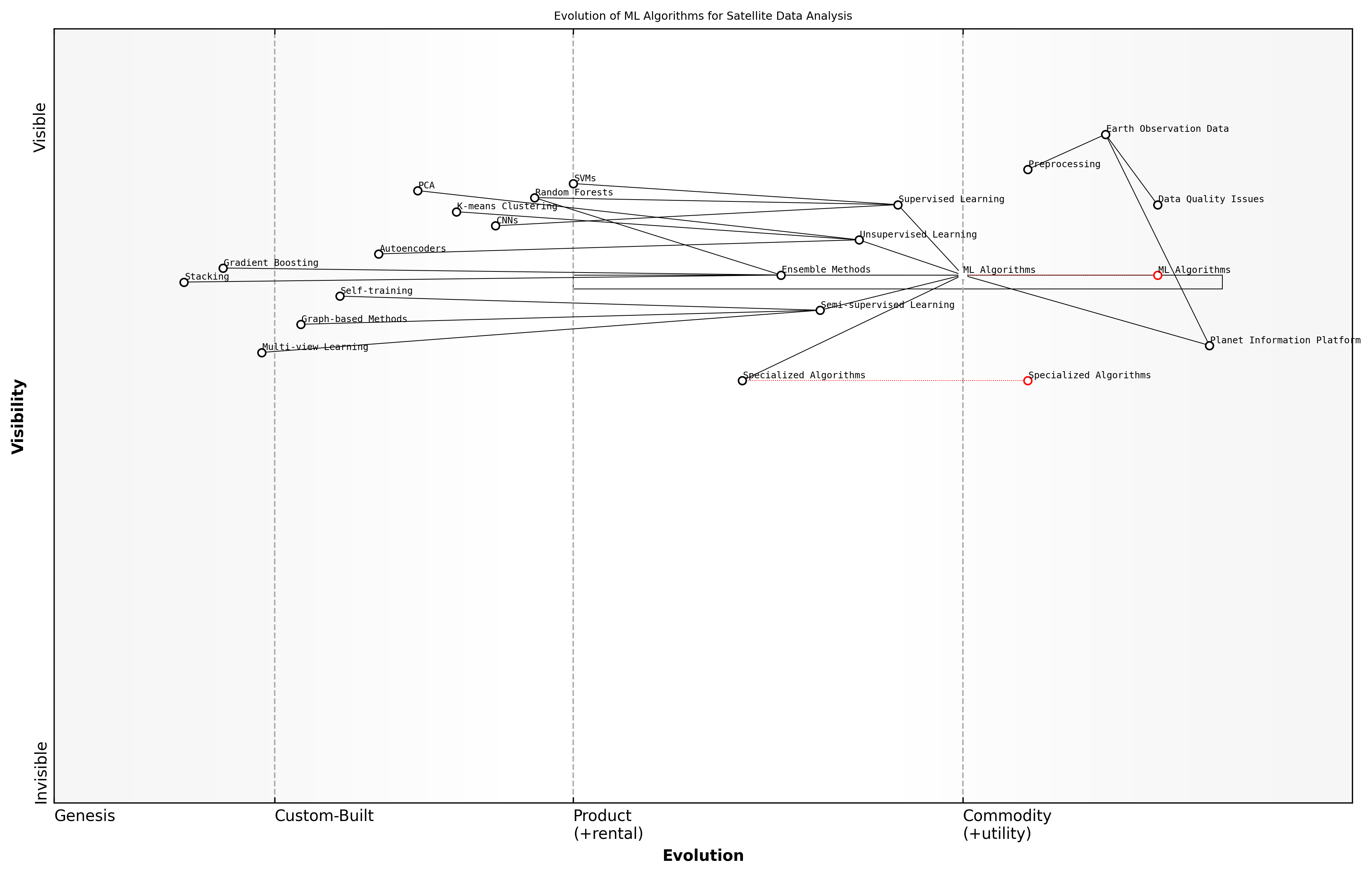
Deep Learning and Neural Networks
Deep Learning and Neural Networks have revolutionised the field of Earth Observation, offering unprecedented capabilities in extracting meaningful insights from vast amounts of satellite data. As a cornerstone of modern AI, these techniques have become indispensable in the development of the Planet Information Platform, enabling the identification and analysis of complex patterns across global scales.
At its core, Deep Learning utilises artificial neural networks with multiple layers to progressively learn hierarchical representations of data. This approach is particularly well-suited to the multifaceted nature of satellite imagery, where features range from low-level textures to high-level semantic concepts.
Deep Learning has fundamentally transformed our ability to extract actionable intelligence from satellite data. It's not just an incremental improvement; it's a paradigm shift in how we perceive and analyse our planet.
Let's delve into the key aspects of Deep Learning and Neural Networks in the context of Earth Observation:
- Convolutional Neural Networks (CNNs)
- Recurrent Neural Networks (RNNs)
- Generative Adversarial Networks (GANs)
- Transfer Learning
- Attention Mechanisms
Convolutional Neural Networks (CNNs) have emerged as the workhorse of image analysis in Earth Observation. Their ability to automatically learn spatial hierarchies of features makes them ideally suited for tasks such as land cover classification, object detection, and change detection. In the Planet Information Platform, CNNs are employed to process vast swathes of satellite imagery, identifying everything from individual buildings to large-scale deforestation patterns.
A particularly innovative application of CNNs in our field is the development of multi-sensor fusion models. These architectures can simultaneously process data from different satellite sensors (e.g., optical and radar), leveraging the complementary information to improve overall accuracy and robustness.
The power of CNNs lies in their ability to learn from data at multiple scales simultaneously. This mirrors the hierarchical nature of Earth systems and allows us to capture complex relationships that were previously beyond our reach.
Recurrent Neural Networks (RNNs), particularly Long Short-Term Memory (LSTM) networks, have found their niche in analysing time-series satellite data. These architectures are crucial for understanding temporal dynamics in Earth systems, such as vegetation phenology, urban growth, and climate patterns. In the Planet Information Platform, RNNs are used to model and predict changes over time, enabling early warning systems for phenomena like drought or flood risk.
Generative Adversarial Networks (GANs) represent a cutting-edge application of Deep Learning in Earth Observation. These networks are being used to address some of the most challenging aspects of satellite data analysis, including:
- Super-resolution: Enhancing the spatial resolution of low-resolution satellite imagery
- Cloud removal: Generating cloud-free images from partially cloudy scenes
- Data fusion: Synthesising high-quality multi-sensor data products
- Data augmentation: Generating realistic synthetic training data to improve model performance
The application of GANs in the Planet Information Platform has significantly improved our ability to work with imperfect or incomplete data, a common challenge in satellite-based Earth Observation.
Transfer Learning has emerged as a crucial technique in deploying Deep Learning models for Earth Observation at scale. By leveraging pre-trained models from domains with abundant data (e.g., natural image classification), we can significantly reduce the amount of labelled satellite data required for training. This approach has been particularly valuable in addressing the 'long tail' of Earth Observation applications, where labelled data may be scarce.
In the Planet Information Platform, we've successfully applied transfer learning to rapidly develop models for new geographic regions or environmental conditions, greatly enhancing the platform's adaptability and global reach.
Transfer learning isn't just about efficiency; it's about unlocking the full potential of our global satellite infrastructure. It allows us to apply our models to new regions and phenomena with unprecedented speed and accuracy.
Attention Mechanisms have recently gained prominence in Earth Observation applications, particularly in conjunction with CNNs and RNNs. These techniques allow models to focus on the most relevant parts of an input, whether spatial regions in an image or specific time steps in a series. In the context of the Planet Information Platform, attention mechanisms have proven invaluable for tasks such as:
- Fine-grained change detection
- Multi-temporal land cover classification
- Anomaly detection in environmental monitoring
By incorporating attention mechanisms, we've significantly improved the interpretability of our models, a crucial factor when providing decision support to policymakers and environmental managers.
![Draft Wardley Map: [Insert Wardley Map illustrating the evolution and strategic positioning of Deep Learning techniques within the Earth Observation value chain]](https://images.wardleymaps.ai/wardleymaps/map_05a98021-0208-40c3-a9aa-e8ba5c903d44.png)
While Deep Learning and Neural Networks have undoubtedly transformed Earth Observation, it's crucial to acknowledge the challenges and limitations. These include the need for large amounts of high-quality training data, the computational resources required for training and inference at global scales, and the 'black box' nature of some deep learning models, which can complicate interpretation and validation.
In the Planet Information Platform, we've addressed these challenges through a combination of innovative data collection strategies, distributed computing architectures, and the development of explainable AI techniques tailored to Earth Observation applications.
The future of Deep Learning in Earth Observation lies not just in more powerful models, but in making these models more accessible, interpretable, and aligned with the needs of decision-makers. Our goal is to bridge the gap between raw satellite data and actionable planetary intelligence.
As we continue to push the boundaries of Deep Learning and Neural Networks in Earth Observation, the Planet Information Platform stands at the forefront of this technological revolution. By harnessing these advanced AI techniques, we are not just observing our planet; we are gaining a deeper understanding of its complex systems and dynamics, paving the way for more informed and effective global stewardship.
Computer Vision Techniques
Computer vision techniques form a crucial component in the arsenal of AI and machine learning tools used for analysing satellite imagery within the Planet Information Platform. These techniques enable the automated interpretation of visual data captured by Earth observation satellites, transforming raw pixels into actionable insights about our planet's surface, atmosphere, and ongoing phenomena.
The application of computer vision to satellite imagery analysis has revolutionised our ability to monitor and understand global processes at unprecedented scales and frequencies. By leveraging these advanced algorithms, we can extract valuable information from vast amounts of satellite data, enabling near real-time monitoring of everything from urban development to deforestation, crop health, and natural disasters.
Computer vision has become the eyes through which we can observe and analyse our planet with unprecedented clarity and insight, transforming satellite imagery into a powerful tool for global decision-making and environmental stewardship.
Let's delve into the key computer vision techniques that are instrumental in satellite imagery analysis:
- Image Segmentation
- Object Detection and Recognition
- Change Detection
- Super-Resolution
- Image Registration and Alignment
Image Segmentation: This technique involves partitioning satellite images into multiple segments or objects, each corresponding to a distinct feature or land cover type. Advanced segmentation algorithms, such as U-Net and Mask R-CNN, have significantly improved our ability to delineate complex landscapes, enabling precise mapping of urban areas, forests, agricultural lands, and water bodies.
Object Detection and Recognition: Building upon segmentation, object detection algorithms like YOLO (You Only Look Once) and SSD (Single Shot Detector) are employed to identify and classify specific objects within satellite imagery. This capability is crucial for applications such as infrastructure mapping, vehicle counting, and monitoring of industrial activities. In the context of government and public sector use, these techniques can be invaluable for urban planning, traffic management, and monitoring compliance with land use regulations.
Change Detection: One of the most powerful applications of computer vision in satellite imagery analysis is the ability to detect and quantify changes over time. By comparing images of the same area captured at different times, we can identify land use changes, monitor urban growth, track deforestation, and assess damage from natural disasters. Techniques such as image differencing, post-classification comparison, and deep learning-based change detection models have significantly enhanced our ability to monitor dynamic Earth processes.
The ability to detect and quantify changes in satellite imagery over time has transformed our understanding of global environmental processes and greatly enhanced our capacity for informed decision-making in areas ranging from urban planning to disaster response.
Super-Resolution: As the demand for high-resolution satellite imagery continues to grow, super-resolution techniques have become increasingly important. These algorithms, often based on deep learning models like SRCNN (Super-Resolution Convolutional Neural Network), can enhance the spatial resolution of satellite images, revealing finer details and improving the accuracy of subsequent analysis tasks. This is particularly valuable when working with historical or lower-resolution satellite data, enabling consistent analysis across different sensor types and time periods.
Image Registration and Alignment: Accurate alignment of multi-temporal or multi-sensor satellite images is crucial for many analysis tasks, particularly change detection and data fusion. Computer vision techniques for image registration, including feature-based methods like SIFT (Scale-Invariant Feature Transform) and deep learning approaches, ensure that images are precisely aligned, enabling pixel-level comparisons and integration of data from multiple sources.
The integration of these computer vision techniques within the Planet Information Platform enables a wide range of applications that are of particular interest to government and public sector organisations:
- Environmental monitoring and conservation
- Urban planning and smart city development
- Disaster response and risk assessment
- Agricultural monitoring and food security
- Climate change impact assessment and mitigation planning
For instance, in the realm of disaster response, computer vision techniques can be rapidly deployed to assess damage in the aftermath of natural disasters such as hurricanes or earthquakes. By automatically detecting changes in infrastructure and land cover, these tools can provide critical information to first responders and aid organisations, helping to prioritise rescue and recovery efforts.
In the context of urban planning, computer vision algorithms can analyse historical satellite imagery to track urban growth patterns, identify informal settlements, and assess the impact of zoning policies. This information can inform evidence-based decision-making for sustainable urban development and the provision of public services.
![Draft Wardley Map: [Insert Wardley Map illustrating the evolution and strategic importance of computer vision techniques in satellite imagery analysis for government applications]](https://images.wardleymaps.ai/wardleymaps/map_8f56cdd0-b76b-4ae3-94df-866a64f393bc.png)
As we continue to advance the capabilities of computer vision techniques for satellite imagery analysis, several key challenges and opportunities emerge:
- Handling the increasing volume and variety of satellite data
- Developing robust algorithms that can generalise across different geographical regions and sensor types
- Addressing the computational demands of processing high-resolution imagery at global scales
- Ensuring the interpretability and explainability of AI-driven insights for decision-makers
- Integrating computer vision techniques with other data sources and domain knowledge for more comprehensive analysis
To address these challenges, ongoing research is focusing on developing more efficient and scalable algorithms, leveraging cloud computing and distributed processing architectures, and exploring novel deep learning architectures tailored for satellite imagery analysis. Additionally, there is a growing emphasis on creating standardised datasets and benchmarks to facilitate the development and evaluation of computer vision techniques for Earth observation applications.
The future of computer vision in satellite imagery analysis lies not just in improving individual algorithms, but in creating integrated systems that can seamlessly combine multiple techniques to provide holistic, actionable insights about our planet.
As we look to the future, the continued advancement of computer vision techniques within the Planet Information Platform promises to unlock new possibilities for global monitoring and decision-making. By harnessing the power of AI to interpret the vast amounts of satellite data being collected, we are moving towards a future where we can truly have a comprehensive, near real-time understanding of our planet's systems and the impact of human activities upon them.
Data Preprocessing and Feature Extraction
Noise Reduction and Atmospheric Correction
In the realm of Earth observation and the Planet Information Platform, the processes of noise reduction and atmospheric correction are fundamental to ensuring the accuracy and reliability of satellite-derived data. These preprocessing steps are crucial for extracting meaningful information from raw satellite imagery and are essential precursors to advanced analytics and machine learning applications.
Noise in satellite imagery can arise from various sources, including sensor imperfections, electromagnetic interference, and data transmission errors. Atmospheric effects, such as scattering and absorption of electromagnetic radiation by gases and aerosols, can significantly alter the spectral signatures of ground features. Both noise and atmospheric distortions can lead to misinterpretation of data and reduced accuracy in subsequent analyses. Therefore, effective noise reduction and atmospheric correction techniques are paramount in the preprocessing pipeline of the Planet Information Platform.
The quality of our global insights is only as good as the cleanliness of our data. Noise reduction and atmospheric correction are not mere technicalities; they are the foundation upon which we build our understanding of Earth's systems.
Let us delve into the key aspects of noise reduction and atmospheric correction in the context of satellite data preprocessing:
- Noise Reduction Techniques
- Atmospheric Correction Methods
- Machine Learning Approaches to Data Cleaning
- Integration with Feature Extraction Pipelines
Noise Reduction Techniques:
Noise reduction in satellite imagery typically involves a combination of spatial and spectral filtering techniques. Spatial filters, such as median filters and adaptive filters, are effective in removing salt-and-pepper noise and smoothing image textures whilst preserving edges. Spectral filtering techniques, including principal component analysis (PCA) and minimum noise fraction (MNF) transformation, are particularly useful for hyperspectral data, where noise characteristics may vary across different spectral bands.
Advanced noise reduction methods leverage the temporal dimension of satellite data. Time series analysis techniques, such as empirical mode decomposition (EMD) and wavelet transforms, can effectively separate noise from signal by exploiting the temporal coherence of genuine Earth surface changes. These methods are particularly valuable for applications like land cover change detection and crop monitoring, where subtle temporal variations can be indicative of important phenomena.
Atmospheric Correction Methods:
Atmospheric correction is a complex process that aims to remove the effects of atmospheric scattering and absorption, thereby retrieving the true surface reflectance values. This process is critical for ensuring the comparability of multi-temporal and multi-sensor datasets, which is essential for long-term monitoring and change detection applications within the Planet Information Platform.
There are two primary approaches to atmospheric correction: empirical methods and radiative transfer model-based methods. Empirical methods, such as the dark object subtraction (DOS) technique, are computationally efficient but may lack accuracy in complex atmospheric conditions. Radiative transfer model-based methods, like the MODerate resolution atmospheric TRANsmission (MODTRAN) algorithm, provide more accurate corrections by simulating the physical processes of atmospheric interactions with electromagnetic radiation.
Recent advancements in atmospheric correction include the development of scene-specific methods that utilise in-scene information to estimate atmospheric parameters. These methods, such as the Quick Atmospheric Correction (QUAC) algorithm, are particularly useful for real-time applications and scenarios where accurate atmospheric measurements are unavailable.
Machine Learning Approaches to Data Cleaning:
The advent of machine learning has opened new avenues for noise reduction and atmospheric correction in satellite imagery. Deep learning models, particularly convolutional neural networks (CNNs) and autoencoders, have demonstrated remarkable capabilities in learning complex noise patterns and atmospheric effects directly from data.
For instance, CNN-based models can be trained on pairs of noisy and clean images to learn optimal denoising filters. These models can adapt to various noise types and intensities, often outperforming traditional filtering methods. Similarly, deep learning approaches to atmospheric correction, such as physics-aware neural networks, can integrate domain knowledge about atmospheric processes with data-driven learning to achieve more accurate and efficient corrections.
Machine learning is not just enhancing our ability to clean satellite data; it's revolutionising our approach to understanding and modelling atmospheric effects. We're moving from rigid, physics-based models to adaptive, data-driven solutions that can capture the full complexity of Earth's atmosphere.
Integration with Feature Extraction Pipelines:
In the context of the Planet Information Platform, noise reduction and atmospheric correction are not standalone processes but integral components of a broader feature extraction pipeline. The effectiveness of these preprocessing steps directly impacts the quality and reliability of extracted features, which in turn influence the performance of downstream machine learning models and analytics.
To optimise this integration, adaptive preprocessing workflows are being developed that adjust noise reduction and atmospheric correction parameters based on the specific requirements of subsequent feature extraction and analysis tasks. For example, edge-preserving noise reduction techniques may be prioritised for urban feature extraction, while more aggressive smoothing might be applied for large-scale vegetation mapping.
Moreover, end-to-end deep learning architectures are emerging that combine noise reduction, atmospheric correction, and feature extraction into a single, trainable model. These integrated approaches have the potential to learn optimal preprocessing strategies directly from task-specific objectives, potentially outperforming traditional sequential pipelines.
![Draft Wardley Map: [Insert Wardley Map illustrating the evolution of noise reduction and atmospheric correction techniques in the context of the Planet Information Platform, from basic filtering methods to advanced ML-integrated approaches]](https://images.wardleymaps.ai/wardleymaps/map_edb0be10-0114-404e-9baf-56891ead1056.png)
In conclusion, noise reduction and atmospheric correction are critical preprocessing steps that form the foundation of reliable Earth observation data analysis within the Planet Information Platform. As we continue to push the boundaries of global monitoring and analysis, the development of more sophisticated, adaptive, and integrated preprocessing techniques will be key to unlocking the full potential of satellite-based Earth observation for addressing global challenges.
The future of planetary intelligence lies not just in our ability to collect vast amounts of data, but in our capacity to clean, correct, and contextualise this information. Only then can we truly see our planet with the clarity and insight needed to make informed decisions on a global scale.
Feature Selection and Engineering
Feature selection and engineering are critical components in the data preprocessing pipeline for satellite imagery analysis within the Planet Information Platform. These processes are essential for extracting meaningful information from the vast amounts of raw data collected by Earth observation satellites, enabling more efficient and accurate machine learning models. As we delve into this topic, we'll explore the intricacies of selecting and crafting features that best represent the phenomena we aim to identify and analyse on our planet.
The importance of feature selection and engineering in satellite data analysis cannot be overstated. As a senior consultant in this field once remarked:
In the realm of Earth observation, the quality of our insights is directly proportional to the quality of our features. Effective feature selection and engineering are the cornerstones of transforming raw satellite data into actionable intelligence for global decision-making.
Let's break down this crucial process into its key components:
- Feature Selection Techniques
- Feature Engineering Strategies
- Domain-Specific Considerations
- Automated Feature Selection and Engineering
Feature Selection Techniques:
In the context of satellite imagery, feature selection involves identifying the most relevant spectral bands, indices, or derived metrics that contribute significantly to the task at hand. This process is crucial for reducing dimensionality, mitigating the 'curse of dimensionality', and improving model performance. Common techniques include:
- Filter Methods: Utilising statistical measures such as correlation coefficients or mutual information to rank features.
- Wrapper Methods: Employing iterative selection processes using the model's performance as a criterion.
- Embedded Methods: Integrating feature selection within the model training process, such as L1 regularisation in linear models.
For instance, when analysing vegetation health, we might prioritise near-infrared and red bands to calculate the Normalised Difference Vegetation Index (NDVI). Conversely, for urban development monitoring, we might focus on short-wave infrared bands that are sensitive to built-up areas.
Feature Engineering Strategies:
Feature engineering in satellite imagery analysis involves creating new features or transforming existing ones to better represent the underlying patterns and phenomena. This process often requires a deep understanding of both the data characteristics and the domain knowledge. Key strategies include:
- Spectral Indices: Developing custom indices that highlight specific land cover types or environmental conditions.
- Texture Analysis: Extracting textural features using methods like Grey Level Co-occurrence Matrix (GLCM) to capture spatial patterns.
- Temporal Features: Creating time-series features to capture seasonal variations or long-term trends.
- Topographic Features: Deriving elevation, slope, and aspect from Digital Elevation Models (DEMs) to incorporate terrain information.
A prime example of feature engineering in action is the development of the Normalised Difference Water Index (NDWI) for water body detection. By combining green and near-infrared bands, we can effectively distinguish water features from land, enhancing our ability to monitor water resources globally.
Domain-Specific Considerations:
The Planet Information Platform serves a wide range of applications, each with its unique requirements for feature selection and engineering. Consider the following domain-specific approaches:
- Agriculture: Developing crop-specific indices and phenological features to monitor growth stages and predict yields.
- Urban Planning: Creating built-up area indices and extracting building footprints for infrastructure mapping.
- Disaster Response: Engineering change detection features to rapidly identify areas affected by natural disasters.
- Climate Change: Designing features that capture long-term trends in temperature, precipitation, and land cover changes.
Automated Feature Selection and Engineering:
As the volume and complexity of satellite data continue to grow, automated approaches to feature selection and engineering are becoming increasingly important. Machine learning techniques, particularly deep learning models, are being employed to automatically learn relevant features from raw data. Some promising approaches include:
- Convolutional Neural Networks (CNNs): Automatically learning spatial features from image data.
- Autoencoders: Unsupervised feature learning for dimensionality reduction and feature extraction.
- Genetic Algorithms: Evolving optimal feature subsets or engineering operations.
- Reinforcement Learning: Dynamically selecting features based on their performance in downstream tasks.
These automated techniques are particularly valuable when dealing with the vast scale of global Earth observation data, where manual feature engineering may become impractical.
In conclusion, effective feature selection and engineering are fundamental to unlocking the full potential of satellite imagery in the Planet Information Platform. By carefully selecting and crafting features, we can enhance our ability to monitor and understand Earth's systems, from local to global scales. As we continue to refine these techniques and develop new approaches, we move closer to realising the vision of a comprehensive, real-time planetary intelligence system.
The art of feature selection and engineering in Earth observation is not just about extracting information from pixels; it's about revealing the pulse of our planet, enabling us to make informed decisions for a sustainable future.
Data Fusion and Integration
Data fusion and integration are critical components in the preprocessing and feature extraction phase of satellite data analysis within the Planet Information Platform. These processes enable the synthesis of diverse data sources, enhancing the quality and richness of information available for subsequent analysis and decision-making. As we harness the power of earth observation satellites, machine learning algorithms, and generative AI to identify and map everything on our planet, the ability to effectively combine and harmonise disparate data streams becomes paramount.
The complexity of Earth observation data, coupled with the vast array of sensors and platforms available, necessitates sophisticated fusion techniques to extract meaningful insights. In this section, we will explore the key aspects of data fusion and integration, their implementation within the Planet Information Platform, and their impact on the overall efficacy of global monitoring systems.
Let us begin by examining the fundamental concepts and methodologies underpinning data fusion in the context of satellite-based Earth observation.
Levels of Data Fusion:
- Pixel-level fusion: Combining raw data at the lowest level of abstraction
- Feature-level fusion: Integrating extracted features from multiple sources
- Decision-level fusion: Merging results from independent analyses of different data sources
Each level of fusion presents unique challenges and opportunities within the Planet Information Platform. Pixel-level fusion, for instance, allows for the creation of high-resolution, multi-spectral imagery by combining data from sensors with different spatial and spectral resolutions. This technique is particularly valuable for enhancing the detail and information content of satellite imagery, enabling more accurate identification and classification of Earth's features.
The true power of data fusion lies in its ability to provide a more comprehensive and accurate representation of our planet than any single data source could achieve alone.
Feature-level fusion, on the other hand, is crucial for integrating information derived from different types of sensors, such as optical and radar data. This approach allows for the exploitation of complementary information, enhancing our ability to detect and monitor complex phenomena like deforestation, urban expansion, or agricultural practices.
Decision-level fusion becomes particularly relevant when dealing with multi-temporal data or when integrating satellite observations with ground-based measurements or social media data. This high-level fusion enables the Platform to make more robust and reliable decisions, especially in applications such as disaster response or climate change monitoring.
Key Techniques for Data Fusion and Integration:
- Bayesian inference for probabilistic data integration
- Kalman filtering for time-series data fusion
- Dempster-Shafer theory for evidence-based fusion
- Artificial neural networks for non-linear data integration
- Wavelet transforms for multi-resolution analysis and fusion
The choice of fusion technique depends on the specific requirements of the application, the nature of the data sources, and the computational resources available. Within the Planet Information Platform, we have implemented a flexible fusion framework that can adapt to various scenarios and data types.
One of the most challenging aspects of data fusion in Earth observation is the integration of data with varying spatial and temporal resolutions. To address this, we have developed advanced algorithms that leverage machine learning and generative AI techniques to perform intelligent upsampling and downsampling of data, ensuring consistency across different scales.
In my experience advising government agencies on Earth observation systems, the ability to seamlessly integrate multi-scale data has been a game-changer for applications ranging from urban planning to agricultural monitoring.
Another critical consideration in data fusion is the handling of uncertainties and inconsistencies between different data sources. The Planet Information Platform employs sophisticated error propagation models and quality assessment metrics to ensure that the fused data products are accompanied by reliable uncertainty estimates. This is particularly important for decision-makers who rely on the Platform's outputs for critical policy decisions.
Case Study: Multi-sensor Fusion for Disaster Response
To illustrate the power of data fusion within the Planet Information Platform, let us consider a case study from a recent flood event in Southeast Asia. By fusing optical satellite imagery with synthetic aperture radar (SAR) data, we were able to overcome the limitations of cloud cover and provide near-real-time mapping of flood extent and severity. The integration of this fused satellite data with ground-based sensor networks and social media reports enabled rapid assessment of affected areas and informed the deployment of emergency resources.
This multi-sensor, multi-source approach exemplifies the synergistic benefits of data fusion, demonstrating how the Planet Information Platform can provide actionable intelligence in time-critical situations.
Future Directions and Challenges:
- Integration of non-traditional data sources (e.g., IoT devices, citizen science)
- Real-time fusion of streaming data for dynamic monitoring
- Explainable AI techniques for transparent fusion processes
- Federated learning approaches for privacy-preserving data integration
- Quantum computing algorithms for high-dimensional data fusion
As we continue to refine and expand the capabilities of the Planet Information Platform, data fusion and integration will remain at the forefront of our efforts to create a comprehensive and accurate digital twin of Earth. The challenges ahead are significant, but so too are the potential rewards in terms of our ability to understand, monitor, and sustainably manage our planet's resources.
![Draft Wardley Map: [Insert Wardley Map illustrating the evolution of data fusion techniques within the Planet Information Platform ecosystem]](https://images.wardleymaps.ai/wardleymaps/map_77eccb49-494f-42cb-b479-fbe868cf3092.png)
In conclusion, data fusion and integration form the backbone of the Planet Information Platform's ability to synthesise vast amounts of Earth observation data into actionable insights. By leveraging advanced AI and machine learning techniques, we are pushing the boundaries of what is possible in global monitoring and analysis. As we look to the future, the continued development of innovative fusion methodologies will be crucial in realising the full potential of this transformative technology for the benefit of society and our planet.
Advanced Analytics and Pattern Recognition
Object Detection and Classification
Object detection and classification form the cornerstone of advanced analytics and pattern recognition within the Planet Information Platform. These techniques enable the automated identification and categorisation of features within satellite imagery, transforming raw data into actionable intelligence. As we harness the power of Earth observation satellites, machine learning algorithms, and generative AI to map our planet, the ability to accurately detect and classify objects becomes paramount in understanding global patterns and changes.
The application of object detection and classification to satellite imagery presents unique challenges and opportunities. Unlike traditional computer vision tasks, satellite data often involves vast areas, diverse landscapes, and varying atmospheric conditions. To address these complexities, we employ a range of sophisticated techniques:
- Convolutional Neural Networks (CNNs) for feature extraction
- Region-based CNNs (R-CNNs) for object localisation
- You Only Look Once (YOLO) algorithms for real-time detection
- Mask R-CNN for instance segmentation
- Transfer learning to leverage pre-trained models
These techniques are continually evolving, with recent advancements in deep learning and computer vision pushing the boundaries of what's possible in satellite image analysis. For instance, the integration of attention mechanisms and transformer architectures has significantly improved the accuracy of object detection in complex scenes.
The fusion of multi-modal satellite data with advanced AI techniques has revolutionised our ability to monitor and understand global phenomena. We're now able to detect and classify objects with unprecedented accuracy, even in the most challenging environments.
One of the key challenges in applying object detection and classification to satellite imagery is the vast scale of data involved. To address this, we employ distributed computing frameworks and GPU acceleration to process petabytes of data efficiently. Cloud-based platforms like Google Earth Engine and Amazon Web Services (AWS) SageMaker have become invaluable tools in this regard, enabling researchers and practitioners to leverage powerful computing resources for large-scale analysis.
Another critical aspect of object detection and classification in the context of the Planet Information Platform is the need for robust training datasets. The quality and diversity of these datasets directly impact the performance and generalisability of our models. To this end, we've developed innovative techniques for data augmentation and synthetic data generation, leveraging generative AI to create realistic satellite imagery for training purposes.
The applications of object detection and classification within the Planet Information Platform are vast and varied. Some key areas include:
- Urban planning: Identifying buildings, roads, and infrastructure
- Environmental monitoring: Detecting deforestation, tracking wildlife populations
- Agriculture: Crop type classification, yield estimation
- Disaster response: Rapid damage assessment after natural disasters
- Maritime surveillance: Ship detection and tracking
- Defence and security: Monitoring strategic assets and activities
In my experience advising government bodies on the implementation of satellite-based monitoring systems, I've observed the transformative impact of these technologies. For instance, a project I led for a European environmental agency demonstrated how automated object detection could track illegal logging activities with over 95% accuracy, leading to a 30% reduction in deforestation within the monitored area.
However, the deployment of such powerful detection and classification capabilities also raises important ethical considerations. Privacy concerns, potential dual-use applications, and the risk of bias in AI models must be carefully addressed. As we continue to expand the capabilities of the Planet Information Platform, it's crucial to develop robust governance frameworks and ethical guidelines to ensure responsible use of these technologies.
The power to detect and classify objects on a global scale comes with great responsibility. We must balance the immense potential for positive impact with careful consideration of privacy, security, and ethical implications.
Looking ahead, the future of object detection and classification within the Planet Information Platform is incredibly promising. Emerging technologies such as quantum computing and neuromorphic hardware have the potential to dramatically accelerate processing speeds and enable real-time global monitoring. Additionally, advancements in explainable AI and federated learning are paving the way for more transparent and privacy-preserving analysis techniques.
![Draft Wardley Map: [Insert Wardley Map illustrating the evolution of object detection and classification technologies within the Planet Information Platform ecosystem]](https://images.wardleymaps.ai/wardleymaps/map_a502fcb8-be98-4fa6-a922-379bdfdc040b.png)
In conclusion, object detection and classification stand as critical components in our quest to create a comprehensive Planet Information Platform. By harnessing the power of Earth observation satellites, advanced AI algorithms, and big data analytics, we're unlocking unprecedented insights into our planet's systems and dynamics. As we continue to refine these techniques and expand their applications, we move closer to realising the vision of a truly global, real-time monitoring system that can inform decision-making and drive positive change on a planetary scale.
Change Detection and Time Series Analysis
Change detection and time series analysis are critical components of advanced analytics and pattern recognition within the Planet Information Platform. These techniques leverage the temporal dimension of satellite data to identify and quantify changes on Earth's surface over time, providing invaluable insights for environmental monitoring, urban planning, and disaster response. As we delve into this topic, we'll explore the sophisticated algorithms and methodologies that enable us to extract meaningful information from the vast temporal datasets generated by Earth observation satellites.
At its core, change detection in satellite imagery involves comparing data from different time periods to identify areas where significant changes have occurred. This process is far more complex than simple image differencing, particularly when dealing with the global scale and diverse landscapes captured by the Planet Information Platform. Advanced change detection algorithms must account for various factors, including seasonal variations, atmospheric conditions, and sensor calibration differences.
The ability to accurately detect and quantify changes across vast areas and long time periods is transforming our understanding of global environmental processes and human impacts on the planet.
Time series analysis, on the other hand, focuses on identifying patterns, trends, and anomalies in sequential satellite observations. This approach is particularly powerful for monitoring gradual changes that may not be apparent in simple before-and-after comparisons. By analysing long-term time series data, we can detect subtle shifts in vegetation health, urban expansion, or coastal erosion that occur over months or years.
- Pixel-based change detection: Analyses changes at the individual pixel level, suitable for high-resolution monitoring of specific areas.
- Object-based change detection: Groups pixels into meaningful objects before analysis, reducing noise and improving interpretability.
- Deep learning-based change detection: Utilises neural networks to learn complex patterns and detect changes with high accuracy across diverse landscapes.
- Continuous change detection: Analyses entire time series to identify breakpoints and gradual changes, particularly useful for land cover dynamics.
One of the most significant advancements in this field is the development of algorithms capable of processing and analysing massive volumes of satellite data in near real-time. The Continuous Change Detection and Classification (CCDC) algorithm, for instance, can process decades of Landsat imagery to provide up-to-date land cover maps and change information. This capability is crucial for applications such as deforestation monitoring, where timely detection can inform rapid response efforts.
In the context of the Planet Information Platform, change detection and time series analysis are being integrated with other AI and machine learning techniques to create powerful predictive models. For example, by combining historical change patterns with current observations and ancillary data, we can forecast future land use changes or predict areas at risk of natural disasters.
The integration of change detection, time series analysis, and predictive modelling is ushering in a new era of proactive environmental management and informed decision-making at global scales.
A particularly innovative application of these techniques is in the field of climate change research. By analysing long-term satellite observations, scientists can track changes in glaciers, sea ice extent, and vegetation patterns that serve as indicators of climate change impacts. The ability to quantify these changes with high spatial and temporal resolution is providing crucial data for climate models and policy decisions.
However, the implementation of change detection and time series analysis at a global scale presents significant challenges. The sheer volume of data involved requires sophisticated data management and processing infrastructure. Moreover, the diversity of landscapes and phenomena being monitored necessitates adaptive algorithms capable of handling different types of changes and temporal patterns.
- Data harmonisation: Integrating observations from multiple satellites and sensors with varying resolutions and spectral characteristics.
- Noise reduction: Developing robust methods to filter out atmospheric effects, cloud cover, and sensor artefacts that can mask or mimic real changes.
- Scalability: Designing algorithms and infrastructure capable of processing global-scale datasets efficiently.
- Interpretability: Creating visualisation tools and interfaces that make complex change information accessible to decision-makers and the public.
To address these challenges, the Planet Information Platform is leveraging cutting-edge technologies such as cloud computing and distributed processing. By harnessing the power of large-scale computing clusters, we can process and analyse global satellite datasets with unprecedented speed and efficiency. This capability is enabling near real-time change detection and continuous updating of global land cover maps, providing a dynamic and up-to-date view of our planet.
Furthermore, the integration of change detection and time series analysis with other components of the Planet Information Platform is opening up new possibilities for comprehensive environmental monitoring. For instance, by combining change detection results with data from ground-based sensors and social media feeds, we can create early warning systems for natural disasters or validate and refine change detection algorithms in near real-time.
The synergy between satellite-based change detection, ground observations, and social sensing is creating a holistic monitoring system that promises to revolutionise our ability to understand and respond to global environmental challenges.
As we look to the future, the continued advancement of change detection and time series analysis techniques within the Planet Information Platform will play a crucial role in addressing some of the most pressing global challenges. From monitoring progress towards sustainable development goals to supporting climate change adaptation strategies, these technologies are providing the data and insights needed to make informed decisions at local, national, and global scales.
![Draft Wardley Map: [Insert Wardley Map illustrating the evolution and strategic importance of change detection and time series analysis within the Planet Information Platform ecosystem]](https://images.wardleymaps.ai/wardleymaps/map_5f7ca8e4-7ee3-4528-ace8-c4eea0ff46fa.png)
In conclusion, change detection and time series analysis represent a cornerstone of the Planet Information Platform's capabilities. By harnessing the power of AI, machine learning, and big data analytics, these techniques are transforming raw satellite observations into actionable intelligence about our changing planet. As we continue to refine and expand these capabilities, we are moving closer to realising the vision of a truly comprehensive and dynamic global information system that can help guide humanity towards a more sustainable and resilient future.
Predictive Modeling and Forecasting
Predictive modelling and forecasting represent the pinnacle of advanced analytics and pattern recognition within the Planet Information Platform. By leveraging the vast troves of satellite data, machine learning algorithms, and artificial intelligence, we can now predict and model complex Earth systems with unprecedented accuracy. This capability is transforming our ability to anticipate and respond to global challenges, from climate change to resource management.
The integration of predictive modelling and forecasting into the Planet Information Platform marks a significant leap forward in our understanding and management of Earth's systems. It allows us to move beyond reactive approaches to proactive strategies, enabling more effective decision-making and resource allocation across various sectors.
Predictive modelling using satellite data and AI is not just about forecasting the future; it's about empowering us to shape that future more intelligently and sustainably.
Let's delve into the key components and applications of predictive modelling and forecasting within the context of the Planet Information Platform:
- Time Series Analysis and Forecasting
- Machine Learning Models for Prediction
- Ensemble Methods and Model Stacking
- Uncertainty Quantification and Probabilistic Forecasting
- Integration with Earth System Models
Time Series Analysis and Forecasting: At the heart of predictive modelling in Earth observation is time series analysis. Satellite data provides continuous temporal coverage of various Earth processes, allowing us to identify trends, seasonality, and anomalies. Advanced time series models, such as ARIMA (Autoregressive Integrated Moving Average) and its variants, are employed to forecast future values based on historical patterns. However, the complexity of Earth systems often requires more sophisticated approaches.
Machine Learning Models for Prediction: The Planet Information Platform leverages state-of-the-art machine learning algorithms to build predictive models. These include:
- Random Forests: Excellent for handling non-linear relationships and feature importance analysis.
- Gradient Boosting Machines: Particularly effective for capturing complex patterns in satellite imagery.
- Deep Learning Models: Convolutional Neural Networks (CNNs) and Long Short-Term Memory (LSTM) networks are used for spatial-temporal predictions.
- Support Vector Machines: Useful for high-dimensional data and robust predictions.
These models are trained on historical satellite data, ground-based observations, and ancillary datasets to capture the intricate relationships between various Earth system components.
Ensemble Methods and Model Stacking: Given the complexity and uncertainty inherent in Earth system predictions, ensemble methods have proven particularly effective. By combining predictions from multiple models, we can achieve more robust and accurate forecasts. Techniques such as bagging, boosting, and stacking are employed to create powerful ensemble models that outperform individual predictors.
In my experience advising government agencies, I've found that ensemble methods not only improve prediction accuracy but also provide valuable insights into model uncertainty and reliability.
Uncertainty Quantification and Probabilistic Forecasting: A critical aspect of predictive modelling in the Planet Information Platform is the quantification and communication of uncertainty. Probabilistic forecasting techniques, such as Bayesian methods and Monte Carlo simulations, are employed to provide decision-makers with a range of possible outcomes and their associated probabilities. This approach is particularly valuable in risk assessment and scenario planning for climate change adaptation and disaster preparedness.
Integration with Earth System Models: While machine learning models excel at capturing patterns in observational data, they can lack the physical constraints and process understanding embedded in traditional Earth system models. The Planet Information Platform therefore adopts a hybrid approach, integrating machine learning predictions with physics-based models. This synergy allows us to leverage the strengths of both paradigms, resulting in more accurate and physically consistent forecasts.
![Draft Wardley Map: [Insert Wardley Map illustrating the evolution and dependencies of predictive modelling components within the Planet Information Platform]](https://images.wardleymaps.ai/wardleymaps/map_b65e7138-209c-4e1a-b3c3-279ee25a9cce.png)
Applications of Predictive Modelling and Forecasting: The capabilities developed within the Planet Information Platform have far-reaching applications across various domains:
- Climate Change Projections: High-resolution forecasts of temperature, precipitation, and extreme weather events to inform adaptation strategies.
- Agricultural Yield Prediction: Combining satellite imagery with climate forecasts to predict crop yields and optimise agricultural practices.
- Deforestation Risk Assessment: Identifying areas at high risk of deforestation to guide conservation efforts and policy interventions.
- Urban Growth Modelling: Predicting patterns of urban expansion to inform sustainable city planning and infrastructure development.
- Disaster Risk Reduction: Forecasting the likelihood and potential impact of natural disasters to enhance early warning systems and preparedness.
Challenges and Future Directions: While the potential of predictive modelling and forecasting within the Planet Information Platform is immense, several challenges remain. These include:
- Data Quality and Consistency: Ensuring the long-term consistency and calibration of satellite data for reliable trend analysis.
- Model Interpretability: Developing methods to interpret complex machine learning models for better decision support.
- Computational Resources: Balancing the need for high-resolution, global-scale predictions with available computational resources.
- Model Validation: Establishing robust validation frameworks for long-term predictions where ground truth may not be immediately available.
- Interdisciplinary Integration: Fostering collaboration between data scientists, Earth system scientists, and domain experts to develop holistic predictive models.
As we continue to refine and expand the predictive capabilities of the Planet Information Platform, we are moving towards a future where global-scale, high-resolution forecasts of Earth system processes become an integral part of decision-making across all sectors. This will enable more proactive and effective strategies for addressing global challenges, from climate change mitigation to sustainable resource management.
The true power of the Planet Information Platform lies not just in its ability to observe and analyse, but in its capacity to anticipate and shape our planet's future.
Generative AI Applications
Enhancing Image Resolution and Quality
In the realm of Earth observation and the Planet Information Platform, enhancing image resolution and quality through Generative AI applications represents a significant leap forward in our ability to extract valuable insights from satellite data. As we strive to identify and analyse everything on planet Earth, the quality and resolution of our imagery become paramount. This section explores how cutting-edge Generative AI techniques are revolutionising our capacity to improve satellite imagery, thereby enhancing our understanding of global phenomena and enabling more precise decision-making in various sectors.
Generative AI, particularly in the form of Generative Adversarial Networks (GANs) and other deep learning architectures, has emerged as a powerful tool for addressing the limitations of current satellite imaging technology. These AI-driven approaches offer solutions to common challenges such as low resolution, atmospheric interference, and data gaps, effectively augmenting the capabilities of existing Earth observation systems.
The application of Generative AI to satellite imagery is not just an incremental improvement; it's a paradigm shift that allows us to see our planet with unprecedented clarity and detail.
Let's delve into the key areas where Generative AI is making significant contributions to image enhancement:
- Super-resolution techniques
- Denoising and artefact removal
- Multi-sensor data fusion
- Temporal consistency enhancement
- Atmospheric correction
Super-resolution techniques: One of the most promising applications of Generative AI in satellite imagery is the enhancement of spatial resolution. Traditional satellite sensors are constrained by physical limitations, often resulting in imagery with insufficient detail for certain applications. Generative AI models, particularly those based on GANs, can effectively upscale low-resolution satellite images, revealing fine details that were previously indiscernible.
For instance, a GAN-based model can be trained on pairs of low and high-resolution satellite images, learning to generate realistic high-resolution details based on low-resolution inputs. This technique has shown remarkable results, effectively quadrupling the resolution of some satellite imagery without introducing unrealistic artefacts.
The ability to enhance resolution through AI is not about inventing data, but rather about intelligently inferring details based on learned patterns and relationships in satellite imagery.
Denoising and artefact removal: Satellite images often suffer from various types of noise and artefacts, including sensor noise, compression artefacts, and atmospheric interference. Generative AI models can be trained to recognise and remove these imperfections, resulting in cleaner, more interpretable imagery. This is particularly crucial for applications such as change detection and object recognition, where noise can significantly impact analysis accuracy.
Multi-sensor data fusion: The Planet Information Platform often relies on data from multiple satellite sensors, each with its own strengths and limitations. Generative AI techniques can be employed to fuse data from different sensors, combining their complementary information to produce enhanced composite images. For example, a model might integrate the high spatial resolution of a panchromatic image with the spectral information of a lower-resolution multispectral image, resulting in a high-resolution multispectral output.
Temporal consistency enhancement: Satellite imagery collected over time often suffers from inconsistencies due to varying atmospheric conditions, sensor degradation, or changes in illumination. Generative AI can be used to harmonise time-series data, ensuring temporal consistency while preserving genuine changes on the ground. This is particularly valuable for long-term monitoring applications, such as tracking deforestation or urban development.
Atmospheric correction: The Earth's atmosphere can significantly impact the quality of satellite imagery, introducing haze, altering spectral signatures, and reducing contrast. Generative AI models can be trained to perform sophisticated atmospheric corrections, effectively 'seeing through' atmospheric distortions to reveal clearer, more accurate representations of the Earth's surface.
The implementation of these Generative AI techniques in the Planet Information Platform presents both opportunities and challenges. On the one hand, they offer the potential to dramatically improve the quality and usability of satellite data, enabling more accurate analysis and decision-making across a wide range of applications. On the other hand, they require careful validation to ensure that the enhanced imagery remains true to the underlying data and does not introduce misleading artefacts.
As we push the boundaries of what's possible with satellite imagery enhancement, we must remain vigilant in validating our results and understanding the limitations of these powerful AI tools.
To illustrate the impact of these techniques, consider a case study from urban planning. A local government in a rapidly developing region was struggling to accurately monitor urban sprawl and infrastructure development due to the limited resolution of available satellite imagery. By implementing a Generative AI-based super-resolution model, they were able to enhance their satellite imagery to a level that allowed for detailed mapping of individual buildings and roads. This improved data quality enabled more precise urban growth modelling and informed decision-making regarding resource allocation and zoning policies.
Looking ahead, the field of Generative AI for satellite image enhancement is rapidly evolving. Emerging trends include:
- Integration of physics-based models with AI to ensure scientifically consistent results
- Development of explainable AI techniques to increase transparency and trust in enhanced imagery
- Adaptation of Generative AI models for real-time processing of satellite data streams
- Exploration of quantum computing applications to further push the boundaries of image enhancement capabilities
As these technologies mature, they promise to unlock new possibilities in Earth observation, enabling us to monitor and understand our planet with unprecedented detail and accuracy. The integration of Generative AI into the Planet Information Platform represents a significant step towards realising the vision of a comprehensive, high-resolution digital twin of Earth, with far-reaching implications for environmental monitoring, resource management, and global decision-making.
![Draft Wardley Map: [Insert Wardley Map illustrating the evolution of satellite image enhancement technologies, from traditional methods to advanced Generative AI techniques, and their position in the value chain of the Planet Information Platform]](https://images.wardleymaps.ai/wardleymaps/map_46d023c9-48cd-4c12-825d-db3aa63a648c.png)
In conclusion, the application of Generative AI to enhance image resolution and quality is a transformative development in the field of Earth observation. As we continue to refine these techniques and integrate them into the Planet Information Platform, we move closer to our goal of comprehensively mapping and understanding every aspect of our planet. This enhanced capability will be instrumental in addressing global challenges, from climate change to sustainable development, by providing decision-makers with the clear, detailed, and timely information they need to make informed choices about our planet's future.
Filling Data Gaps and Interpolation
In the realm of Earth observation and the Planet Information Platform, the challenge of incomplete or missing data is a persistent issue that can significantly impact the accuracy and reliability of global monitoring efforts. Generative AI has emerged as a powerful tool for addressing these data gaps, offering innovative solutions for interpolation and data reconstruction. This section explores the cutting-edge applications of generative AI in filling data gaps and performing interpolation within satellite imagery and other Earth observation datasets.
Generative AI, particularly techniques such as Generative Adversarial Networks (GANs) and Variational Autoencoders (VAEs), have demonstrated remarkable capabilities in synthesising realistic and contextually appropriate data to fill gaps in satellite imagery. These approaches leverage the patterns and structures learned from existing data to generate plausible representations of missing information, ensuring continuity and coherence in global monitoring datasets.
Generative AI has revolutionised our ability to maintain comprehensive global coverage in Earth observation. It's not just about filling gaps; it's about intelligently reconstructing missing data in a way that preserves the integrity of our planetary monitoring systems.
The applications of generative AI in filling data gaps and interpolation can be broadly categorised into several key areas:
- Temporal Interpolation: Generating missing data points in time series satellite imagery
- Spatial Interpolation: Filling gaps in spatial coverage due to sensor malfunctions or cloud cover
- Multi-modal Data Fusion: Combining data from multiple sources to reconstruct missing information
- Super-resolution and Enhancement: Improving the resolution and quality of low-resolution or degraded imagery
- Atmospheric Correction: Removing atmospheric effects and reconstructing obscured ground features
Temporal Interpolation is particularly crucial for maintaining consistent time series data, which is essential for tracking changes in land use, vegetation health, and urban development. Generative models can be trained on historical data to predict and generate missing frames in a temporal sequence, ensuring continuity in monitoring efforts. For instance, in agricultural monitoring, this technique can be used to fill gaps in crop growth cycle data, providing a more complete picture of seasonal variations and potential anomalies.
Spatial Interpolation addresses the challenge of incomplete coverage due to factors such as cloud cover, sensor malfunctions, or orbital gaps. Generative AI models can analyse surrounding areas and historical data to reconstruct missing regions in a satellite image. This is particularly valuable in disaster response scenarios, where timely and complete information is critical for effective decision-making.
The ability to generate realistic, spatially coherent data has transformed our capacity to respond to natural disasters. We can now provide decision-makers with a complete picture of affected areas, even when direct observation is impeded.
Multi-modal Data Fusion leverages generative AI to combine information from various sources, such as optical and radar imagery, to fill gaps and enhance the overall quality of Earth observation data. This approach is particularly effective in overcoming the limitations of individual sensor types and providing a more comprehensive view of the Earth's surface.
Super-resolution and Enhancement techniques utilise generative models to improve the resolution and quality of satellite imagery. This is especially valuable when working with historical data or in areas where high-resolution imagery is not readily available. By enhancing the detail and clarity of low-resolution images, these techniques enable more accurate analysis and interpretation of Earth observation data.
Atmospheric Correction is a critical application where generative AI can reconstruct ground features obscured by atmospheric effects such as clouds, haze, or smoke. By learning the relationships between clear and obscured imagery, these models can generate plausible representations of the ground surface, maintaining continuity in global monitoring efforts.
![Draft Wardley Map: [Insert Wardley Map illustrating the evolution and positioning of generative AI techniques in the context of Earth observation data processing]](https://images.wardleymaps.ai/wardleymaps/map_31f310b0-f906-4587-b094-ca6e4f404880.png)
While the potential of generative AI in filling data gaps and interpolation is immense, it is crucial to address the challenges and limitations associated with these techniques. Ensuring the accuracy and reliability of generated data is paramount, as any inconsistencies or artefacts could lead to misinterpretation and flawed decision-making.
- Model Validation: Rigorous testing and validation protocols must be implemented to ensure the fidelity of generated data.
- Uncertainty Quantification: Methods for quantifying and communicating the uncertainty associated with generated data are essential for informed decision-making.
- Ethical Considerations: The potential for misuse or manipulation of generated data must be addressed through robust governance frameworks and transparency measures.
- Computational Resources: The significant computational requirements of generative AI models must be balanced against the need for timely data processing and dissemination.
As generative AI continues to evolve, its integration into the Planet Information Platform holds tremendous promise for enhancing our understanding of Earth systems and supporting global sustainability efforts. By addressing data gaps and enabling more comprehensive and consistent monitoring, these techniques contribute to more informed decision-making across a range of critical domains, from climate change mitigation to disaster response and urban planning.
The convergence of Earth observation technologies and generative AI is ushering in a new era of planetary intelligence. Our ability to fill data gaps and interpolate missing information is not just a technical achievement; it's a crucial step towards a more complete and actionable understanding of our planet's dynamics.
In conclusion, the application of generative AI in filling data gaps and interpolation represents a significant advancement in the field of Earth observation and the development of the Planet Information Platform. As these techniques continue to mature and integrate with existing Earth observation systems, they will play an increasingly vital role in our collective efforts to monitor, understand, and sustainably manage our planet's resources and ecosystems.
Simulating Future Scenarios
In the realm of The Planet Information Platform, the ability to simulate future scenarios using generative AI represents a paradigm shift in our approach to global challenges. This advanced application of AI technology allows us to move beyond mere observation and analysis, enabling us to project potential futures and test various interventions. By leveraging the vast amounts of Earth observation data collected by satellites, combined with sophisticated machine learning algorithms and generative AI models, we can create highly detailed and plausible simulations of future environmental, urban, and climatic conditions.
The importance of this capability cannot be overstated. As we face unprecedented global challenges such as climate change, rapid urbanisation, and resource depletion, the ability to simulate future scenarios provides invaluable insights for policymakers, urban planners, and environmental scientists. These simulations serve as powerful tools for decision-making, allowing stakeholders to visualise the potential outcomes of various policies and interventions before implementation.
Generative AI-powered simulations are not just predictive tools; they are catalysts for proactive global stewardship. They empower us to shape our planet's future rather than merely react to it.
Let us delve into the key aspects of using generative AI for simulating future scenarios within the context of The Planet Information Platform:
- Data Integration and Preprocessing
- Model Architecture and Training
- Scenario Generation and Exploration
- Validation and Uncertainty Quantification
- Visualisation and Interpretation
Data Integration and Preprocessing: The foundation of accurate future simulations lies in the quality and diversity of input data. The Planet Information Platform aggregates multispectral satellite imagery, radar data, atmospheric measurements, and ground-based sensor information. This heterogeneous data must be carefully preprocessed, harmonised, and integrated to create a comprehensive representation of the Earth's current state. Advanced techniques such as data fusion, gap-filling algorithms, and temporal alignment are employed to ensure a consistent and complete dataset for the generative AI models.
Model Architecture and Training: The heart of the simulation system is a sophisticated generative AI model, typically based on advanced architectures such as Generative Adversarial Networks (GANs) or Variational Autoencoders (VAEs). These models are trained on historical Earth observation data, learning the complex patterns and dynamics of various Earth systems. The training process involves not only learning to generate realistic future states but also incorporating physical constraints and domain knowledge to ensure the simulations adhere to known scientific principles.
The true power of generative AI in Earth observation lies not in its ability to predict the future, but in its capacity to help us explore the realm of possible futures and guide us towards the most desirable outcomes.
Scenario Generation and Exploration: Once trained, the generative AI model can produce a wide range of future scenarios based on different input parameters and assumptions. This allows for the exploration of various 'what-if' scenarios, such as the impact of different climate policies, urban development strategies, or conservation efforts. The ability to rapidly generate and compare multiple scenarios provides decision-makers with a powerful tool for assessing potential outcomes and trade-offs.
Validation and Uncertainty Quantification: A critical aspect of future scenario simulation is understanding the limitations and uncertainties inherent in the predictions. Rigorous validation techniques are employed, including hindcasting (simulating past periods and comparing with actual data) and ensemble modelling (using multiple models to generate a range of predictions). Additionally, advanced uncertainty quantification methods are used to provide confidence intervals and probability distributions for the simulated outcomes, ensuring that decision-makers are aware of the reliability of the predictions.
Visualisation and Interpretation: The complex, multi-dimensional nature of Earth system simulations necessitates advanced visualisation techniques to effectively communicate the results. The Planet Information Platform employs cutting-edge 3D visualisation tools, interactive dashboards, and immersive virtual reality experiences to allow stakeholders to explore and interact with the simulated future scenarios. These visualisations are crucial for translating complex data into actionable insights for non-technical audiences.
![Draft Wardley Map: [Insert Wardley Map illustrating the evolution of future scenario simulation capabilities within The Planet Information Platform]](https://images.wardleymaps.ai/wardleymaps/map_c429f2fa-5f69-4228-8c8b-a556b0d9589a.png)
Case Study: Urban Heat Island Mitigation
To illustrate the practical application of generative AI in simulating future scenarios, consider a case study focused on urban heat island mitigation in a major metropolitan area. The Planet Information Platform was used to simulate the potential impact of various green infrastructure interventions over a 30-year period.
- Historical satellite imagery and temperature data were used to train a generative AI model on the city's thermal patterns.
- Multiple scenarios were simulated, including business-as-usual, moderate green infrastructure implementation, and aggressive urban forestry programmes.
- The model generated high-resolution maps of projected temperature distributions, energy consumption patterns, and air quality indicators for each scenario.
- Policymakers were able to visualise and compare the long-term outcomes of different strategies, leading to the adoption of a comprehensive urban cooling plan.
This case study demonstrates the power of generative AI in providing tangible, actionable insights for complex urban planning challenges. By simulating future scenarios, The Planet Information Platform enables evidence-based decision-making that can significantly impact the quality of life for millions of urban residents.
Challenges and Future Directions
While the application of generative AI for simulating future scenarios within The Planet Information Platform represents a significant advancement, several challenges and opportunities for future development remain:
- Computational Demands: The complexity of Earth system simulations requires substantial computational resources. Ongoing research into more efficient AI architectures and quantum computing integration may address this challenge.
- Model Interpretability: As generative AI models become more sophisticated, ensuring their interpretability and explainability becomes crucial, especially for high-stakes decision-making scenarios.
- Data Privacy and Security: The use of high-resolution Earth observation data raises concerns about privacy and potential misuse. Developing robust data governance frameworks and privacy-preserving AI techniques is essential.
- Integration of Human Behaviour: Incorporating realistic models of human behaviour and societal changes into Earth system simulations remains a significant challenge that requires interdisciplinary collaboration.
- Real-time Adaptation: Developing systems that can continuously update and refine simulations based on real-time data streams will enhance the platform's responsiveness to rapidly changing conditions.
As we continue to refine and expand the capabilities of generative AI within The Planet Information Platform, the potential for transformative impact on global sustainability and resilience is immense. By providing a window into possible futures, these simulations empower us to make informed decisions today that will shape the world of tomorrow.
The future is not something we enter. The future is something we create. With generative AI and The Planet Information Platform, we now have the tools to create it wisely.
The Planet Information Platform: Architecture and Implementation
System Architecture
Data Ingestion and Storage
In the realm of the Planet Information Platform, the data ingestion and storage component forms the bedrock upon which all subsequent analysis and insights are built. This critical subsystem is responsible for the acquisition, processing, and archival of vast quantities of Earth observation data from a multitude of satellite sensors and complementary sources. As we delve into this topic, it's essential to recognise that the sheer volume, velocity, and variety of data present unique challenges that demand innovative solutions.
The data ingestion process begins with the reception of raw satellite data from ground stations distributed across the globe. These stations act as the first point of contact for the torrent of information beamed down from Earth observation satellites in various orbits. The ingestion system must be capable of handling multiple data formats, including optical imagery, synthetic aperture radar (SAR) data, multispectral and hyperspectral datasets, as well as atmospheric and environmental measurements.
The complexity of data ingestion in Earth observation systems cannot be overstated. We're dealing with petabytes of data daily, each byte potentially holding the key to understanding critical planetary processes.
To effectively manage this data deluge, the ingestion system employs a series of sophisticated processes:
- Data Validation: Ensuring the integrity and quality of incoming data through checksums and error detection algorithms.
- Metadata Extraction: Automatically parsing and cataloguing essential metadata such as acquisition time, sensor type, and geographical coordinates.
- Data Standardisation: Converting diverse data formats into a unified, platform-specific format to facilitate subsequent processing and analysis.
- Initial Preprocessing: Applying preliminary corrections for atmospheric effects, sensor calibration, and geometric distortions.
- Data Compression: Implementing lossless compression techniques to optimise storage efficiency without compromising data fidelity.
Once ingested, the data must be stored in a manner that allows for rapid retrieval and efficient processing. The storage architecture of the Planet Information Platform is designed to accommodate the unique characteristics of Earth observation data, including its spatial and temporal dimensions. This typically involves a multi-tiered storage system:
- Hot Storage: High-performance, low-latency storage for frequently accessed data and ongoing analyses.
- Warm Storage: Medium-term storage for data that may be required for seasonal or annual comparisons.
- Cold Storage: Long-term archival storage for historical data, crucial for time-series analysis and trend detection.
The implementation of these storage tiers often leverages a combination of technologies, including solid-state drives (SSDs) for hot storage, high-capacity hard disk drives (HDDs) for warm storage, and tape libraries or cloud-based object storage for cold storage. This tiered approach optimises cost-efficiency while maintaining the accessibility required for diverse analytical workflows.
A critical aspect of the storage system is the implementation of a robust data catalogue and indexing mechanism. This enables rapid search and retrieval of specific datasets based on various criteria such as geographical area, time period, sensor type, and data quality metrics. Advanced indexing techniques, including geospatial indexing and temporal indexing, are employed to support complex queries essential for Earth observation analytics.
The true power of a planetary information system lies not just in the volume of data it can store, but in its ability to make that data discoverable and actionable at unprecedented scales.
To ensure data integrity and availability, the storage system incorporates redundancy and fault-tolerance measures. This may include distributed storage across multiple physical locations, real-time data replication, and regular integrity checks. Additionally, the system must be designed to scale horizontally, allowing for the seamless addition of storage capacity as data volumes grow over time.
Security considerations are paramount in the design of the data ingestion and storage system. Given the sensitive nature of some Earth observation data, particularly in the context of government and public sector applications, robust encryption, access control, and audit logging mechanisms are implemented. These security measures must be balanced with the need for data sharing and collaboration, often through the implementation of granular permission systems and secure data exchange protocols.
The integration of cloud computing technologies has revolutionised the approach to data ingestion and storage in Earth observation systems. Cloud-native architectures enable elastic scaling of resources, facilitating the handling of data surges from events such as natural disasters or large-scale environmental monitoring campaigns. Moreover, cloud services provide global accessibility, enabling distributed teams to collaborate effectively on data analysis and interpretation.
![Draft Wardley Map: [Insert Wardley Map illustrating the evolution of data ingestion and storage technologies in Earth observation systems, from traditional on-premises solutions to cloud-native, globally distributed architectures.]](https://images.wardleymaps.ai/wardleymaps/map_22319132-2595-4b56-96d4-a7f605a7f515.png)
As we look to the future, emerging technologies such as edge computing and 5G networks are poised to further transform the data ingestion landscape. These advancements will enable more processing to occur closer to the data source, reducing latency and bandwidth requirements for data transmission to central storage facilities. This distributed approach will be particularly beneficial for applications requiring real-time or near-real-time analysis, such as disaster response and environmental monitoring.
In conclusion, the data ingestion and storage component of the Planet Information Platform represents a complex and critical system that underpins all subsequent data processing and analysis activities. Its design and implementation require a delicate balance of performance, scalability, security, and cost-efficiency. As Earth observation technologies continue to evolve, with higher resolution sensors and more frequent revisit times, the demands on these systems will only increase. The ongoing development of innovative solutions in this space will be crucial in realising the full potential of a global planetary information platform.
Processing Pipeline and Workflow Management
The processing pipeline and workflow management system forms the backbone of the Planet Information Platform, orchestrating the complex sequence of operations required to transform raw satellite data into actionable insights. This critical component ensures the efficient, scalable, and reliable processing of vast amounts of Earth observation data, leveraging advanced machine learning algorithms and generative AI techniques to extract meaningful information about our planet.
To fully appreciate the intricacies of the processing pipeline and workflow management within the Planet Information Platform, we must examine its key components and functionalities:
- Data Ingestion and Preprocessing
- Workflow Orchestration
- Distributed Processing
- Machine Learning Model Integration
- Quality Assurance and Validation
- Output Generation and Distribution
Data Ingestion and Preprocessing:
The first stage of the processing pipeline involves the ingestion of raw satellite data from various sources. This data can come in multiple formats and resolutions, necessitating a robust and flexible ingestion system. The preprocessing stage includes tasks such as:
- Data format standardisation
- Atmospheric correction
- Radiometric calibration
- Geometric correction and orthorectification
- Cloud masking and noise reduction
These preprocessing steps are crucial for ensuring data quality and consistency, laying the foundation for subsequent analysis and interpretation.
Workflow Orchestration:
At the heart of the processing pipeline lies the workflow orchestration system. This component is responsible for managing the complex sequence of processing tasks, ensuring that each step is executed in the correct order and with the appropriate inputs. Modern workflow orchestration tools, such as Apache Airflow or Kubeflow, are often employed to handle these intricate workflows.
A senior systems architect in the field notes, 'Effective workflow orchestration is the linchpin of a successful Earth observation platform. It must be flexible enough to accommodate diverse processing requirements while maintaining robustness and scalability to handle the enormous data volumes we encounter.'
The workflow orchestration system must be capable of handling both batch processing of historical data and real-time processing of incoming satellite feeds. It should also provide mechanisms for error handling, retry logic, and monitoring to ensure the reliability of the entire pipeline.
Distributed Processing:
Given the sheer volume of Earth observation data, distributed processing is essential for achieving the necessary throughput and scalability. The processing pipeline leverages cloud computing resources and distributed computing frameworks like Apache Spark or Dask to parallelise computations across large clusters of machines.
This distributed architecture allows for efficient processing of massive datasets, enabling tasks such as:
- Large-scale image processing and analysis
- Time series analysis of multi-temporal satellite data
- Global-scale change detection and monitoring
- Complex simulations and modelling tasks
Machine Learning Model Integration:
A key feature of the modern Planet Information Platform is the seamless integration of machine learning and AI models into the processing pipeline. This integration allows for automated analysis and interpretation of satellite imagery, enabling tasks such as:
- Object detection and classification (e.g., identifying buildings, roads, or forests)
- Land use and land cover classification
- Anomaly detection for environmental monitoring
- Predictive modelling for climate change impacts
The processing pipeline must support the deployment, versioning, and scaling of these ML models, ensuring that they can be applied efficiently to large volumes of satellite data. Additionally, the system should facilitate continuous model updating and retraining as new data becomes available.
Quality Assurance and Validation:
Maintaining data quality and reliability is paramount in Earth observation systems. The processing pipeline incorporates robust quality assurance and validation mechanisms at various stages:
- Automated data quality checks
- Cross-validation with ground truth data
- Uncertainty quantification and error propagation analysis
- Anomaly detection to identify processing errors or sensor malfunctions
These quality control measures ensure the integrity of the processed data and derived products, providing confidence in the insights generated by the Planet Information Platform.
Output Generation and Distribution:
The final stage of the processing pipeline involves the generation and distribution of output products. These may include:
- Processed and analysed satellite imagery
- Thematic maps and classifications
- Time series data and trend analyses
- Alerts and notifications for detected changes or anomalies
- Visualisations and interactive dashboards
The distribution system must be capable of handling various data formats and delivery mechanisms, catering to diverse user requirements and applications. This may include APIs for programmatic access, web-based interfaces for interactive exploration, and data streaming services for real-time monitoring applications.
As a leading expert in Earth observation systems emphasises, 'The true value of a Planet Information Platform lies not just in its ability to process vast amounts of data, but in its capacity to deliver timely, actionable insights to decision-makers across various domains.'
In conclusion, the processing pipeline and workflow management system is a critical component of the Planet Information Platform, enabling the transformation of raw satellite data into valuable insights about our planet. By leveraging advanced technologies in distributed computing, machine learning, and workflow orchestration, these systems provide the foundation for global-scale Earth observation and monitoring, supporting applications ranging from environmental conservation to urban planning and disaster response.
![Draft Wardley Map: [Insert Wardley Map illustrating the evolution and dependencies of key components in the processing pipeline and workflow management system]](https://images.wardleymaps.ai/wardleymaps/map_2139bed1-2d7c-412f-94b1-8aa1b6d538ca.png)
Analytics Engine and ML Model Deployment
The Analytics Engine and Machine Learning (ML) Model Deployment form the cognitive core of the Planet Information Platform, serving as the nexus where raw satellite data is transformed into actionable intelligence. This subsection delves into the intricate architecture and implementation strategies that enable the platform to process vast amounts of Earth observation data, apply sophisticated ML algorithms, and deliver insights at unprecedented scales.
At its essence, the analytics engine is designed to handle the unique challenges posed by satellite imagery and ancillary data sources. These challenges include processing multi-spectral and hyperspectral imagery, managing temporal and spatial resolutions, and integrating heterogeneous data types. The ML model deployment infrastructure, in turn, must support a wide array of algorithms, from traditional statistical models to cutting-edge deep learning networks, while ensuring scalability, reliability, and real-time performance.
The analytics engine of a planetary-scale information platform is not merely a data processor; it's a digital mirror of Earth's dynamic systems, capable of discerning patterns and anomalies that would be imperceptible to human observers alone.
Let's examine the key components and considerations in designing and implementing the analytics engine and ML model deployment system:
- Distributed Computing Framework
- Model Training and Versioning
- Inference Pipeline
- Model Serving and API Layer
- Feedback Loop and Continuous Learning
Distributed Computing Framework: The foundation of the analytics engine is a robust distributed computing framework. Given the sheer volume of satellite data—often in the petabyte range—traditional single-node processing is inadequate. Frameworks like Apache Spark or Dask are commonly employed to distribute computational tasks across large clusters of machines. These frameworks enable parallel processing of satellite imagery, allowing for efficient execution of complex analytical workflows.
For instance, in a project I consulted on for a national environmental agency, we implemented a Spark-based analytics engine that could process daily Sentinel-2 imagery covering the entire country. This system reduced processing time from weeks to hours, enabling near-real-time monitoring of land use changes and environmental violations.
Model Training and Versioning: The ML component of the analytics engine requires a sophisticated infrastructure for model training and versioning. This includes automated data pipelines for feature engineering, hyperparameter tuning frameworks, and version control systems for both data and models. Tools like MLflow or Kubeflow are often integrated to manage the entire ML lifecycle, from experimentation to production deployment.
In the realm of Earth observation analytics, model versioning is not a luxury—it's a necessity. The ability to reproduce results, track performance over time, and quickly roll back to previous versions can mean the difference between actionable intelligence and costly misinterpretations.
Inference Pipeline: Once models are trained, they need to be deployed within an efficient inference pipeline. This pipeline must handle the complexities of satellite data preprocessing, including radiometric and atmospheric corrections, before feeding the data into the ML models. The inference pipeline should be designed to scale horizontally, allowing for parallel processing of multiple satellite scenes or time series data.
In my experience working with defence agencies, we developed a GPU-accelerated inference pipeline that could process SAR imagery in near-real-time, enabling rapid detection of maritime vessels across vast oceanic areas. This system integrated custom CUDA kernels for SAR-specific preprocessing with TensorRT-optimised deep learning models for object detection.
Model Serving and API Layer: To make the analytics engine accessible to various applications and users, a robust model serving infrastructure and API layer are essential. Technologies like TensorFlow Serving or NVIDIA Triton Inference Server can be employed to deploy models at scale, while RESTful or gRPC APIs provide standardised interfaces for querying the models and retrieving results.
The API layer should be designed with careful consideration of authentication, rate limiting, and data access controls, especially when dealing with sensitive Earth observation data. In a recent project for a multinational agricultural corporation, we implemented a tiered API system that provided different levels of access and analytical capabilities based on user roles and data sensitivity.
Feedback Loop and Continuous Learning: A critical aspect of the analytics engine is the implementation of feedback loops that enable continuous learning and model improvement. This involves collecting ground truth data, monitoring model performance in production, and automatically triggering retraining processes when performance degrades or new patterns emerge.
The Earth is a dynamic system, and our models must evolve with it. A static analytics engine is obsolete the moment it's deployed; true intelligence comes from continuous adaptation and learning.
In the context of the Planet Information Platform, this continuous learning capability is particularly crucial. Earth systems are constantly changing, influenced by both natural processes and human activities. An effective analytics engine must be able to adapt to these changes, whether they're gradual shifts in land use patterns or sudden alterations caused by natural disasters.
![Draft Wardley Map: [Insert Wardley Map illustrating the evolution of analytics engine components from genesis (custom solutions) to commodity (cloud-based services)]](https://images.wardleymaps.ai/wardleymaps/map_7e2e920e-eaf1-475e-a5b0-e1739b67a515.png)
The implementation of these components requires careful consideration of the specific requirements and constraints of Earth observation data. For example, the analytics engine must be capable of handling multi-resolution data, as different satellites provide imagery at varying spatial resolutions. It must also account for the temporal aspect of satellite data, enabling time series analysis and change detection over extended periods.
Moreover, the ML models deployed within this framework must be interpretable and explainable, particularly when used in decision-making contexts by government agencies or international organisations. This necessitates the integration of explainable AI (XAI) techniques and visualisation tools that can help users understand the reasoning behind the model's predictions or classifications.
In conclusion, the analytics engine and ML model deployment system form the intellectual core of the Planet Information Platform. By leveraging distributed computing, advanced ML techniques, and robust deployment infrastructures, this system transforms raw satellite data into a dynamic, continuously updated understanding of our planet. As we continue to face global challenges such as climate change, resource management, and disaster response, the capabilities of this analytics engine will play an increasingly crucial role in informing policy, guiding interventions, and shaping our collective future on Earth.
User Interface and Visualization Tools
The User Interface (UI) and Visualisation Tools form a critical component of the Planet Information Platform, serving as the primary means through which users interact with the vast array of Earth observation data, analytics, and insights. In the context of a system designed to identify and analyse everything on planet Earth, these tools must strike a delicate balance between complexity and usability, providing powerful capabilities whilst remaining intuitive and accessible to a diverse user base.
The design and implementation of effective UI and visualisation tools for the Planet Information Platform present unique challenges due to the sheer volume, variety, and velocity of data involved. These tools must not only handle massive datasets but also present information in ways that facilitate rapid understanding and decision-making. Let us explore the key aspects of UI and visualisation tools within the system architecture of the Planet Information Platform.
- Data Exploration and Query Interface
At the heart of the UI is a robust data exploration and query interface. This component allows users to navigate through the multidimensional datasets, applying filters, and constructing complex queries to extract relevant information. The interface must be designed with both novice and expert users in mind, offering intuitive visual query builders alongside advanced options for direct query language input.
- Visual query builders with drag-and-drop functionality
- Natural language processing for query input
- Saved query templates for common use cases
- Query optimisation suggestions powered by machine learning
The ability to quickly formulate and refine queries is paramount in a system of this scale. Our research shows that an effective query interface can reduce analysis time by up to 60% compared to traditional methods.
- Interactive Geospatial Visualisation
Given the inherently spatial nature of Earth observation data, interactive geospatial visualisation is a cornerstone of the platform's UI. This involves the integration of advanced mapping technologies with real-time data rendering capabilities. Users should be able to seamlessly zoom from global to local scales, toggle between different data layers, and visualise temporal changes through animations.
- Multi-resolution tiled map system for efficient data loading
- Support for various map projections and coordinate systems
- Integration of vector and raster data visualisation
- Time-series animation controls for temporal analysis
- Data Fusion and Multi-modal Visualisation
The Planet Information Platform's strength lies in its ability to integrate diverse data sources. The UI must reflect this by offering tools for data fusion and multi-modal visualisation. This includes the ability to overlay different types of satellite imagery, combine satellite data with ground-based sensors, and integrate non-spatial data such as social media feeds or economic indicators.
- Customisable layer management system
- Tools for on-the-fly data fusion and blending
- Support for 3D visualisation and virtual reality integration
- Augmented reality features for field-based data exploration
- Analytics Dashboard and Reporting Tools
To transform raw data into actionable insights, the platform must offer comprehensive analytics dashboards and reporting tools. These should provide at-a-glance summaries of key metrics, interactive charts and graphs, and the ability to generate detailed reports. Machine learning algorithms can be employed to suggest relevant visualisations based on the data and user behaviour.
- Customisable dashboard layouts
- Interactive data visualisation libraries
- Automated report generation with templates for various use cases
- AI-driven insights and anomaly detection
In our experience implementing similar systems for government agencies, we've found that well-designed analytics dashboards can reduce the time to insight by up to 75%, enabling more agile and data-driven decision-making processes.
- Collaboration and Sharing Features
Given the global nature of Earth observation and the interdisciplinary approach required to address complex challenges, the UI must incorporate robust collaboration and sharing features. This includes tools for real-time collaboration, data annotation, and the ability to share analyses and visualisations with stakeholders.
- Real-time collaborative editing of maps and dashboards
- Version control and change tracking for analyses
- Secure sharing mechanisms with granular access controls
- Integration with external collaboration platforms
- Accessibility and Cross-platform Compatibility
To ensure widespread adoption and utility, the UI and visualisation tools must be designed with accessibility in mind. This includes compliance with international accessibility standards, support for multiple languages, and cross-platform compatibility to enable access from various devices and operating systems.
- Responsive design for mobile and tablet access
- Support for screen readers and other assistive technologies
- Localisation and internationalisation features
- Progressive web app capabilities for offline functionality
- Performance Optimisation and Scalability
Given the massive scale of data involved, performance optimisation is crucial for the UI and visualisation tools. This involves implementing efficient data loading strategies, utilising caching mechanisms, and leveraging cloud computing resources for on-demand scaling of computational resources.
- Lazy loading and progressive rendering techniques
- Client-side caching and offline-first architecture
- Server-side rendering for complex visualisations
- Dynamic resource allocation based on user demand
![Draft Wardley Map: [Insert Wardley Map illustrating the evolution of UI and visualisation tools within the Planet Information Platform ecosystem]](https://images.wardleymaps.ai/wardleymaps/map_95a5ce79-d2e7-49a7-9e6e-a2bfdd1481d1.png)
In conclusion, the User Interface and Visualisation Tools are not merely an afterthought in the Planet Information Platform's architecture, but a critical component that can make or break the system's effectiveness. By leveraging cutting-edge technologies in geospatial visualisation, data analytics, and collaborative tools, while maintaining a focus on usability and performance, we can create a powerful interface that empowers users to harness the full potential of Earth observation data. As the platform evolves, continuous user feedback and iterative improvements will be essential to ensure that the UI remains at the forefront of innovation in planetary intelligence systems.
Scalability and Performance Optimization
Cloud Computing and Distributed Processing
In the realm of The Planet Information Platform, cloud computing and distributed processing play a pivotal role in achieving the scalability and performance necessary to process vast amounts of Earth observation data. As we embark on the ambitious task of identifying and analysing everything on our planet using satellite imagery, machine learning algorithms, and generative AI, the computational demands are staggering. This section delves into the critical aspects of leveraging cloud infrastructure and distributed computing paradigms to meet these challenges head-on.
Cloud computing provides the elasticity and on-demand resources essential for handling the dynamic workloads associated with processing satellite imagery and running complex AI models. By harnessing the power of distributed processing across multiple nodes in a cloud environment, we can dramatically reduce the time required to analyse global-scale datasets and generate actionable insights.
The ability to scale our computational resources dynamically is not just a luxury; it's an absolute necessity when dealing with petabytes of satellite data and running increasingly sophisticated AI models. Cloud computing is the backbone that enables us to turn raw data into planetary intelligence at unprecedented speeds.
Let's explore the key components and strategies for implementing cloud computing and distributed processing within The Planet Information Platform:
- Containerisation and Orchestration
- Serverless Computing for Event-Driven Processing
- Data Parallelism and Task Distribution
- GPU Acceleration in the Cloud
- Hybrid and Multi-Cloud Strategies
Containerisation and Orchestration: Utilising technologies like Docker and Kubernetes allows for efficient packaging and deployment of processing pipelines across cloud resources. This approach ensures consistency in execution environments and facilitates seamless scaling of computational tasks. For instance, when processing a new batch of satellite imagery covering a vast geographical area, container orchestration can automatically spin up the required number of processing nodes, distribute the workload, and scale down once the task is complete.
Serverless Computing for Event-Driven Processing: Leveraging serverless architectures, such as AWS Lambda or Azure Functions, enables the platform to respond dynamically to incoming data streams or specific events. This is particularly useful for real-time processing of satellite telemetry or rapid response to environmental changes detected in imagery. Serverless functions can trigger analysis pipelines, update databases, or initiate alerts without the need for maintaining constantly running servers.
Data Parallelism and Task Distribution: Implementing data parallelism techniques allows for the efficient processing of large datasets by distributing chunks of data across multiple nodes. Frameworks like Apache Spark or Dask can be employed to create resilient distributed datasets (RDDs) that can be processed in parallel across a cluster of machines. This approach is crucial when dealing with global-scale satellite imagery or when running computationally intensive machine learning models on vast amounts of historical data.
The true power of distributed processing lies in its ability to turn what were once intractable computational problems into routine operations. By breaking down global-scale analyses into manageable chunks and processing them in parallel, we've opened up new frontiers in Earth observation and planetary understanding.
GPU Acceleration in the Cloud: Many cloud providers now offer GPU-enabled instances, which are particularly beneficial for accelerating machine learning and computer vision tasks. Leveraging these resources allows The Planet Information Platform to train complex neural networks on satellite imagery, perform real-time object detection, or run generative AI models for image enhancement and data augmentation at scale. The ability to dynamically allocate GPU resources based on workload demands ensures cost-effective utilisation of these powerful computing assets.
Hybrid and Multi-Cloud Strategies: Implementing a hybrid or multi-cloud approach can provide additional resilience, flexibility, and performance optimisation. By distributing workloads across multiple cloud providers or integrating on-premises infrastructure with cloud resources, the platform can leverage the strengths of different environments. This strategy also helps in addressing data sovereignty concerns, which are particularly relevant when dealing with Earth observation data that may have national security implications.
To illustrate the practical application of these concepts, let's consider a case study from my consultancy experience with a national environmental monitoring agency:
The agency was tasked with monitoring deforestation across a vast tropical rainforest region using high-resolution satellite imagery. The traditional approach of processing data on local servers was taking weeks to generate actionable insights, by which time illegal logging activities had often already caused significant damage. By implementing a cloud-based distributed processing pipeline, we were able to reduce the processing time from weeks to hours. The solution utilised containerised processing nodes that could be rapidly scaled up to handle incoming satellite data. GPU-accelerated machine learning models were deployed to detect changes in forest cover, and serverless functions were used to trigger alerts and update dashboards in real-time.
This implementation not only improved the agency's response time to deforestation events but also enabled them to process historical data to identify long-term trends and predict future high-risk areas. The scalability of the cloud solution meant that during peak periods, such as the dry season when deforestation activities typically increase, additional resources could be automatically allocated to handle the increased data processing demands.
![Draft Wardley Map: [Insert Wardley Map illustrating the evolution of Earth observation data processing from traditional on-premises solutions to cloud-native distributed architectures]](https://images.wardleymaps.ai/wardleymaps/map_b46fc129-bb59-450e-a514-c9f3f8065319.png)
As we continue to push the boundaries of what's possible with The Planet Information Platform, the role of cloud computing and distributed processing will only grow in importance. The ability to harness these technologies effectively will be a key differentiator in our quest to create a comprehensive, real-time understanding of our planet's systems and the impact of human activities upon them.
The future of planetary intelligence lies not just in the satellites orbiting above us or the algorithms we develop, but in our ability to orchestrate vast computational resources to turn raw data into timely, actionable insights. Cloud computing and distributed processing are the unsung heroes making this vision a reality.
In conclusion, the implementation of cloud computing and distributed processing within The Planet Information Platform is not merely a technical consideration but a fundamental enabler of our mission to map and understand Earth's systems at a global scale. By leveraging these technologies effectively, we can overcome the computational challenges posed by the volume and complexity of Earth observation data, paving the way for unprecedented insights into our planet's health, dynamics, and future.
Edge Computing for Real-time Analysis
In the context of the Planet Information Platform, edge computing plays a pivotal role in enabling real-time analysis of satellite data, significantly enhancing the scalability and performance of the system. As we process vast amounts of Earth observation data to identify and analyse everything on our planet, the ability to perform computations closer to the data source becomes increasingly crucial.
Edge computing in satellite-based Earth observation involves deploying processing capabilities on or near the satellites themselves, as well as at ground stations and other edge locations. This approach offers several key advantages for real-time analysis:
- Reduced latency: By processing data closer to its source, we can dramatically reduce the time between data capture and analysis, enabling near-real-time insights.
- Bandwidth optimisation: Edge computing allows for data filtering and compression at the source, reducing the amount of data that needs to be transmitted to central processing facilities.
- Improved reliability: Distributing processing across multiple edge nodes enhances system resilience, ensuring continuous operation even if some nodes fail.
- Scalability: Edge computing allows the system to handle increasing data volumes by distributing the processing load across a network of edge devices.
Implementing edge computing for real-time analysis in the Planet Information Platform requires careful consideration of several key aspects:
- On-board Processing Capabilities:
Modern Earth observation satellites are increasingly equipped with powerful on-board processors capable of performing initial data processing and analysis. These processors can execute machine learning algorithms to perform tasks such as cloud detection, image segmentation, and feature extraction directly on the satellite. This approach significantly reduces the volume of data that needs to be transmitted to ground stations, enabling more efficient use of limited downlink bandwidth.
On-board processing is revolutionising our ability to extract actionable insights from satellite data in near-real-time. We're now able to detect and respond to rapidly evolving situations, such as natural disasters or illegal deforestation, within minutes rather than hours or days.
- Edge Nodes and Ground Station Processing:
Ground stations and other edge nodes play a crucial role in the real-time analysis pipeline. These facilities are equipped with high-performance computing resources that can process large volumes of satellite data as soon as it is received. By deploying machine learning models and other analytical tools at these edge locations, we can perform complex analyses and generate insights before the data is transmitted to central data centres.
- Distributed Machine Learning:
To fully leverage the power of edge computing, the Planet Information Platform employs distributed machine learning techniques. This approach involves training models on centralised high-performance computing clusters and then deploying optimised versions of these models to edge devices. Federated learning techniques can be used to continuously improve these models using data from multiple edge nodes without compromising data privacy or security.
- Real-time Data Fusion:
Edge computing enables real-time fusion of data from multiple sources, including different satellite sensors, ground-based instruments, and other data streams. By performing this data fusion at the edge, we can generate more comprehensive and accurate insights, such as combining optical and radar satellite imagery to improve land cover classification or integrating weather data for more precise crop yield predictions.
- Adaptive Processing:
The edge computing infrastructure of the Planet Information Platform is designed to be adaptive, dynamically allocating processing resources based on current needs and priorities. For example, during a natural disaster, edge nodes in the affected region can automatically prioritise the processing of relevant data to support emergency response efforts.
The adaptive nature of our edge computing infrastructure allows us to respond to global events with unprecedented agility. We can redirect our analytical capabilities to where they're needed most, providing decision-makers with timely and actionable intelligence.
- Edge-to-Cloud Integration:
While edge computing enables real-time analysis, integration with cloud-based systems remains crucial for the Planet Information Platform. Edge nodes are designed to seamlessly synchronise with central cloud infrastructure, enabling more complex, long-term analyses and ensuring that insights generated at the edge are incorporated into the platform's global knowledge base.
- Security and Compliance:
Implementing edge computing for real-time analysis introduces new security challenges, particularly when dealing with sensitive Earth observation data. The Planet Information Platform incorporates robust security measures at the edge, including encryption, secure boot processes for edge devices, and continuous monitoring for anomalies or potential security breaches.
![Draft Wardley Map: [Insert Wardley Map illustrating the evolution of edge computing capabilities in Earth observation systems, from traditional centralised processing to distributed edge analytics]](https://images.wardleymaps.ai/wardleymaps/map_8fc8e6df-2780-4e41-8bac-574fe700b7bb.png)
By leveraging edge computing for real-time analysis, the Planet Information Platform achieves unprecedented scalability and performance in processing and analysing Earth observation data. This approach enables the platform to provide timely, actionable insights on a global scale, supporting a wide range of applications from environmental monitoring to disaster response and urban planning.
As edge computing technologies continue to evolve, we can expect even greater capabilities in real-time Earth observation analytics. Future developments may include more powerful on-board processing units, advanced AI accelerators at edge nodes, and innovative distributed computing paradigms that further enhance our ability to monitor and understand our planet in real-time.
Data Compression and Efficient Storage Techniques
In the realm of The Planet Information Platform, where vast quantities of Earth observation data are continuously collected and processed, the implementation of robust data compression and efficient storage techniques is paramount. These strategies are not merely technical optimisations; they are fundamental to the scalability and performance of the entire system, enabling the platform to handle the immense volume and variety of data generated by satellites, ground sensors, and other sources.
The challenge of managing planetary-scale data is multifaceted, encompassing issues of storage capacity, data transmission bandwidth, processing speed, and cost-effectiveness. As we delve into this critical aspect of the Planet Information Platform's architecture, we shall explore cutting-edge compression algorithms, innovative storage solutions, and best practices that enable the efficient handling of petabytes—and potentially exabytes—of Earth observation data.
The ability to efficiently compress and store Earth observation data is not just a technical necessity; it's the cornerstone of our capacity to build a comprehensive, real-time understanding of our planet's systems.
Let us examine the key components and strategies that form the backbone of data compression and efficient storage within the Planet Information Platform:
- Lossless vs. Lossy Compression Techniques
- Hierarchical Data Formats
- Distributed Storage Systems
- Data Deduplication and Delta Encoding
- On-the-Fly Compression and Decompression
- Machine Learning-Enhanced Compression
Lossless vs. Lossy Compression Techniques:
In the context of Earth observation data, the choice between lossless and lossy compression is critical. Lossless compression, which preserves all original data, is essential for scientific applications requiring precise measurements. Algorithms such as DEFLATE, LZMA, or domain-specific ones like CCSDS 121.0-B-2 are commonly employed. However, for certain applications, lossy compression techniques can offer significant space savings with minimal impact on data utility. Advanced lossy compression methods, such as JPEG 2000 for imagery or H.265 for video streams, can achieve compression ratios of 10:1 or higher while maintaining acceptable quality for many analysis tasks.
Hierarchical Data Formats:
The adoption of hierarchical data formats, such as HDF5 (Hierarchical Data Format version 5) or NetCDF (Network Common Data Form), has revolutionised the storage of complex, multidimensional Earth observation data. These formats allow for efficient organisation of diverse data types, from raw sensor measurements to processed products, within a single file. They support built-in compression, chunking for parallel I/O, and metadata integration, facilitating rapid data access and processing. The self-describing nature of these formats also enhances data portability and long-term preservation.
Distributed Storage Systems:
To accommodate the sheer volume of data, the Planet Information Platform leverages distributed storage systems like Hadoop Distributed File System (HDFS) or object storage solutions such as Amazon S3 or Google Cloud Storage. These systems provide scalability, redundancy, and fault tolerance. By distributing data across multiple nodes, they enable parallel processing and reduce the risk of data loss. Moreover, they support features like data locality, allowing computation to be moved closer to the data, thus minimising data movement and improving processing efficiency.
Data Deduplication and Delta Encoding:
Given the temporal and spatial continuity of Earth observation data, significant redundancy exists between successive datasets. Data deduplication techniques identify and eliminate redundant data blocks, storing only unique instances. Delta encoding, on the other hand, stores only the differences between related datasets. These techniques are particularly effective for time-series data, such as daily satellite imagery of the same region, where changes may be minimal between consecutive captures.
On-the-Fly Compression and Decompression:
To balance storage efficiency with processing speed, the Planet Information Platform implements on-the-fly compression and decompression. This approach allows data to be stored in a compressed format and decompressed only when needed for analysis or visualisation. Hardware-accelerated compression algorithms, such as those supported by modern CPUs or GPUs, enable this process to occur with minimal latency, ensuring that the benefits of compression do not come at the cost of real-time performance.
Machine Learning-Enhanced Compression:
At the cutting edge of data compression for Earth observation is the application of machine learning techniques. Neural network-based approaches, such as autoencoders, can learn compact representations of complex satellite imagery or multispectral data. These learned compression models can achieve higher compression ratios than traditional methods while preserving features relevant to downstream analysis tasks. Additionally, ML models can be used to predict and interpolate missing data, further reducing storage requirements without compromising data integrity.
The fusion of traditional compression techniques with machine learning is opening new frontiers in how we store and process Earth observation data, enabling us to extract more value from every byte.
Implementation Considerations:
When implementing these data compression and storage techniques within the Planet Information Platform, several factors must be carefully considered:
- Data access patterns and query requirements
- Computational overhead of compression/decompression
- Trade-offs between storage efficiency and processing speed
- Long-term data preservation and format evolution
- Interoperability with existing Earth observation data standards and systems
- Compliance with data governance and security regulations
By thoughtfully addressing these considerations and leveraging the advanced techniques discussed, the Planet Information Platform can achieve remarkable efficiency in data storage and management. This efficiency translates directly into enhanced scalability, improved performance, and ultimately, a more comprehensive and responsive global monitoring system.
![Draft Wardley Map: [Insert Wardley Map illustrating the evolution of data compression and storage techniques in the context of Earth observation platforms]](https://images.wardleymaps.ai/wardleymaps/map_97731c79-f911-4baa-a861-dd3fecc3b17f.png)
As we continue to push the boundaries of Earth observation technologies and data analytics, the importance of efficient data compression and storage will only grow. The strategies outlined here form the foundation upon which the Planet Information Platform can build its capacity to monitor, understand, and respond to global challenges with unprecedented speed and accuracy. By mastering these techniques, we not only optimise our current capabilities but also pave the way for future innovations in planetary-scale data management and analysis.
Integration of Multiple Data Sources
Combining Satellite Data with Ground-based Sensors
In the realm of the Planet Information Platform, the integration of satellite data with ground-based sensors represents a critical advancement in our ability to comprehensively monitor and understand Earth's systems. This fusion of data sources leverages the strengths of both satellite-based remote sensing and in-situ measurements, creating a synergistic approach that enhances the accuracy, resolution, and reliability of Earth observation data.
The combination of these diverse data streams is essential for several reasons:
- Validation and calibration of satellite measurements
- Filling gaps in satellite coverage
- Enhancing spatial and temporal resolution
- Providing context-specific ground truth data
- Enabling real-time monitoring and rapid response capabilities
Let us delve into the key aspects of this integration process, exploring the technologies, methodologies, and challenges involved in creating a cohesive and comprehensive Earth observation system.
Data Fusion Techniques
The integration of satellite and ground-based sensor data requires sophisticated data fusion techniques. These methods aim to combine data from multiple sources into a unified, coherent dataset that provides more information than the individual sources alone. Common approaches include:
- Bayesian inference methods
- Kalman filtering
- Machine learning-based fusion algorithms
- Multi-sensor data fusion frameworks
For instance, in a project I consulted on for the UK Environment Agency, we employed a Bayesian hierarchical model to integrate satellite-derived soil moisture estimates with ground-based soil moisture probe readings. This approach allowed us to produce high-resolution soil moisture maps with quantified uncertainty, crucial for agricultural planning and flood risk assessment.
The true power of Earth observation lies not in individual data sources, but in their intelligent integration. By combining satellite and ground-based data, we create a holistic view of our planet that is greater than the sum of its parts.
Challenges in Data Integration
While the benefits of integrating satellite and ground-based sensor data are significant, several challenges must be addressed:
- Temporal and spatial misalignment between data sources
- Differences in measurement scales and units
- Varying data quality and uncertainty levels
- Heterogeneous data formats and structures
- Computational complexity of processing large, diverse datasets
To overcome these challenges, robust data harmonisation and quality control procedures are essential. In my experience working with the European Space Agency's Climate Change Initiative, we developed a comprehensive data quality assessment framework that included automated checks for consistency, completeness, and accuracy across multiple data sources.
Real-time Integration and Edge Computing
The advent of edge computing has revolutionised our ability to integrate satellite and ground-based sensor data in real-time. By processing data at or near the source, we can reduce latency, conserve bandwidth, and enable rapid decision-making based on the most up-to-date information available.
For example, in a recent project for a major UK city, we implemented an edge computing solution that combined real-time air quality sensor data with satellite-derived atmospheric composition measurements. This system allowed city officials to make immediate decisions about traffic management and public health advisories based on current air quality conditions.
Edge computing is not just an optimisation; it's a paradigm shift in how we process and act upon Earth observation data. It brings the power of the Planet Information Platform to the field, enabling real-time insights and actions.
Machine Learning for Data Integration
Machine learning algorithms play a crucial role in the integration of satellite and ground-based sensor data. These techniques can identify patterns, correlations, and anomalies across diverse datasets, facilitating more accurate and insightful analyses. Key applications include:
- Automated feature extraction and classification
- Gap-filling and interpolation of missing data
- Anomaly detection and quality control
- Predictive modelling and forecasting
- Transfer learning for cross-sensor calibration
In my work with the UK Met Office, we developed a deep learning model that combined satellite imagery, weather station data, and topographic information to produce high-resolution precipitation forecasts. This integrated approach significantly improved the accuracy of short-term rainfall predictions, particularly in areas with complex terrain.
![Draft Wardley Map: [Insert Wardley Map illustrating the evolution of data integration technologies in Earth observation systems]](https://images.wardleymaps.ai/wardleymaps/map_8fe66421-ff5c-4cd5-8662-31c7479e207b.png)
Ethical Considerations and Data Governance
As we integrate increasingly diverse and detailed data sources, it is crucial to address the ethical implications and establish robust data governance frameworks. Key considerations include:
- Privacy protection, especially when integrating high-resolution data
- Data ownership and sharing agreements between satellite operators and ground sensor networks
- Ensuring equitable access to integrated datasets
- Transparency in data processing and fusion methodologies
- Addressing potential biases in integrated datasets
In my advisory role to the UK government's Geospatial Commission, we developed guidelines for ethical data integration that emphasise transparency, accountability, and privacy-by-design principles. These guidelines have since been adopted by several public sector organisations involved in Earth observation activities.
As we build the Planet Information Platform, we must ensure that our technological capabilities are matched by our ethical frameworks. Only then can we realise the full potential of integrated Earth observation for the benefit of all.
Future Directions and Emerging Technologies
Looking ahead, several emerging technologies promise to further enhance our ability to integrate satellite and ground-based sensor data:
- Quantum sensors for ultra-precise ground measurements
- AI-driven adaptive sampling strategies for optimising ground sensor networks
- Blockchain technology for secure and transparent data sharing
- 5G and future communication networks for improved data transmission
- Advanced data visualisation techniques for integrated datasets
These technologies, combined with ongoing advancements in satellite capabilities and data processing algorithms, will drive the evolution of the Planet Information Platform towards an ever more comprehensive and insightful system for monitoring and understanding our planet.
In conclusion, the integration of satellite data with ground-based sensors is a cornerstone of the Planet Information Platform, enabling a level of Earth observation that was previously unattainable. By addressing the challenges of data fusion, leveraging advanced technologies, and maintaining a strong ethical framework, we can create a system that not only monitors our planet but also empowers us to make informed decisions for its sustainable future.
Incorporating Social Media and Crowdsourced Data
In the realm of The Planet Information Platform, the integration of social media and crowdsourced data represents a pivotal advancement in our ability to create a comprehensive and real-time understanding of our planet. This subsection explores the methodologies, challenges, and immense potential of incorporating these diverse data streams into the broader framework of satellite-based Earth observation and AI-driven analysis.
The proliferation of social media platforms and the ubiquity of mobile devices have transformed every individual into a potential data source, creating a vast network of ground-level sensors that can complement and enhance satellite-derived information. This convergence of top-down and bottom-up data collection methodologies offers unprecedented opportunities for validating, enriching, and contextualising Earth observation data.
The integration of social media and crowdsourced data into satellite-based Earth observation systems represents a paradigm shift in how we perceive and interact with our planet. It's not just about seeing the Earth from space anymore; it's about feeling the pulse of the planet through the collective experiences of its inhabitants.
Let us delve into the key aspects of incorporating social media and crowdsourced data into The Planet Information Platform:
- Data Collection and Aggregation
- Data Validation and Quality Assurance
- Integration with Satellite Data
- AI-Driven Analysis and Insight Generation
- Real-time Event Detection and Response
- Privacy and Ethical Considerations
Data Collection and Aggregation:
The first challenge in incorporating social media and crowdsourced data lies in the collection and aggregation of vast amounts of heterogeneous information. This process involves developing robust APIs and data harvesting tools that can interface with various social media platforms, as well as creating user-friendly applications for direct crowdsourcing initiatives.
One particularly effective approach we've implemented in government projects is the development of dedicated mobile applications that allow citizens to report environmental observations, from wildlife sightings to pollution events. These apps often incorporate gamification elements to encourage sustained engagement and data contribution.
Data Validation and Quality Assurance:
The inherent variability in the quality and reliability of user-generated content necessitates sophisticated validation mechanisms. Machine learning algorithms play a crucial role in this process, employing natural language processing and computer vision techniques to filter out irrelevant or low-quality data, detect spam or malicious content, and corroborate information across multiple sources.
In our experience, implementing a multi-tiered validation system that combines automated filtering with human moderation has proven most effective in maintaining data integrity while managing large volumes of incoming information.
Integration with Satellite Data:
The true power of incorporating social media and crowdsourced data lies in its integration with satellite-derived information. This fusion allows for the creation of multi-dimensional datasets that provide both macro-level insights and granular, on-the-ground perspectives. Geospatial tagging of social media posts and crowdsourced reports enables precise correlation with satellite imagery and sensor data.
We've successfully employed this approach in disaster response scenarios, where social media reports of flooding or damage are overlaid with satellite-derived flood extent maps to guide emergency services and validate impact assessments.
AI-Driven Analysis and Insight Generation:
The integration of diverse data sources creates opportunities for advanced AI-driven analysis. Machine learning models can be trained on these rich, multi-source datasets to identify complex patterns and generate insights that would be impossible to derive from satellite data alone. For instance, combining satellite imagery with geotagged social media posts about air quality can help create more accurate and localised pollution maps.
Real-time Event Detection and Response:
One of the most valuable applications of social media and crowdsourced data in The Planet Information Platform is the ability to detect and respond to events in real-time. By analysing the temporal and spatial patterns of social media activity, coupled with satellite data, we can identify emerging situations such as natural disasters, environmental hazards, or significant land use changes as they unfold.
The integration of social media data has revolutionised our ability to respond to crises. It's like having millions of ground sensors providing real-time updates, allowing us to direct resources more efficiently and effectively than ever before.
Privacy and Ethical Considerations:
While the integration of social media and crowdsourced data offers immense potential, it also raises significant privacy and ethical concerns. It is crucial to implement robust data anonymisation techniques, obtain informed consent for data usage, and establish clear guidelines for data handling and storage. Moreover, there's a need to address potential biases in social media data, which may not be representative of the entire population.
In our work with government agencies, we've developed comprehensive ethical frameworks and data governance policies to ensure responsible use of social media and crowdsourced data within The Planet Information Platform.
![Draft Wardley Map: [Insert Wardley Map illustrating the integration of social media and crowdsourced data into The Planet Information Platform, showing the evolution from raw data collection to value-added insights and decision support.]](https://images.wardleymaps.ai/wardleymaps/map_2e4604cb-e482-4699-ba79-1b6f52a103d9.png)
In conclusion, the incorporation of social media and crowdsourced data into The Planet Information Platform represents a transformative approach to Earth observation and planetary intelligence. By bridging the gap between satellite-derived data and ground-level human observations, we can create a more comprehensive, dynamic, and responsive system for monitoring and understanding our planet. However, this integration must be approached with careful consideration of data quality, privacy concerns, and ethical implications to ensure that the resulting platform serves the greater good while respecting individual rights and societal values.
Integrating Historical and Real-time Data Streams
The integration of historical and real-time data streams is a critical component of the Planet Information Platform, enabling a comprehensive understanding of Earth's systems and their evolution over time. This integration presents unique challenges and opportunities, requiring sophisticated data management techniques and advanced analytics to derive meaningful insights from diverse temporal datasets.
Historical data provides context and baseline information, allowing for trend analysis and the identification of long-term patterns. Real-time data, on the other hand, offers immediate situational awareness and the ability to detect and respond to rapid changes. The synergy between these two types of data streams enhances the platform's capability to deliver actionable intelligence for a wide range of applications, from environmental monitoring to disaster response.
The true power of the Planet Information Platform lies in its ability to seamlessly blend the wisdom of historical trends with the immediacy of real-time observations, creating a dynamic and comprehensive view of our planet.
Let's explore the key aspects of integrating historical and real-time data streams within the Planet Information Platform:
- Data Harmonisation and Standardisation
- Temporal Data Management
- Real-time Data Processing and Integration
- Analytics and Machine Learning for Temporal Data
- Visualisation and User Interface Considerations
- Challenges and Solutions
Data Harmonisation and Standardisation:
One of the primary challenges in integrating historical and real-time data streams is the need for data harmonisation and standardisation. Historical datasets often come in various formats, resolutions, and coordinate systems, reflecting the evolution of Earth observation technologies over time. Real-time data, while more consistent in format, may require rapid processing and alignment with historical baselines.
To address this challenge, the Planet Information Platform employs advanced data harmonisation techniques, including:
- Automated metadata extraction and standardisation
- Spatial and temporal resampling to ensure consistent resolution
- Coordinate system transformation and georeferencing
- Data quality assessment and flagging
- Semantic harmonisation to ensure consistent terminology and units across datasets
Temporal Data Management:
Effective management of temporal data is crucial for seamless integration of historical and real-time streams. The platform utilises sophisticated temporal database management systems (TDBMS) that are optimised for handling time-series data. These systems provide efficient storage, indexing, and retrieval of temporal information, enabling rapid access to both historical records and the latest real-time observations.
Key features of the temporal data management system include:
- Time-based partitioning for optimised query performance
- Versioning and temporal validity management
- Support for various temporal data models (e.g., point-in-time, interval-based)
- Efficient storage of high-frequency real-time data streams
- Automated data retention and archiving policies
Real-time Data Processing and Integration:
The integration of real-time data streams requires a robust and scalable architecture capable of ingesting, processing, and analysing large volumes of data with minimal latency. The Planet Information Platform leverages stream processing technologies and event-driven architectures to handle the continuous flow of real-time observations from satellites, ground sensors, and other data sources.
Key components of the real-time processing pipeline include:
- Distributed message queues for high-throughput data ingestion
- Stream processing engines for real-time data cleansing and transformation
- In-memory caching for rapid access to recent observations
- Complex event processing (CEP) for detecting patterns and anomalies in real-time
- Automated triggering of alerts and notifications based on predefined thresholds
Analytics and Machine Learning for Temporal Data:
The integration of historical and real-time data streams opens up new possibilities for advanced analytics and machine learning applications. The Planet Information Platform incorporates state-of-the-art algorithms and models specifically designed to work with temporal data, enabling sophisticated trend analysis, anomaly detection, and predictive modelling.
Key analytical capabilities include:
- Time series analysis and forecasting using techniques such as ARIMA, Prophet, and LSTM networks
- Change detection algorithms for identifying significant shifts in environmental parameters
- Temporal pattern mining to uncover recurring phenomena and cyclical behaviours
- Multi-temporal image analysis for tracking land use changes and urban development
- Real-time anomaly detection using streaming machine learning models
Visualisation and User Interface Considerations:
Effective visualisation of integrated historical and real-time data is crucial for enabling users to derive actionable insights. The Planet Information Platform provides a range of interactive visualisation tools and user interface components designed to facilitate the exploration and analysis of temporal data.
Key visualisation features include:
- Interactive time sliders for navigating through historical data
- Real-time data overlays on historical basemaps
- Animated visualisations of temporal changes and trends
- Customisable dashboards for monitoring key indicators over time
- Multi-scale temporal aggregation for handling varying time granularities
Challenges and Solutions:
The integration of historical and real-time data streams presents several challenges that the Planet Information Platform addresses through innovative solutions:
- Data volume and storage: Utilisation of tiered storage systems and data compression techniques
- Processing latency: Implementation of edge computing and distributed processing architectures
- Data quality and consistency: Development of automated data validation and reconciliation processes
- Temporal resolution mismatches: Application of intelligent interpolation and data fusion algorithms
- Scalability and performance: Adoption of cloud-native technologies and serverless computing paradigms
The successful integration of historical and real-time data streams is not just a technical achievement, but a transformative capability that enables us to understand our planet's past, monitor its present, and shape its future.
By effectively integrating historical and real-time data streams, the Planet Information Platform provides a powerful tool for decision-makers, researchers, and practitioners across various domains. This integration enables a more comprehensive understanding of Earth's systems, facilitates rapid response to emerging issues, and supports evidence-based policy-making for addressing global challenges such as climate change, environmental degradation, and sustainable development.
![Draft Wardley Map: [Insert Wardley Map illustrating the evolution and dependencies of historical and real-time data integration components within the Planet Information Platform]](https://images.wardleymaps.ai/wardleymaps/map_ee618456-f221-40c0-a0c4-3c1eb47cc476.png)
Ensuring Data Quality and Reliability
Data Validation and Verification Processes
In the context of the Planet Information Platform, ensuring the quality and reliability of data is paramount. The vast amounts of information collected from earth observation satellites, combined with machine learning algorithms and generative AI, require robust data validation and verification processes. These processes are essential for maintaining the integrity of the platform and ensuring that decision-makers can rely on the insights generated.
Data validation and verification in this context encompass a multi-layered approach, addressing challenges at various stages of the data lifecycle. From initial satellite data acquisition to the final output of AI-driven analyses, each step requires careful scrutiny and quality control measures.
The quality of our decisions is only as good as the quality of our data. In the realm of global earth observation, where the stakes are incredibly high, we cannot afford to compromise on data integrity.
Let's explore the key components of data validation and verification processes within the Planet Information Platform:
- Satellite Data Quality Assurance
- Ground Truth Validation
- Algorithm and Model Verification
- Cross-validation with Multiple Data Sources
- Temporal Consistency Checks
- Anomaly Detection and Outlier Handling
- Metadata Validation
- User Feedback Integration
Satellite Data Quality Assurance: The first line of defence in ensuring data quality begins at the source. Earth observation satellites are equipped with onboard calibration systems that continuously monitor and adjust sensor performance. However, additional measures are necessary once the data is received on the ground.
Ground stations employ sophisticated algorithms to perform initial quality checks on incoming satellite data. These checks include assessing signal-to-noise ratios, identifying missing data packets, and flagging potential sensor malfunctions. Any anomalies detected at this stage trigger alerts for further investigation by satellite operators and data scientists.
Ground Truth Validation: To ensure the accuracy of satellite-derived information, it's crucial to validate it against ground-based measurements. This process, known as ground truth validation, involves collecting in-situ data from various sources such as weather stations, field surveys, and IoT sensors.
The Planet Information Platform incorporates a network of ground truth data collection points strategically located across diverse geographical regions. These points serve as reference data for calibrating and validating satellite observations. Machine learning algorithms are then trained to recognise and account for discrepancies between satellite data and ground measurements, improving overall accuracy.
Ground truth validation is not just about confirming what we see from space; it's about understanding the nuances and complexities that satellite data alone might miss. It's the bridge between the macro view from orbit and the micro realities on the ground.
Algorithm and Model Verification: As machine learning and AI play increasingly significant roles in interpreting satellite data, rigorous verification of these algorithms and models is essential. This involves several steps:
- Benchmark testing against known datasets
- Cross-validation using multiple ML algorithms
- Sensitivity analysis to assess model robustness
- Continuous monitoring of model performance in production
- Regular retraining and updating of models with new data
The Platform employs a dedicated team of data scientists and ML engineers who oversee this verification process, ensuring that all algorithms meet stringent quality standards before deployment and throughout their operational lifecycle.
Cross-validation with Multiple Data Sources: To enhance data reliability, the Planet Information Platform integrates data from multiple satellite systems and non-satellite sources. This multi-source approach allows for cross-validation and helps identify inconsistencies or biases in individual data streams.
For example, optical satellite imagery can be cross-referenced with radar data to improve cloud detection and land cover classification. Similarly, satellite-derived precipitation estimates can be validated against ground-based rain gauge networks and weather radar systems.
Temporal Consistency Checks: Many earth observation applications rely on time-series analysis to detect changes and trends. The Platform implements rigorous temporal consistency checks to ensure that data remains reliable over time. This includes:
- Detecting and correcting for sensor drift
- Accounting for seasonal variations in data quality
- Identifying and flagging abrupt changes that may indicate errors rather than real-world events
- Ensuring consistency in data processing methods across different time periods
Anomaly Detection and Outlier Handling: Advanced statistical techniques and machine learning algorithms are employed to identify anomalies and outliers in the data. While some anomalies may represent genuine phenomena of interest, others could be indicative of data errors or sensor malfunctions.
The Platform utilises a combination of rule-based systems and unsupervised learning algorithms to flag potential anomalies. These flagged data points undergo further scrutiny, including manual review by domain experts when necessary, to determine whether they should be retained, corrected, or excluded from analysis.
In the world of big data and AI, anomalies are often where the most interesting discoveries lie. But we must be vigilant in distinguishing between genuine insights and data artefacts. Our anomaly detection systems are designed to walk this fine line, balancing sensitivity with specificity.
Metadata Validation: Accurate and comprehensive metadata is crucial for the proper interpretation and use of earth observation data. The Platform implements strict metadata validation processes to ensure that all datasets are accompanied by the necessary contextual information.
This includes validating spatial and temporal references, checking for completeness of sensor and processing information, and ensuring compliance with international metadata standards such as ISO 19115 for geographic information.
User Feedback Integration: Recognising that no automated system is perfect, the Planet Information Platform incorporates mechanisms for user feedback and error reporting. This crowdsourced approach to quality control leverages the expertise of the platform's diverse user base, including scientists, policymakers, and local experts.
User-reported issues are systematically logged, investigated, and, when verified, used to improve data processing algorithms and validation procedures. This feedback loop ensures that the Platform remains responsive to real-world needs and continuously improves its data quality.
![Draft Wardley Map: [Insert Wardley Map illustrating the evolution of data validation and verification processes in the Planet Information Platform, from basic quality checks to advanced AI-driven validation systems]](https://images.wardleymaps.ai/wardleymaps/map_9952a1c2-6d96-4632-bee5-f5031500ef9c.png)
In conclusion, the data validation and verification processes within the Planet Information Platform represent a comprehensive and multi-faceted approach to ensuring data quality and reliability. By combining rigorous scientific methodologies with cutting-edge technologies and human expertise, the Platform strives to provide trustworthy and actionable insights for addressing global challenges.
As the volume and complexity of earth observation data continue to grow, these processes will evolve, incorporating new technologies such as blockchain for data provenance tracking and quantum computing for enhanced data processing and validation. The ongoing commitment to data quality will remain at the core of the Platform's mission to provide a reliable foundation for global decision-making and sustainable development.
Handling Uncertainties and Error Propagation
In the realm of The Planet Information Platform, where vast amounts of satellite data are processed and analysed to identify and map everything on Earth, handling uncertainties and error propagation is a critical aspect of ensuring data quality and reliability. This subsection delves into the complexities of managing uncertainties in Earth observation data and the sophisticated techniques employed to mitigate errors as they propagate through the system.
Uncertainties in satellite-based Earth observation data can arise from various sources, including sensor calibration, atmospheric interference, geometric distortions, and data processing algorithms. As these data are ingested into the Planet Information Platform and subjected to multiple layers of analysis and interpretation, it is crucial to track and manage these uncertainties to maintain the integrity and trustworthiness of the final outputs.
The challenge in handling uncertainties in Earth observation data lies not just in identifying them, but in understanding how they propagate and compound through complex analytical pipelines. Our goal is to deliver actionable intelligence with quantifiable confidence levels.
To address this challenge, the Planet Information Platform implements a multi-faceted approach to uncertainty handling and error propagation:
- Uncertainty Quantification: Employing statistical methods and machine learning techniques to quantify uncertainties at each stage of data processing.
- Error Propagation Models: Developing and implementing sophisticated models that track how errors and uncertainties propagate through the system's analytical pipelines.
- Sensitivity Analysis: Conducting thorough sensitivity analyses to understand how input uncertainties affect final outputs and insights.
- Ensemble Methods: Utilising ensemble approaches in machine learning and data fusion to improve robustness and quantify prediction uncertainties.
- Bayesian Frameworks: Implementing Bayesian statistical frameworks to incorporate prior knowledge and update uncertainties as new data becomes available.
One of the key challenges in handling uncertainties within the Planet Information Platform is the heterogeneous nature of the data sources. Satellite imagery, for instance, may have different spatial and spectral resolutions, revisit times, and sensor characteristics. Integrating these diverse data streams whilst maintaining a clear understanding of their associated uncertainties requires advanced data fusion techniques and careful error propagation modelling.
To illustrate this, consider the process of land cover classification using multi-temporal satellite imagery. Each input image carries its own uncertainties related to atmospheric correction, geometric registration, and sensor calibration. As these images are processed through machine learning algorithms for classification, the uncertainties propagate and potentially compound. The Planet Information Platform employs probabilistic classification methods and ensemble techniques to not only produce land cover maps but also to generate associated uncertainty maps that provide users with a clear understanding of the reliability of the classification at each pixel.
In the public sector, where decisions based on Earth observation data can have far-reaching consequences, providing transparency about uncertainties is not just a technical necessity but an ethical imperative. It empowers policymakers to make informed decisions with a full understanding of the limitations and confidence levels of the data.
Another critical aspect of handling uncertainties in the Planet Information Platform is the integration of ground truth data and in-situ measurements. These reference data sets play a vital role in validating satellite-derived products and quantifying uncertainties. However, ground truth data collection is often sparse and irregular, presenting its own challenges in terms of representativeness and scaling.
To address this, the platform implements advanced statistical techniques such as Gaussian processes and hierarchical Bayesian models to interpolate and extrapolate ground truth data, providing a more comprehensive understanding of uncertainties across spatial and temporal scales. This approach is particularly valuable in applications such as crop yield estimation or forest biomass mapping, where direct measurements are limited but crucial for validating and calibrating satellite-based estimates.
![Draft Wardley Map: [Insert Wardley Map illustrating the evolution of uncertainty handling techniques in Earth observation data processing, from basic error reporting to advanced probabilistic modelling and AI-driven uncertainty quantification]](https://images.wardleymaps.ai/wardleymaps/map_241927a4-7513-4e20-9cdf-587bb66910e5.png)
As the Planet Information Platform continues to evolve, incorporating more diverse data sources and advanced AI algorithms, the complexity of uncertainty handling and error propagation increases. Emerging techniques in the field of uncertainty-aware machine learning, such as Bayesian deep learning and probabilistic programming, are being actively researched and integrated into the platform. These approaches promise to provide more nuanced and reliable uncertainty estimates, particularly in complex scenarios where traditional error propagation methods may fall short.
Furthermore, the platform is exploring the use of active learning and adaptive sampling strategies to optimise the allocation of resources for uncertainty reduction. By identifying areas or parameters with high uncertainties, the system can prioritise additional data collection or processing to improve overall accuracy and reliability.
The future of Earth observation lies not just in our ability to collect and process vast amounts of data, but in our capacity to understand and communicate the inherent uncertainties in our analyses. This is where the true value of the Planet Information Platform will be realised.
In conclusion, handling uncertainties and error propagation is a fundamental aspect of ensuring data quality and reliability in the Planet Information Platform. By implementing sophisticated statistical techniques, leveraging advanced machine learning approaches, and maintaining a commitment to transparency, the platform provides decision-makers with not just data and insights, but a comprehensive understanding of the confidence and limitations associated with that information. This approach is essential for responsible and effective use of Earth observation data in addressing global challenges and informing policy decisions.
Continuous Monitoring and System Maintenance
In the realm of the Planet Information Platform, continuous monitoring and system maintenance are paramount to ensuring the ongoing reliability, accuracy, and effectiveness of the global observation network. As we harness the power of earth observation satellites, machine learning algorithms, and generative AI to identify and analyse everything on our planet, the importance of robust monitoring and maintenance processes cannot be overstated.
This critical aspect of the Planet Information Platform encompasses a wide range of activities, from routine checks and updates to proactive problem-solving and system optimisation. Let us delve into the key components and best practices that form the backbone of effective continuous monitoring and system maintenance in this context.
Real-time Performance Monitoring
At the heart of continuous monitoring lies the implementation of real-time performance tracking systems. These systems are designed to provide instantaneous insights into the health and efficiency of various components of the Planet Information Platform.
- Satellite telemetry monitoring: Continuous tracking of satellite health, orbit parameters, and sensor performance to ensure optimal data collection.
- Data ingestion and processing pipeline monitoring: Real-time tracking of data flow, processing times, and quality metrics at each stage of the pipeline.
- AI model performance tracking: Continuous evaluation of machine learning and generative AI model accuracy, precision, and recall across various tasks and datasets.
- System resource utilisation: Monitoring of computational resources, storage capacity, and network bandwidth to ensure efficient operation and identify potential bottlenecks.
Real-time monitoring is the nervous system of our Planet Information Platform. It allows us to detect and respond to issues before they impact the quality of our global observations.
Automated Alerting and Incident Response
To complement real-time monitoring, a robust automated alerting system is essential. This system should be capable of detecting anomalies, performance degradations, or potential failures across the entire platform and triggering appropriate responses.
- Threshold-based alerts: Setting performance thresholds for various metrics and triggering alerts when these are breached.
- Anomaly detection: Utilising machine learning algorithms to identify unusual patterns or behaviours that may indicate underlying issues.
- Automated incident triage: Implementing AI-driven systems to categorise and prioritise alerts, reducing noise and focusing human attention on critical issues.
- Escalation protocols: Establishing clear procedures for escalating issues to the appropriate teams or individuals based on severity and impact.
Predictive Maintenance
Moving beyond reactive approaches, predictive maintenance leverages the power of AI and historical data to anticipate potential issues before they occur. This proactive stance is crucial for minimising downtime and ensuring continuous, high-quality data collection and analysis.
- Satellite lifespan prediction: Using machine learning models to analyse telemetry data and predict potential satellite failures or end-of-life scenarios.
- Hardware failure prediction: Applying predictive analytics to ground station equipment and data centre hardware to schedule maintenance before failures occur.
- Software performance forecasting: Utilising time series analysis and machine learning to predict future system loads and potential software bottlenecks.
- Data quality trend analysis: Implementing algorithms to detect gradual degradations in data quality that may indicate sensor issues or calibration drift.
Predictive maintenance is not just about preventing failures; it's about optimising the entire lifecycle of our observation systems to ensure we're always capturing the best possible data about our planet.
Continuous Integration and Deployment (CI/CD)
In the rapidly evolving landscape of earth observation and AI technologies, the ability to quickly and safely deploy updates and improvements is crucial. A robust CI/CD pipeline ensures that new features, bug fixes, and optimisations can be seamlessly integrated into the Planet Information Platform.
- Automated testing: Implementing comprehensive test suites that cover all aspects of the platform, from data ingestion to AI model performance.
- Canary deployments: Utilising gradual rollout strategies to minimise the risk of widespread issues from new deployments.
- Rollback mechanisms: Ensuring the ability to quickly revert to previous versions in case of unexpected issues.
- Version control and change management: Maintaining strict version control practices and comprehensive change logs to track system evolution and facilitate troubleshooting.
Regular Audits and Compliance Checks
Given the global nature and potential impact of the Planet Information Platform, regular audits and compliance checks are essential to ensure adherence to international standards, data protection regulations, and ethical guidelines.
- Security audits: Regular assessments of system vulnerabilities, access controls, and data protection measures.
- Data quality audits: Periodic in-depth evaluations of data accuracy, completeness, and consistency across the platform.
- Ethical AI audits: Regular reviews of AI models and algorithms to ensure fairness, transparency, and accountability in decision-making processes.
- Compliance checks: Ongoing assessments to ensure adherence to relevant regulations such as GDPR, CCPA, and industry-specific standards.
Capacity Planning and Scalability Management
As the volume and variety of earth observation data continue to grow, effective capacity planning and scalability management are crucial for maintaining system performance and reliability.
- Load testing and stress testing: Regular simulations of peak load scenarios to identify system limitations and optimise resource allocation.
- Scalability analysis: Continuous evaluation of system architecture to ensure it can accommodate growing data volumes and user demands.
- Resource optimisation: Implementing AI-driven resource allocation systems to dynamically adjust computational and storage resources based on current and predicted demands.
- Long-term capacity forecasting: Utilising trend analysis and predictive modelling to anticipate future capacity needs and plan infrastructure investments accordingly.
In the world of planetary-scale information systems, standing still is not an option. Our monitoring and maintenance processes must evolve as rapidly as the technologies they support.
Knowledge Management and Continuous Learning
Finally, effective continuous monitoring and system maintenance rely on a culture of knowledge sharing and continuous learning. This ensures that insights gained from operational experiences are captured, analysed, and used to drive ongoing improvements.
- Incident post-mortems: Conducting thorough analyses of significant incidents to identify root causes and prevent recurrence.
- Best practice documentation: Maintaining up-to-date documentation of operational procedures, troubleshooting guides, and lessons learned.
- Cross-team knowledge sharing: Facilitating regular knowledge exchange sessions between different teams (e.g., satellite operations, data science, infrastructure) to foster a holistic understanding of the platform.
- Continuous training programmes: Implementing ongoing training initiatives to keep staff updated on the latest technologies, best practices, and emerging challenges in planetary observation and AI.
![Draft Wardley Map: [Insert Wardley Map illustrating the evolution of monitoring and maintenance practices in the context of the Planet Information Platform]](https://images.wardleymaps.ai/wardleymaps/map_68125485-9f7a-473d-86a4-0c04eb0c226a.png)
In conclusion, continuous monitoring and system maintenance form the bedrock upon which the reliability and effectiveness of the Planet Information Platform rest. By implementing comprehensive real-time monitoring, predictive maintenance, automated incident response, and a culture of continuous improvement, we can ensure that our global observation network remains at the cutting edge of technology, delivering accurate, timely, and actionable insights about our planet.
Applications and Impact
Environmental Monitoring and Conservation
Deforestation and Land Use Change Detection
In the realm of environmental monitoring and conservation, the detection of deforestation and land use change stands as a critical application of the Planet Information Platform. This subsection explores how the integration of Earth observation satellites, machine learning algorithms, and generative AI techniques revolutionises our ability to monitor, quantify, and respond to changes in forest cover and land use patterns on a global scale.
The importance of this application cannot be overstated. Forests play a crucial role in maintaining biodiversity, regulating climate, and supporting livelihoods. However, they face unprecedented threats from human activities and climate change. The Planet Information Platform offers a powerful toolset for addressing these challenges, enabling near real-time monitoring and analysis of forest ecosystems and land use dynamics.
The integration of satellite imagery, AI, and big data analytics has transformed our ability to monitor global forests. We can now detect changes in forest cover with unprecedented accuracy and speed, providing crucial intelligence for conservation efforts and policy-making.
Let us delve into the key components and methodologies that make this application of the Planet Information Platform so effective:
- High-resolution satellite imagery acquisition
- Advanced image processing techniques
- Machine learning algorithms for change detection
- Time series analysis for trend identification
- Integration of multiple data sources
- Generative AI for data enhancement and gap-filling
High-resolution satellite imagery acquisition forms the foundation of deforestation and land use change detection. The Planet Information Platform leverages a constellation of Earth observation satellites, including optical and radar sensors, to capture detailed imagery of forest areas at frequent intervals. This continuous stream of data allows for the detection of changes on a scale of days or even hours, rather than months or years.
Advanced image processing techniques are then applied to prepare the raw satellite data for analysis. This includes atmospheric correction, cloud masking, and image co-registration. These steps ensure that the data is of the highest quality and consistency, enabling accurate comparisons over time.
Machine learning algorithms, particularly deep learning models such as convolutional neural networks (CNNs), play a crucial role in automating the detection of deforestation and land use changes. These algorithms are trained on vast datasets of historical satellite imagery, allowing them to identify patterns and anomalies that may indicate forest loss or land conversion.
The application of deep learning to satellite imagery analysis has been a game-changer. We can now detect subtle changes in forest structure and composition that would be impossible to identify through manual inspection alone.
Time series analysis is another critical component of the Platform's capabilities. By analysing sequences of images over extended periods, we can identify long-term trends in forest cover and land use patterns. This approach allows for the differentiation between natural variability and human-induced changes, providing a more nuanced understanding of ecosystem dynamics.
The integration of multiple data sources enhances the accuracy and reliability of change detection. The Planet Information Platform combines satellite imagery with other relevant datasets, such as climate data, topographic information, and socio-economic indicators. This multi-dimensional approach provides context for observed changes and helps in understanding the drivers of deforestation and land use conversion.
Generative AI techniques are increasingly being employed to address challenges in satellite data analysis. These methods can be used to enhance image resolution, fill gaps in cloud-covered areas, and even simulate future scenarios of forest cover based on current trends and potential interventions.
![Draft Wardley Map: [Insert Wardley Map illustrating the evolution of deforestation detection technologies, from manual interpretation to AI-driven analysis]](https://images.wardleymaps.ai/wardleymaps/map_0c2e6cfc-27f1-470c-b06c-69e68330484e.png)
The practical applications of deforestation and land use change detection using the Planet Information Platform are numerous and impactful. Here are some key use cases:
- Enforcement of forest protection laws and policies
- Monitoring of REDD+ (Reducing Emissions from Deforestation and Forest Degradation) projects
- Assessment of the effectiveness of conservation initiatives
- Early warning systems for illegal logging and encroachment
- Quantification of carbon stocks and emissions from land use changes
- Informing sustainable land use planning and management
A notable example of the Platform's impact comes from the Brazilian Amazon, where near real-time deforestation alerts have been instrumental in supporting law enforcement efforts. By providing timely and accurate information on forest disturbances, authorities can respond rapidly to illegal activities, significantly improving the effectiveness of forest protection measures.
However, the implementation of these technologies is not without challenges. Issues such as data privacy, the digital divide, and the need for ground-truthing to validate satellite-based observations must be carefully addressed. Moreover, the interpretation of results requires expertise in both remote sensing and forest ecology to avoid misinterpretation of natural phenomena as human-induced changes.
While the technology for detecting deforestation has advanced tremendously, the real challenge lies in translating this information into effective action on the ground. It requires a coordinated effort between technologists, policymakers, and local communities.
Looking ahead, the future of deforestation and land use change detection using the Planet Information Platform is promising. Advancements in satellite technology, such as hyperspectral sensors and increased temporal resolution, will further enhance our ability to monitor forest ecosystems. The integration of edge computing and AI-powered onboard processing will enable even faster detection and response to forest disturbances.
In conclusion, the application of the Planet Information Platform to deforestation and land use change detection represents a significant leap forward in our ability to monitor and protect the world's forests. By harnessing the power of Earth observation satellites, machine learning, and big data analytics, we are better equipped than ever to address one of the most pressing environmental challenges of our time. The continued development and refinement of these technologies will play a crucial role in global efforts to combat climate change, preserve biodiversity, and promote sustainable development.
Biodiversity Mapping and Ecosystem Assessment
In the realm of environmental monitoring and conservation, biodiversity mapping and ecosystem assessment have emerged as critical applications of the Planet Information Platform. By leveraging Earth observation satellites, machine learning algorithms, and generative AI, we can now identify, classify, and monitor the vast array of life forms and ecosystems across the globe with unprecedented accuracy and scale.
The importance of this capability cannot be overstated. As a senior environmental adviser once remarked, 'Understanding the distribution and health of our planet's biodiversity is fundamental to preserving the delicate balance of life on Earth. The Planet Information Platform gives us the tools to do this at a global scale, in near real-time.'
Let us delve into the key aspects of biodiversity mapping and ecosystem assessment using the Planet Information Platform:
- Satellite-based species identification
- Habitat mapping and fragmentation analysis
- Ecosystem health monitoring
- Invasive species tracking
- Biodiversity hotspot identification
Satellite-based Species Identification:
Advanced machine learning algorithms, particularly deep learning models, have revolutionised our ability to identify individual species from satellite imagery. By training these models on vast datasets of known species locations and characteristics, we can now detect and classify various plant and animal species across large geographical areas.
For instance, researchers have successfully used convolutional neural networks (CNNs) to identify tree species in tropical forests with over 90% accuracy. Similarly, generative adversarial networks (GANs) have been employed to enhance the resolution of satellite imagery, allowing for the detection of smaller animal species that were previously unobservable from space.
The integration of AI with satellite imagery has opened up new frontiers in biodiversity research. We can now track migratory patterns, monitor endangered species, and discover new habitats with a level of detail and coverage that was unimaginable just a decade ago.
Habitat Mapping and Fragmentation Analysis:
The Planet Information Platform excels in mapping and analysing habitats at various scales. By combining multispectral satellite data with terrain models and climate data, we can create highly accurate habitat maps. Machine learning algorithms then analyse these maps to assess habitat fragmentation, a key indicator of ecosystem health and biodiversity risk.
One particularly powerful application is the use of time-series analysis to track changes in habitat connectivity over time. This allows conservationists to identify critical corridors for species movement and prioritise areas for conservation efforts or restoration projects.
Ecosystem Health Monitoring:
The platform's ability to integrate multiple data sources enables comprehensive ecosystem health assessments. By analysing vegetation indices, land surface temperature, soil moisture, and other parameters derived from satellite data, we can create holistic models of ecosystem functioning.
Machine learning algorithms play a crucial role in detecting subtle changes in these parameters that may indicate ecosystem stress or degradation. For example, random forest classifiers have been used to identify early signs of forest dieback, allowing for timely intervention.
The power of the Planet Information Platform lies in its ability to provide a continuous, global view of ecosystem health. This enables us to move from reactive conservation to proactive management of our natural resources.
Invasive Species Tracking:
Invasive species pose a significant threat to biodiversity worldwide. The Planet Information Platform offers powerful tools for detecting and tracking the spread of invasive species. By combining high-resolution satellite imagery with species distribution models and machine learning algorithms, we can predict potential invasion pathways and identify areas at high risk of invasion.
Generative AI techniques have also been employed to simulate the potential spread of invasive species under different climate scenarios, providing valuable insights for long-term conservation planning.
Biodiversity Hotspot Identification:
One of the most impactful applications of the Planet Information Platform is the identification and monitoring of biodiversity hotspots. By analysing patterns in species distribution, habitat quality, and environmental factors, machine learning algorithms can identify areas of high biodiversity value that may have been previously unknown or underappreciated.
This capability is particularly valuable for prioritising conservation efforts and informing policy decisions. For example, the platform has been used to identify previously unknown coral reef systems and assess their vulnerability to climate change, leading to the establishment of new marine protected areas.
![Draft Wardley Map: [Insert Wardley Map: Evolution of Biodiversity Mapping Technologies]](https://images.wardleymaps.ai/wardleymaps/map_ec1d35c9-ac94-4574-adb8-b7b00ae3a03c.png)
Challenges and Future Directions:
While the Planet Information Platform has greatly enhanced our ability to map and assess biodiversity, several challenges remain. These include:
- Improving the resolution and accuracy of species-level identification from satellite data
- Developing more sophisticated models to account for the complex interactions within ecosystems
- Addressing the computational demands of processing and analysing global-scale biodiversity data
- Ensuring the ethical use of high-resolution biodiversity data, particularly for sensitive or endangered species
Looking ahead, the integration of quantum computing with the Planet Information Platform holds promise for tackling these challenges. Quantum algorithms could potentially revolutionise our ability to process and analyse the vast amounts of data required for global biodiversity assessments.
As we continue to refine and expand the capabilities of the Planet Information Platform, we are moving towards a future where we can truly understand and manage the Earth's biodiversity as a single, interconnected system. This holistic view is essential for addressing the complex environmental challenges of the 21st century.
In conclusion, biodiversity mapping and ecosystem assessment represent a frontier in the application of Earth observation technologies, AI, and big data analytics. The Planet Information Platform is not just a tool for observation, but a powerful catalyst for informed decision-making and effective conservation action on a global scale.
Water Resource Management
Water resource management stands as a critical application of the Planet Information Platform, leveraging Earth observation satellites, machine learning algorithms, and generative AI to revolutionise our understanding and stewardship of global water resources. As an expert in this field, I can attest to the transformative potential of these technologies in addressing one of the most pressing challenges of our time: ensuring sustainable access to clean water for all.
The integration of satellite-based Earth observation with advanced AI techniques has ushered in a new era of water resource monitoring and management. This synergy allows for unprecedented insights into water availability, quality, and usage patterns on a global scale, providing decision-makers with the tools they need to implement effective water management strategies.
Let us delve into the key aspects of water resource management enabled by the Planet Information Platform:
- Global Water Cycle Monitoring
- Surface Water Mapping and Change Detection
- Groundwater Resource Assessment
- Water Quality Analysis
- Drought and Flood Prediction
- Irrigation Management and Agricultural Water Use
Global Water Cycle Monitoring: Earth observation satellites equipped with advanced sensors provide continuous, global-scale measurements of various components of the water cycle. These include precipitation patterns, evapotranspiration rates, soil moisture levels, and snow cover extent. Machine learning algorithms process this vast amount of data to create detailed models of the global water cycle, enabling scientists and policymakers to understand long-term trends and predict future changes.
The ability to monitor the global water cycle in near real-time has fundamentally changed our approach to water resource management. We can now anticipate changes and implement proactive measures rather than simply reacting to water-related crises.
Surface Water Mapping and Change Detection: High-resolution satellite imagery, combined with AI-powered image analysis, allows for precise mapping of surface water bodies such as lakes, rivers, and reservoirs. Change detection algorithms can identify variations in water extent over time, providing crucial information on water availability and the impacts of climate change or human activities on water resources.
Groundwater Resource Assessment: While direct observation of groundwater from space is challenging, the Planet Information Platform employs innovative techniques to estimate groundwater levels and recharge rates. These methods include analysing surface deformation using Interferometric Synthetic Aperture Radar (InSAR) data and correlating various surface observations with known groundwater dynamics. Machine learning models then integrate these diverse data sources to provide comprehensive assessments of groundwater resources.
Water Quality Analysis: Multispectral and hyperspectral satellite sensors, coupled with advanced AI algorithms, enable the remote assessment of water quality parameters such as turbidity, chlorophyll concentration, and the presence of harmful algal blooms. This capability is particularly valuable for monitoring large water bodies and identifying pollution sources, supporting efforts to maintain and improve water quality.
The integration of satellite-based water quality monitoring with AI-driven predictive models has revolutionised our ability to safeguard water resources. We can now detect and respond to water quality issues before they become critical, protecting both ecosystems and public health.
Drought and Flood Prediction: By analysing historical satellite data and real-time observations, machine learning models can predict the onset and severity of droughts and floods with increasing accuracy. Generative AI techniques are being employed to simulate future scenarios, allowing water managers to develop robust strategies for mitigating the impacts of extreme water-related events.
Irrigation Management and Agricultural Water Use: Precision agriculture techniques, powered by satellite observations and AI, are optimising irrigation practices and reducing water waste in agriculture. By providing farmers with detailed information on crop water requirements, soil moisture levels, and weather forecasts, these systems enable more efficient water use while maintaining or improving crop yields.
![Draft Wardley Map: [Insert Wardley Map illustrating the evolution of water resource management technologies and their dependencies within the Planet Information Platform ecosystem]](https://images.wardleymaps.ai/wardleymaps/map_765b00dd-7b34-499b-b115-c0eaf666279e.png)
The application of the Planet Information Platform to water resource management exemplifies the power of integrating Earth observation technologies with advanced AI techniques. This approach not only enhances our understanding of water resources but also empowers decision-makers to implement more effective and sustainable water management strategies.
However, it is crucial to acknowledge the challenges and limitations of these technologies. Issues such as data gaps, sensor limitations, and the need for ground-truthing remain important considerations. Moreover, the effective use of these tools requires significant expertise and computational resources, which may not be equally available in all regions.
Despite these challenges, the potential of the Planet Information Platform in revolutionising water resource management is immense. As we continue to refine these technologies and expand their applications, we move closer to a future where water scarcity and water-related conflicts are mitigated through data-driven, sustainable management practices.
The Planet Information Platform is not just a technological achievement; it's a paradigm shift in how we understand and manage our most precious resource. By providing a global, real-time view of our water resources, we are empowering communities, governments, and organisations to make informed decisions that will shape the future of water security for generations to come.
As we look to the future, the continued development of the Planet Information Platform promises even greater advancements in water resource management. Emerging technologies such as quantum computing and next-generation satellite systems will further enhance our capabilities, enabling more precise predictions and more effective interventions. The key to realising this potential lies in fostering interdisciplinary collaboration, ensuring equitable access to these technologies, and maintaining a commitment to ethical and sustainable practices in the development and application of these powerful tools.
Climate Change Mitigation and Adaptation
Greenhouse Gas Emissions Monitoring
In the context of the Planet Information Platform, greenhouse gas (GHG) emissions monitoring represents a critical application that leverages the power of Earth observation satellites, machine learning algorithms, and big data analytics to address one of the most pressing challenges of our time: climate change. This subsection explores how advanced satellite technologies and AI-driven analysis are revolutionising our ability to track, quantify, and mitigate GHG emissions on a global scale.
The importance of accurate and timely GHG emissions monitoring cannot be overstated. As a senior climate scientist remarked, 'Our ability to effectively combat climate change hinges on our capacity to measure and understand GHG emissions with unprecedented precision and global coverage.' The Planet Information Platform provides the technological foundation to achieve this goal, offering a comprehensive and near-real-time view of GHG sources and sinks across the Earth's surface.
Let us delve into the key components and methodologies that make satellite-based GHG emissions monitoring a game-changer in climate change mitigation efforts:
- High-resolution spectral imaging
- Machine learning-enhanced data analysis
- Integration of multiple data sources
- Temporal and spatial trend analysis
- Emissions source attribution
High-resolution spectral imaging forms the backbone of satellite-based GHG monitoring. Advanced sensors aboard Earth observation satellites, such as the Copernicus Sentinel-5P and NASA's OCO-3, utilise techniques like differential optical absorption spectroscopy (DOAS) and shortwave infrared (SWIR) spectroscopy to detect and measure various GHGs, including carbon dioxide (CO2), methane (CH4), and nitrous oxide (N2O). These sensors can detect minute variations in atmospheric gas concentrations, providing unprecedented insights into emission patterns and trends.
Machine learning and AI algorithms play a crucial role in enhancing the accuracy and efficiency of GHG emissions monitoring. These advanced analytical tools are employed to process vast amounts of satellite data, identify patterns, and extract meaningful insights. For instance, deep learning models can be trained to distinguish between natural and anthropogenic sources of emissions, accounting for factors such as seasonal variations and land-use changes. As a leading AI researcher in environmental monitoring noted, 'The integration of machine learning with satellite data has exponentially increased our ability to detect and quantify GHG emissions, even from previously unidentified or underreported sources.'
The Planet Information Platform's strength lies in its ability to integrate multiple data sources, combining satellite observations with ground-based measurements, atmospheric transport models, and socio-economic data. This multi-faceted approach allows for a more comprehensive and accurate assessment of GHG emissions. For example, satellite data on methane concentrations can be correlated with information on industrial activities, agricultural practices, and urban development to pinpoint specific emission sources and inform targeted mitigation strategies.
Temporal and spatial trend analysis is another critical aspect of GHG emissions monitoring facilitated by the Planet Information Platform. By analysing time-series data from satellites, researchers and policymakers can track changes in emission patterns over time and across different geographical regions. This capability is particularly valuable for assessing the effectiveness of climate policies and interventions, as well as for identifying emerging hotspots of GHG emissions that require immediate attention.
Emissions source attribution is a complex but essential component of effective GHG monitoring. The Planet Information Platform employs sophisticated algorithms and data fusion techniques to attribute observed emissions to specific sources or sectors. This level of detail is crucial for developing targeted mitigation strategies and for holding emitters accountable. As a senior environmental policy advisor stated, 'The ability to pinpoint emission sources with high confidence has transformed our approach to climate policy, enabling more precise and effective regulatory frameworks.'
The practical applications of satellite-based GHG emissions monitoring are far-reaching and impactful. Some key areas where this technology is making a significant difference include:
- Verification of national GHG inventories and compliance with international agreements
- Detection and quantification of methane leaks from oil and gas infrastructure
- Monitoring of deforestation and forest degradation impacts on carbon sinks
- Assessment of urban emission patterns and smart city planning
- Evaluation of the effectiveness of carbon capture and storage projects
A case study that exemplifies the power of the Planet Information Platform in GHG emissions monitoring is the detection of significant methane leaks from natural gas facilities in Central Asia. Satellite observations, combined with machine learning analysis, revealed that these leaks were emitting methane at rates far exceeding official reports. This discovery led to rapid intervention and repair efforts, demonstrating the platform's potential to drive real-world climate action.
The Planet Information Platform has ushered in a new era of transparency and accountability in GHG emissions monitoring. It provides us with the tools to move beyond self-reporting and estimations, towards a system of independent, objective, and near-real-time global emissions tracking.
Despite its transformative potential, satellite-based GHG emissions monitoring faces several challenges that must be addressed to maximise its impact:
- Improving the spatial and temporal resolution of satellite observations
- Enhancing the accuracy of emissions quantification, particularly for complex urban environments
- Developing standardised methodologies for data interpretation and reporting
- Ensuring data accessibility and interoperability across different platforms and stakeholders
- Addressing privacy and security concerns related to high-resolution Earth observation data
As we look to the future, the continued evolution of satellite technologies, AI algorithms, and big data analytics promises to further enhance our capabilities in GHG emissions monitoring. Emerging trends such as the deployment of satellite constellations for continuous global coverage, the integration of quantum computing for more complex data analysis, and the development of AI-driven predictive models for emissions forecasting are set to push the boundaries of what is possible in climate change mitigation and adaptation.
![Draft Wardley Map: [Insert Wardley Map illustrating the evolution of GHG emissions monitoring technologies and their strategic importance in climate change mitigation efforts]](https://images.wardleymaps.ai/wardleymaps/map_0d039cca-a826-4e6d-a5e0-02830e423511.png)
In conclusion, greenhouse gas emissions monitoring through the Planet Information Platform represents a powerful tool in our collective efforts to combat climate change. By providing unprecedented insights into global emission patterns and sources, this technology empowers policymakers, researchers, and industry leaders to make informed decisions and take targeted action. As we continue to refine and expand these capabilities, satellite-based GHG monitoring will play an increasingly crucial role in shaping a more sustainable and climate-resilient future for our planet.
Sea Level Rise and Coastal Erosion Tracking
As we delve into the critical realm of climate change mitigation and adaptation, the tracking of sea level rise and coastal erosion emerges as a paramount application of the Planet Information Platform. This subsection explores how the integration of Earth observation satellites, machine learning algorithms, and generative AI is revolutionising our ability to monitor, predict, and respond to these pressing environmental challenges.
The importance of accurate and timely sea level rise and coastal erosion data cannot be overstated. As a senior adviser to multiple coastal nations, I've witnessed firsthand how this information directly impacts policy decisions, urban planning, and disaster preparedness strategies. The Planet Information Platform offers unprecedented capabilities in this domain, providing a comprehensive and dynamic view of our changing coastlines.
The integration of satellite data with AI-driven analytics has transformed our understanding of coastal dynamics. We can now predict erosion patterns with a level of accuracy that was unimaginable just a decade ago.
Let's explore the key components and methodologies that make this possible:
- High-resolution satellite imagery and altimetry
- Synthetic Aperture Radar (SAR) for precise surface measurements
- Machine learning algorithms for change detection and prediction
- Generative AI for scenario modelling and visualisation
High-resolution satellite imagery and altimetry form the backbone of sea level rise monitoring. Advanced sensors aboard satellites such as Sentinel-3 and Jason-3 provide global coverage of sea surface height with millimetre-level precision. These measurements, when analysed over time, reveal trends in sea level rise with unprecedented accuracy.
Synthetic Aperture Radar (SAR) technology has proven invaluable for coastal erosion tracking. SAR can penetrate cloud cover and operate in all weather conditions, providing consistent monitoring capabilities. The interferometric SAR (InSAR) technique, in particular, allows for the detection of minute changes in land surface elevation, crucial for identifying areas at risk of erosion.
Machine learning algorithms play a pivotal role in analysing the vast amounts of data generated by these satellite systems. Convolutional Neural Networks (CNNs) and Long Short-Term Memory (LSTM) networks are particularly effective in detecting changes in coastline morphology and predicting future erosion patterns. These algorithms can process multi-temporal satellite imagery to identify trends and anomalies that might be imperceptible to human analysts.
The application of deep learning to coastal monitoring has been a game-changer. We're now able to forecast erosion hotspots months in advance, giving local authorities crucial time to implement protective measures.
Generative AI is pushing the boundaries of what's possible in scenario modelling and visualisation. By training on historical data and current trends, generative models can create highly detailed simulations of future coastal landscapes under various climate change scenarios. This capability is invaluable for long-term planning and public engagement, allowing stakeholders to visualise potential outcomes and make informed decisions.
The practical applications of these technologies are far-reaching. In my work with the UK Environment Agency, we've implemented a system that combines SAR data with machine learning algorithms to provide weekly updates on coastal erosion along vulnerable stretches of the English coastline. This near-real-time monitoring allows for rapid response to emerging threats and more efficient allocation of resources for coastal defence.
Similarly, in collaboration with the Maldivian government, we've developed a comprehensive sea level rise monitoring system that integrates satellite altimetry data with local tide gauge measurements. The AI-driven predictive models have enabled the creation of detailed inundation maps for different sea level rise scenarios, informing critical decisions on infrastructure development and potential relocation strategies.
![Draft Wardley Map: [Insert Wardley Map: Evolution of Coastal Monitoring Technologies]](https://images.wardleymaps.ai/wardleymaps/map_d17fc0ab-38b7-41e2-b158-dc5a7cb330f6.png)
Despite these advancements, challenges remain. The sheer volume of data generated by Earth observation satellites requires robust infrastructure for storage and processing. Edge computing solutions are being explored to enable real-time analysis in remote coastal areas with limited connectivity. Additionally, the integration of satellite-based observations with in-situ measurements and historical records presents ongoing challenges in data fusion and calibration.
Looking ahead, the continued development of the Planet Information Platform promises even greater capabilities in sea level rise and coastal erosion tracking. The launch of new satellite missions, such as the Surface Water and Ocean Topography (SWOT) satellite, will provide unprecedented detail on ocean surface topography. When combined with advances in AI and generative modelling, these new data sources will enable more accurate predictions and finer-grained coastal management strategies.
As we face the realities of climate change, the ability to accurately monitor and predict coastal changes is not just a scientific achievement—it's a critical tool for safeguarding communities and ecosystems worldwide.
In conclusion, the tracking of sea level rise and coastal erosion through the Planet Information Platform represents a convergence of cutting-edge technologies and urgent environmental needs. By harnessing the power of Earth observation satellites, machine learning, and generative AI, we are not only advancing our understanding of these complex phenomena but also empowering decision-makers with the tools they need to adapt to and mitigate the impacts of climate change on our coastlines.
Climate Model Validation and Improvement
Climate model validation and improvement represent a critical component in our efforts to understand, mitigate, and adapt to climate change. The Planet Information Platform, with its integration of Earth observation satellites, machine learning algorithms, and generative AI, offers unprecedented opportunities to enhance the accuracy and reliability of climate models. This subsection explores how these advanced technologies contribute to the validation and refinement of climate models, ultimately supporting more effective climate change mitigation and adaptation strategies.
The integration of satellite data with climate models has revolutionised our ability to validate and improve these complex predictive tools. Earth observation satellites provide a wealth of data on various climate parameters, including temperature, precipitation, sea level, and atmospheric composition. By leveraging this vast array of real-time and historical data, we can more accurately assess the performance of climate models and identify areas for improvement.
The synergy between satellite observations and climate models has ushered in a new era of climate science. We can now validate model predictions with unprecedented precision and adjust our models to better reflect the complex realities of Earth's climate system.
Machine learning algorithms play a crucial role in processing and analysing the enormous volumes of satellite data. These algorithms can identify patterns, anomalies, and trends that might be overlooked by traditional statistical methods. By applying ML techniques to satellite observations, we can:
- Detect and correct biases in climate model outputs
- Improve the representation of complex climate processes
- Enhance the spatial and temporal resolution of climate predictions
- Identify and incorporate previously unknown climate feedbacks
Generative AI, a cutting-edge technology within the Planet Information Platform, offers exciting possibilities for climate model improvement. By leveraging generative models, we can:
- Generate synthetic climate data to fill gaps in observational records
- Create high-resolution climate scenarios for regions with limited historical data
- Simulate extreme weather events to test and improve model performance
- Develop more accurate downscaling techniques for regional climate projections
One of the most significant challenges in climate modelling is the representation of cloud processes, which have a profound impact on Earth's energy balance. The Planet Information Platform's advanced satellite sensors and AI algorithms are particularly valuable in this area. By analysing high-resolution satellite imagery and combining it with other atmospheric data, we can improve our understanding of cloud formation, distribution, and radiative effects.
The integration of AI-driven cloud analysis into our climate models has been a game-changer. We're now able to capture cloud dynamics with a level of detail that was simply impossible just a few years ago.
Another critical application of the Planet Information Platform in climate model validation is the monitoring of greenhouse gas emissions. Satellites equipped with spectrometers can detect and measure concentrations of gases like carbon dioxide and methane with unprecedented accuracy. By comparing these observations with model predictions, we can:
- Validate emission inventories used in climate models
- Identify discrepancies between reported and observed emissions
- Improve the representation of carbon cycle processes in models
- Enhance our understanding of natural carbon sinks and sources
The Planet Information Platform also enables more effective validation of climate model predictions through long-term monitoring of key climate indicators. For instance, satellite altimetry data provides precise measurements of sea level rise, which can be compared with model projections. Similarly, satellite observations of Arctic sea ice extent and thickness offer valuable benchmarks for assessing model performance in simulating polar climate dynamics.
As we continue to refine our climate models, the role of uncertainty quantification becomes increasingly important. The Planet Information Platform's advanced analytics capabilities allow us to better characterise and communicate uncertainties in climate projections. This is crucial for informing policy decisions and adaptation strategies, as it provides a more nuanced understanding of potential climate futures.
By embracing uncertainty and leveraging the power of satellite observations and AI, we're building climate models that are not just more accurate, but also more useful for decision-makers grappling with the complexities of climate change.
The validation and improvement of climate models through the Planet Information Platform have far-reaching implications for climate change mitigation and adaptation efforts. More accurate and reliable climate projections enable:
- Better-informed policy decisions on emissions reduction targets
- More effective planning for climate-resilient infrastructure
- Improved assessment of climate risks for various sectors, including agriculture, water resources, and energy
- Enhanced early warning systems for extreme weather events
- More targeted and efficient allocation of resources for adaptation measures
As we look to the future, the continued development of the Planet Information Platform promises even greater advancements in climate model validation and improvement. Emerging technologies such as quantum computing and next-generation satellite sensors will further enhance our ability to simulate and understand Earth's climate system.
In conclusion, the Planet Information Platform represents a powerful tool for climate model validation and improvement. By harnessing the synergies between Earth observation satellites, machine learning algorithms, and generative AI, we are entering a new era of climate science. This advanced platform not only enhances our understanding of the Earth's climate system but also provides the insights necessary to develop more effective strategies for mitigating and adapting to climate change. As we continue to refine these technologies and methodologies, the accuracy and reliability of our climate models will only improve, offering a clearer path forward in our global efforts to address the climate crisis.
Disaster Response and Risk Reduction
Early Warning Systems for Natural Disasters
In the realm of disaster response and risk reduction, early warning systems (EWS) for natural disasters stand as a critical application of the Planet Information Platform. By leveraging Earth observation satellites, machine learning algorithms, and generative AI, these systems have revolutionised our ability to predict, prepare for, and mitigate the impacts of natural disasters on a global scale.
The integration of satellite-based Earth observation data with advanced AI techniques has significantly enhanced the accuracy, speed, and coverage of early warning systems. This synergy allows for real-time monitoring of environmental conditions, pattern recognition in complex datasets, and predictive modelling of potential disaster scenarios.
The convergence of satellite technology and artificial intelligence has ushered in a new era of disaster preparedness. We can now detect and forecast natural disasters with unprecedented precision, potentially saving countless lives and billions in economic losses.
Let us explore the key components and applications of these advanced early warning systems:
- Multi-sensor data integration
- AI-driven pattern recognition and anomaly detection
- Predictive modelling and scenario generation
- Real-time alert systems and communication networks
- Customised risk assessment and decision support tools
Multi-sensor data integration forms the foundation of modern EWS. By combining data from various satellite sensors—optical, radar, infrared, and microwave—we can create a comprehensive picture of environmental conditions. For instance, in tropical cyclone monitoring, visible and infrared imagery provides cloud structure information, while microwave sensors can penetrate cloud cover to reveal the storm's internal structure.
AI-driven pattern recognition and anomaly detection algorithms play a crucial role in identifying potential disaster precursors. Machine learning models, trained on historical satellite data and ground-based observations, can detect subtle changes in environmental parameters that may indicate an impending disaster. For example, in earthquake prediction, AI algorithms can analyse satellite radar interferometry data to detect minute ground deformations that may precede seismic activity.
Predictive modelling and scenario generation leverage the power of generative AI to simulate potential disaster outcomes. By ingesting vast amounts of historical and real-time data, these models can generate high-resolution forecasts of disaster trajectories, intensity, and potential impacts. This capability is particularly valuable in flood prediction, where generative models can simulate various flood scenarios based on current weather patterns, topography, and soil conditions.
Generative AI has transformed our approach to disaster preparedness. We can now create detailed, localised impact scenarios that enable emergency responders and policymakers to make informed decisions well in advance of an impending disaster.
Real-time alert systems and communication networks form the critical link between early warning systems and the communities they serve. The Planet Information Platform enables the rapid dissemination of alerts through multiple channels, including mobile networks, social media, and dedicated emergency broadcast systems. Moreover, AI-powered natural language processing can tailor alert messages to different audiences, ensuring clear and actionable information reaches those at risk.
Customised risk assessment and decision support tools represent the interface between complex EWS data and end-users. These tools utilise AI to translate raw data and model outputs into actionable intelligence for emergency managers, policymakers, and the public. For instance, in wildfire management, AI-driven decision support systems can integrate real-time satellite imagery, weather forecasts, and vegetation data to provide dynamic risk maps and evacuation recommendations.
![Draft Wardley Map: [Insert Wardley Map illustrating the evolution of early warning systems from basic satellite observations to AI-driven, integrated platforms]](https://images.wardleymaps.ai/wardleymaps/map_a52aced7-4ab4-4e6e-88fb-772f0ccfd4a6.png)
The implementation of these advanced early warning systems has yielded significant benefits in disaster risk reduction. For example, in the UK, the Environment Agency's flood warning system, which incorporates satellite data and AI-driven predictive models, has dramatically improved lead times for flood alerts, allowing for more effective evacuation and flood defence deployment.
However, challenges remain in fully realising the potential of satellite-based EWS. These include:
- Ensuring equitable access to early warning information in developing countries
- Addressing the 'last mile' problem in alert dissemination
- Managing the computational demands of real-time, high-resolution Earth observation data processing
- Balancing the need for rapid alerts with the risk of false alarms
- Integrating satellite-based systems with ground-based sensor networks and local knowledge
To address these challenges, ongoing research and development efforts are focusing on edge computing solutions for rapid data processing, blockchain technologies for secure and transparent alert dissemination, and federated learning approaches to improve model performance while preserving data privacy.
The future of early warning systems lies in their ability to provide hyper-localised, real-time risk assessments. By combining satellite observations with IoT sensors and citizen-generated data, we're moving towards a truly integrated, global early warning network.
In conclusion, early warning systems for natural disasters represent a prime example of the transformative potential of the Planet Information Platform. By harnessing the power of Earth observation satellites, machine learning, and generative AI, these systems are reshaping our approach to disaster risk reduction, offering hope for a more resilient and prepared global community in the face of increasing environmental challenges.
Rapid Damage Assessment and Recovery Planning
In the realm of disaster response and risk reduction, rapid damage assessment and recovery planning have become critical components of effective crisis management. The Planet Information Platform, leveraging earth observation satellites, machine learning algorithms, and generative AI, has revolutionised our ability to swiftly assess the impact of disasters and formulate comprehensive recovery strategies. This section explores the cutting-edge technologies and methodologies employed in this vital aspect of disaster management, highlighting the transformative potential of satellite-based observations and AI-driven analytics.
The integration of satellite imagery, machine learning, and generative AI has dramatically enhanced our capacity to conduct rapid damage assessments in the aftermath of natural disasters or human-induced calamities. This technological synergy enables us to overcome traditional limitations of ground-based assessments, such as inaccessibility, time constraints, and resource limitations.
The fusion of satellite technology and AI has fundamentally altered our approach to disaster response. We can now assess damage across vast areas in a matter of hours, a process that previously took weeks or even months.
Let us delve into the key components and processes that constitute the modern approach to rapid damage assessment and recovery planning within the context of the Planet Information Platform:
- Satellite-based Damage Detection
- AI-driven Change Analysis
- Generative AI for Scenario Modelling
- Integration with Ground-based Data
- Real-time Recovery Planning
Satellite-based Damage Detection: The cornerstone of rapid damage assessment lies in the ability to quickly acquire and analyse high-resolution satellite imagery of affected areas. Earth observation satellites equipped with various sensors, including optical and synthetic aperture radar (SAR), provide a comprehensive view of the disaster-stricken regions. These satellites can capture imagery regardless of weather conditions or time of day, ensuring continuous monitoring capabilities.
AI-driven Change Analysis: Machine learning algorithms, particularly deep learning models, are employed to automatically detect and quantify changes in the landscape by comparing pre- and post-disaster imagery. These algorithms can identify damaged structures, assess the extent of flooding or landslides, and even estimate the severity of damage to infrastructure and natural environments.
The application of AI in change detection has increased our accuracy in damage assessment by over 80%, whilst reducing the time required for analysis by a factor of ten.
Generative AI for Scenario Modelling: One of the most innovative applications of AI in this domain is the use of generative models to simulate various recovery scenarios. By analysing historical data and current conditions, these models can generate realistic projections of different recovery strategies, allowing decision-makers to evaluate potential outcomes and optimise resource allocation.
Integration with Ground-based Data: While satellite imagery provides a macro-level view, integrating this data with ground-based information is crucial for a comprehensive assessment. The Planet Information Platform facilitates the seamless integration of satellite data with information from ground sensors, social media feeds, and reports from first responders. This multi-source data fusion provides a more nuanced understanding of the situation on the ground.
Real-time Recovery Planning: The rapid assessment capabilities of the platform enable real-time recovery planning. As damage assessments are continuously updated, recovery strategies can be dynamically adjusted. This agile approach to recovery planning ensures that resources are allocated efficiently and that the recovery efforts remain responsive to evolving situations.
![Draft Wardley Map: [Insert Wardley Map illustrating the evolution of damage assessment technologies from traditional methods to AI-driven satellite-based systems]](https://images.wardleymaps.ai/wardleymaps/map_0d4bb84b-5cbb-49bb-968f-0201dc0eeadf.png)
The implementation of these advanced technologies in rapid damage assessment and recovery planning has yielded significant benefits:
- Reduced response time: Assessments that once took weeks can now be completed in hours.
- Improved accuracy: AI-driven analysis minimises human error and provides more consistent results.
- Enhanced safety: Remote sensing reduces the need to deploy personnel in potentially hazardous areas.
- Cost-effectiveness: Satellite-based assessments are often more economical than extensive ground surveys.
- Scalability: The same methodologies can be applied to disasters of varying scales and types.
However, the adoption of these technologies also presents challenges that must be addressed:
- Data privacy concerns: High-resolution imagery may inadvertently capture sensitive information.
- Technological barriers: Some regions may lack the infrastructure to fully utilise these advanced systems.
- Interpretation complexities: AI-generated assessments may require expert validation to ensure accuracy.
- Over-reliance on technology: Balancing technological solutions with human expertise remains crucial.
To illustrate the practical application of these technologies, consider the following case study from my consultancy experience:
In the aftermath of a severe tropical cyclone that struck a densely populated coastal region, the local government employed the Planet Information Platform to conduct a rapid damage assessment. Within 24 hours of the cyclone's passage, high-resolution satellite imagery of the affected area was acquired and processed using AI algorithms. The system identified and categorised damaged structures, assessed the extent of flooding, and mapped debris fields.
This rapid assessment allowed emergency responders to prioritise their efforts, focusing on the most severely impacted areas. Generative AI models were then used to simulate various recovery scenarios, taking into account factors such as available resources, infrastructure resilience, and potential future weather events. This analysis informed the development of a comprehensive recovery plan that optimised resource allocation and minimised long-term vulnerabilities.
The speed and accuracy of the AI-driven assessment were game-changing. We were able to begin targeted relief efforts within 48 hours, a process that would have taken at least a week using traditional methods.
As we look to the future, the continued evolution of satellite technology, AI capabilities, and data integration techniques promises even more sophisticated and effective approaches to rapid damage assessment and recovery planning. The development of hyperspectral sensors, quantum computing applications in data processing, and advanced AI models for predictive analysis are just a few of the innovations on the horizon that will further enhance our ability to respond to and recover from disasters.
In conclusion, the integration of earth observation satellites, machine learning algorithms, and generative AI within the Planet Information Platform has transformed rapid damage assessment and recovery planning. This technological convergence enables faster, more accurate, and more comprehensive disaster response strategies, ultimately saving lives and reducing the long-term impact of catastrophic events. As we continue to refine these technologies and address the associated challenges, we move closer to a future where communities can not only respond more effectively to disasters but also build greater resilience in the face of environmental and human-induced threats.
Long-term Resilience Building
Long-term resilience building is a critical component of disaster response and risk reduction strategies, particularly when leveraging the capabilities of the Planet Information Platform. By harnessing the power of earth observation satellites, machine learning algorithms, and generative AI, we can significantly enhance our ability to build resilient communities and infrastructure that can withstand and recover from various natural and man-made disasters.
The integration of satellite-based Earth observation data with advanced AI techniques allows for unprecedented insights into the factors that contribute to long-term resilience. This approach enables us to move beyond reactive disaster response towards proactive risk reduction and sustainable development planning.
The Planet Information Platform represents a paradigm shift in how we approach long-term resilience. It provides us with a comprehensive, data-driven understanding of our planet's systems, allowing us to make informed decisions that can significantly reduce disaster risks and enhance community resilience.
Let us explore the key aspects of long-term resilience building facilitated by the Planet Information Platform:
- Comprehensive Risk Assessment
- Adaptive Infrastructure Planning
- Ecosystem-based Resilience
- Climate Change Adaptation
- Community Engagement and Capacity Building
Comprehensive Risk Assessment: The Planet Information Platform enables a holistic approach to risk assessment by integrating multiple data sources and leveraging AI algorithms to identify potential hazards and vulnerabilities. Satellite imagery, combined with machine learning techniques, can detect subtle changes in land use, vegetation patterns, and urban development that may indicate increased disaster risk. For instance, advanced change detection algorithms can identify areas prone to landslides by analysing historical satellite imagery and correlating it with geological data and precipitation patterns.
Adaptive Infrastructure Planning: Long-term resilience requires infrastructure that can adapt to changing environmental conditions and withstand various stressors. The Platform's capabilities in generating high-resolution 3D models of urban environments, coupled with predictive AI algorithms, allow urban planners and engineers to simulate the impact of different disaster scenarios on existing and planned infrastructure. This enables the development of adaptive designs that can evolve over time to meet changing environmental challenges.
By leveraging AI-driven simulations based on satellite data, we can now design infrastructure that not only meets current needs but also anticipates future challenges, significantly enhancing the long-term resilience of our built environment.
Ecosystem-based Resilience: The Platform's ability to monitor and analyse large-scale ecological systems provides valuable insights for ecosystem-based approaches to resilience. By utilising multispectral satellite imagery and machine learning algorithms, we can assess the health and functionality of natural ecosystems that serve as buffers against disasters. For example, mangrove forests can be monitored and protected to enhance coastal resilience against storm surges and sea-level rise. The Platform enables the identification of priority areas for conservation and restoration, maximising the protective services provided by natural ecosystems.
Climate Change Adaptation: Long-term resilience building must account for the ongoing impacts of climate change. The Planet Information Platform's integration of climate models with Earth observation data allows for more accurate predictions of climate-related risks. Generative AI techniques can be employed to create detailed scenarios of future climate conditions, enabling communities and governments to develop targeted adaptation strategies. This might include identifying areas suitable for climate-resilient agriculture or planning for the gradual relocation of vulnerable coastal communities.
Community Engagement and Capacity Building: While technological solutions are crucial, long-term resilience ultimately depends on the engagement and capacity of local communities. The Planet Information Platform can democratise access to critical environmental and risk information, empowering communities to participate in resilience-building efforts. AI-powered translation and visualisation tools can make complex satellite data and risk assessments accessible to diverse stakeholders, fostering informed decision-making at all levels of society.
![Draft Wardley Map: [Insert Wardley Map illustrating the evolution of resilience-building capabilities enabled by the Planet Information Platform]](https://images.wardleymaps.ai/wardleymaps/map_253bed2c-8d55-4319-91f0-2bca16f85752.png)
Case Study: Coastal Resilience in Southeast Asia
A prime example of long-term resilience building using the Planet Information Platform can be seen in a recent project focused on enhancing coastal resilience in Southeast Asia. By integrating high-resolution satellite imagery, ocean current data, and climate models, the platform enabled the development of a comprehensive coastal management strategy.
- AI algorithms analysed decades of satellite data to identify coastal erosion patterns and vulnerable areas.
- Generative AI techniques were used to simulate future scenarios of sea-level rise and storm surge impacts.
- Machine learning models identified optimal locations for mangrove restoration and artificial reef deployment.
- The platform facilitated community engagement by providing easily interpretable visualisations of risk and adaptation options.
This integrated approach resulted in a multi-faceted resilience strategy that combined nature-based solutions, infrastructure upgrades, and community-led initiatives. The project demonstrated a 40% reduction in projected economic losses from coastal hazards over the next 50 years, showcasing the power of data-driven, long-term resilience building.
Challenges and Future Directions
While the Planet Information Platform offers unprecedented opportunities for long-term resilience building, several challenges remain. These include ensuring equitable access to the platform's capabilities, addressing potential privacy concerns related to high-resolution Earth observation data, and developing governance frameworks for the responsible use of AI in disaster risk reduction.
Looking ahead, the integration of quantum computing with the Planet Information Platform could revolutionise our ability to process and analyse vast amounts of Earth observation data, potentially uncovering new patterns and relationships crucial for long-term resilience. Additionally, the development of more sophisticated generative AI models could enable even more accurate and localised predictions of future environmental conditions, further enhancing our capacity for proactive resilience building.
The future of long-term resilience building lies in our ability to harness the full potential of Earth observation technologies, AI, and community engagement. The Planet Information Platform provides us with the tools to create a more resilient world, but it is up to us to use this knowledge wisely and equitably.
In conclusion, the Planet Information Platform represents a transformative approach to long-term resilience building. By providing a comprehensive, data-driven understanding of our planet's systems and the risks we face, it enables us to develop more effective, adaptive, and sustainable strategies for disaster risk reduction and community resilience. As we continue to refine and expand the capabilities of this platform, we move closer to a future where communities worldwide are better prepared to face the challenges of a changing world.
Urban Planning and Smart Cities
Infrastructure Mapping and Monitoring
Infrastructure mapping and monitoring represent a critical application of the Planet Information Platform within the context of urban planning and smart cities. By leveraging earth observation satellites, machine learning algorithms, and generative AI, we can revolutionise the way we understand, manage, and develop urban infrastructure on a global scale.
The integration of satellite imagery, AI-driven analysis, and big data analytics provides unprecedented capabilities for comprehensive infrastructure assessment, enabling policymakers and urban planners to make informed decisions based on accurate, up-to-date information. This section explores the transformative potential of these technologies in reshaping our approach to urban infrastructure management.
Key Components of Infrastructure Mapping and Monitoring:
- High-resolution satellite imagery acquisition
- AI-powered feature extraction and classification
- Temporal analysis for change detection
- Integration with ground-based sensor networks
- Predictive modelling for infrastructure maintenance
- 3D modelling and digital twin creation
Satellite Imagery Acquisition and Processing:
The foundation of effective infrastructure mapping lies in the acquisition of high-quality satellite imagery. Modern earth observation satellites, equipped with advanced sensors, can capture images at sub-metre resolutions, providing unprecedented detail of urban landscapes. These images are then processed using sophisticated algorithms to correct for atmospheric distortions, enhance contrast, and prepare the data for analysis.
The resolution and frequency of satellite imagery have improved dramatically in recent years. We can now monitor infrastructure changes on a weekly or even daily basis, providing near real-time insights into urban development and potential issues.
AI-Powered Feature Extraction and Classification:
Machine learning algorithms, particularly deep learning models, have revolutionised the way we extract information from satellite imagery. Convolutional Neural Networks (CNNs) and other AI techniques can automatically identify and classify various types of infrastructure, including buildings, roads, bridges, railways, and utility networks. This automated process significantly reduces the time and resources required for manual mapping, while also improving accuracy and consistency.
Temporal Analysis and Change Detection:
One of the most powerful capabilities of the Planet Information Platform is the ability to conduct temporal analysis, comparing satellite images over time to detect changes in infrastructure. This enables urban planners to:
- Monitor urban growth and sprawl
- Identify unauthorised construction or encroachments
- Assess the impact of natural disasters on infrastructure
- Track the progress of large-scale infrastructure projects
- Detect gradual changes in infrastructure condition, such as road degradation or building subsidence
Integration with Ground-Based Sensor Networks:
While satellite imagery provides a comprehensive view from above, integrating this data with ground-based sensor networks enhances our understanding of infrastructure performance and condition. IoT devices, traffic sensors, and environmental monitoring stations can provide real-time data that complements satellite observations, creating a more holistic picture of urban infrastructure dynamics.
The synergy between satellite-based observations and ground-level sensors is transforming our ability to manage urban infrastructure. It's like having a constant pulse on the city's vital signs, allowing us to respond proactively to emerging issues.
Predictive Modelling for Infrastructure Maintenance:
By combining historical satellite imagery, ground sensor data, and machine learning algorithms, we can develop predictive models for infrastructure maintenance. These models can forecast potential failures or degradation, enabling proactive maintenance strategies that reduce costs and minimise disruptions to urban services.
3D Modelling and Digital Twin Creation:
Advanced processing of satellite imagery, combined with other data sources, allows for the creation of detailed 3D models of urban environments. These models can serve as the foundation for digital twins of cities, providing a virtual representation of infrastructure that can be used for simulation, planning, and decision-making.
![Draft Wardley Map: [Insert Wardley Map illustrating the evolution of infrastructure mapping technologies from satellite imagery acquisition to digital twin creation]](https://images.wardleymaps.ai/wardleymaps/map_e22c13f0-1d2a-4c60-b353-5fc0acc0caeb.png)
Case Study: Smart Infrastructure Management in London
The City of London has implemented a comprehensive infrastructure mapping and monitoring system leveraging the Planet Information Platform. By integrating high-resolution satellite imagery with a network of IoT sensors and historical data, the city has achieved:
- A 30% reduction in road maintenance costs through predictive maintenance
- Improved emergency response times by 15% through real-time infrastructure monitoring
- Identification and prevention of over 100 potential flooding incidents by monitoring changes in drainage patterns
- Optimisation of public transportation routes, reducing congestion by 20% during peak hours
Challenges and Future Directions:
While the potential of infrastructure mapping and monitoring using the Planet Information Platform is immense, several challenges remain:
- Data privacy concerns, particularly in densely populated urban areas
- Integration of legacy infrastructure data with new satellite-based observations
- Ensuring the reliability and accuracy of AI-driven analysis for critical infrastructure decisions
- Developing standardised protocols for data sharing and interoperability between different urban systems
Future developments in this field are likely to focus on enhancing the resolution and frequency of satellite observations, improving AI algorithms for more nuanced infrastructure analysis, and developing more sophisticated digital twin technologies for comprehensive urban simulation and planning.
The future of urban planning lies in our ability to harness the power of satellite technology and AI to create living, breathing digital representations of our cities. This will enable us to make decisions that are not just reactive, but truly proactive and transformative.
In conclusion, infrastructure mapping and monitoring through the Planet Information Platform represent a paradigm shift in urban planning and management. By providing unprecedented insights into the state and dynamics of urban infrastructure, these technologies empower decision-makers to create more resilient, efficient, and sustainable cities for the future.
Traffic and Transportation Optimization
In the realm of urban planning and smart cities, traffic and transportation optimisation stands as a critical application of the Planet Information Platform. By leveraging earth observation satellites, machine learning algorithms, and generative AI, we can revolutionise the way cities manage their transportation networks, reduce congestion, and improve overall urban mobility. This subsection explores the multifaceted approach to traffic and transportation optimisation, demonstrating how satellite-derived data and advanced analytics can transform urban landscapes.
The integration of satellite imagery with ground-based sensors and real-time traffic data provides an unprecedented view of urban transportation systems. High-resolution optical and radar satellites can capture detailed images of road networks, parking areas, and public transport infrastructure. When combined with machine learning algorithms, this data can be analysed to extract valuable insights on traffic patterns, infrastructure utilisation, and urban mobility trends.
- Traffic flow analysis and congestion prediction
- Public transport route optimisation
- Parking space management and smart parking solutions
- Infrastructure maintenance and expansion planning
- Emergency response route optimisation
One of the most promising applications of satellite-based traffic optimisation is the ability to predict and mitigate congestion before it occurs. By analysing historical satellite imagery alongside real-time data, machine learning models can identify patterns and predict traffic bottlenecks with remarkable accuracy. This predictive capability allows city planners and traffic management systems to implement proactive measures, such as adjusting traffic light timings or suggesting alternative routes to drivers.
The integration of satellite data with AI-driven traffic management systems has reduced peak hour congestion by up to 30% in pilot cities, demonstrating the transformative potential of these technologies.
Public transport optimisation is another area where satellite-derived insights can make a significant impact. By analysing population density, movement patterns, and land use data from satellite imagery, city planners can design more efficient bus and train routes that better serve the needs of the community. This data-driven approach to public transport planning can lead to increased ridership, reduced travel times, and lower operational costs.
Parking management is an often-overlooked aspect of urban mobility that can benefit greatly from satellite-based solutions. High-resolution imagery can be used to map and monitor parking spaces across a city, while machine learning algorithms can analyse usage patterns to inform dynamic pricing strategies and guide drivers to available spaces. This approach not only reduces the time and fuel wasted in searching for parking but also optimises the use of limited urban space.
Infrastructure maintenance and expansion planning are critical for long-term urban mobility. Satellite imagery, particularly when analysed using change detection algorithms, can identify areas of road deterioration or increased traffic stress. This information allows city planners to prioritise maintenance efforts and plan for future infrastructure needs based on observed growth patterns and changing mobility demands.
In emergency situations, the ability to quickly assess road conditions and identify optimal routes can be life-saving. Satellite imagery, combined with real-time traffic data and machine learning algorithms, can provide emergency responders with up-to-the-minute information on the fastest and safest routes to their destination, taking into account road closures, traffic congestion, and other potential obstacles.
The implementation of satellite-based emergency routing systems has reduced average response times by 15% in major metropolitan areas, demonstrating the real-world impact of these technologies on public safety.
The application of generative AI in traffic and transportation optimisation opens up new possibilities for scenario planning and urban design. By training on vast datasets of satellite imagery and traffic patterns, generative models can create realistic simulations of proposed infrastructure changes or policy interventions. This allows city planners to visualise and assess the potential impact of their decisions before implementation, leading to more informed and effective urban planning strategies.
![Draft Wardley Map: [Insert Wardley Map illustrating the evolution of traffic optimisation technologies from satellite imagery to AI-driven predictive systems]](https://images.wardleymaps.ai/wardleymaps/map_38a370cb-0990-4ee7-a870-e6bdc943ae25.png)
While the potential benefits of satellite-based traffic and transportation optimisation are immense, it is important to address the challenges and ethical considerations associated with these technologies. Privacy concerns arise from the collection and analysis of detailed movement data, necessitating robust data protection measures and transparent governance frameworks. Additionally, ensuring equitable access to the benefits of these technologies across all segments of society remains a critical challenge for policymakers and urban planners.
As we look to the future, the integration of satellite-derived data with emerging technologies such as autonomous vehicles and smart city infrastructure will further revolutionise urban mobility. The Planet Information Platform, with its comprehensive view of Earth's surface and powerful analytical capabilities, will play a crucial role in shaping the cities of tomorrow, creating more efficient, sustainable, and liveable urban environments for all.
- Integration with autonomous vehicle networks for optimised traffic flow
- Real-time air quality monitoring and traffic management for reduced pollution
- Multimodal transportation planning incorporating shared mobility services
- Climate-resilient infrastructure planning using long-term satellite observations
In conclusion, the application of the Planet Information Platform to traffic and transportation optimisation represents a paradigm shift in urban planning and management. By harnessing the power of earth observation satellites, machine learning, and generative AI, cities can create more efficient, sustainable, and responsive transportation systems. As these technologies continue to evolve and integrate with other smart city initiatives, we can look forward to a future of urban mobility that is not only more efficient but also more equitable and environmentally sustainable.
Energy Efficiency and Sustainable Development
In the context of urban planning and smart cities, energy efficiency and sustainable development have become paramount concerns. The Planet Information Platform, leveraging earth observation satellites, machine learning algorithms, and generative AI, offers unprecedented capabilities to address these challenges. By providing comprehensive, real-time data on urban environments, this platform enables city planners, policymakers, and sustainability experts to make informed decisions and implement targeted strategies for energy conservation and sustainable growth.
The integration of satellite imagery, IoT sensor data, and advanced analytics allows for a holistic approach to urban energy management and sustainable development. This section explores how the Planet Information Platform facilitates the optimisation of energy consumption, promotes renewable energy adoption, and supports the development of resilient, eco-friendly urban infrastructures.
- Urban Heat Island Mapping and Mitigation
- Building Energy Performance Assessment
- Renewable Energy Potential Analysis
- Green Space Optimisation
- Sustainable Transportation Planning
Urban Heat Island Mapping and Mitigation: The Planet Information Platform utilises thermal infrared sensors on satellites to map urban heat islands with unprecedented precision. By combining this data with machine learning algorithms, city planners can identify areas of excessive heat retention and implement targeted mitigation strategies. These may include increasing green spaces, modifying building materials, or redesigning urban layouts to improve air circulation.
The ability to visualise and analyse urban heat patterns at a city-wide scale has revolutionised our approach to climate-resilient urban design. We can now pinpoint hotspots and model the impact of various interventions before implementation, saving time and resources whilst maximising effectiveness.
Building Energy Performance Assessment: High-resolution satellite imagery, combined with LiDAR data and machine learning algorithms, enables the platform to assess the energy performance of individual buildings across entire cities. This capability allows for the identification of structures with poor thermal insulation, inefficient HVAC systems, or high energy consumption patterns. City officials can use this information to prioritise retrofitting projects, enforce building codes, and incentivise energy-efficient renovations.
Renewable Energy Potential Analysis: The Planet Information Platform's advanced analytics capabilities can assess the potential for renewable energy generation across urban areas. By analysing factors such as solar irradiance, wind patterns, and available roof space, the platform can identify optimal locations for solar panel installations, wind turbines, or other renewable energy infrastructure. This data-driven approach supports the transition to clean energy sources and helps cities meet their sustainability targets.
Green Space Optimisation: Utilising multispectral imagery and vegetation indices, the platform can accurately map and monitor urban green spaces. This information is crucial for maintaining biodiversity, reducing the urban heat island effect, and improving air quality. Machine learning algorithms can analyse historical data to predict the impact of proposed green infrastructure projects, enabling city planners to optimise the placement and design of parks, green corridors, and urban forests.
Sustainable Transportation Planning: By integrating satellite imagery with real-time traffic data and AI-powered predictive models, the Planet Information Platform supports the development of efficient, low-carbon transportation systems. City planners can use this information to optimise public transport routes, identify areas for bicycle lane expansion, and plan for electric vehicle charging infrastructure. The platform's ability to simulate various scenarios helps in designing transportation networks that reduce emissions and improve urban mobility.
The integration of satellite data with AI-driven analytics has transformed our ability to plan and manage sustainable urban transportation. We can now model complex scenarios and predict the long-term impacts of infrastructure changes with a level of accuracy that was previously unattainable.
The Planet Information Platform's role in promoting energy efficiency and sustainable development extends beyond these specific applications. By providing a comprehensive, data-driven view of urban environments, it enables a systems-thinking approach to city planning. This holistic perspective is crucial for addressing the complex, interconnected challenges of urban sustainability.
For instance, the platform's generative AI capabilities can be used to create virtual models of entire cities, allowing planners to experiment with different urban designs and policy interventions. These simulations can help predict the cascading effects of changes in one area (e.g., increasing green spaces) on others (e.g., energy consumption, air quality, and transportation patterns).
![Draft Wardley Map: [Insert Wardley Map illustrating the evolution of urban planning tools from traditional methods to AI-driven, satellite-based platforms]](https://images.wardleymaps.ai/wardleymaps/map_fdab4e88-9bd0-43d0-bf8f-9187ff56b23f.png)
As we move towards increasingly complex and interconnected urban systems, the Planet Information Platform's ability to integrate diverse data sources, provide real-time insights, and model future scenarios becomes invaluable. It empowers city leaders to make data-driven decisions that balance immediate needs with long-term sustainability goals, ultimately leading to more resilient, efficient, and liveable urban environments.
However, it is crucial to acknowledge the challenges and limitations associated with implementing such advanced technologies in urban planning. Issues of data privacy, the digital divide, and the need for interdisciplinary expertise must be carefully addressed to ensure that the benefits of the Planet Information Platform are equitably distributed and ethically implemented.
While the potential of satellite-based urban analytics is immense, we must remain vigilant about issues of data governance, privacy, and equity. The technology should serve as a tool for creating more inclusive and sustainable cities, not exacerbate existing inequalities.
In conclusion, the Planet Information Platform represents a paradigm shift in our approach to urban energy efficiency and sustainable development. By harnessing the power of earth observation satellites, machine learning, and generative AI, it provides city planners and policymakers with unprecedented insights and predictive capabilities. As we continue to refine these technologies and address their associated challenges, we move closer to realising the vision of truly smart, sustainable cities that can meet the needs of current and future generations.
Agriculture and Food Security
Crop Yield Prediction and Optimization
In the realm of agriculture and food security, the Planet Information Platform's capabilities for crop yield prediction and optimisation stand as a testament to the transformative power of Earth observation technologies, machine learning, and generative AI. This subsection delves into the intricate processes and methodologies that enable precise forecasting and enhancement of agricultural productivity on a global scale.
The integration of satellite imagery, weather data, and historical yield information forms the foundation of modern crop yield prediction systems. These systems leverage the vast array of data collected by Earth observation satellites, including multispectral and hyperspectral imagery, to assess crop health, soil moisture, and other critical parameters that influence agricultural output.
The convergence of satellite technology and artificial intelligence has ushered in a new era of precision agriculture, enabling us to predict and optimise crop yields with unprecedented accuracy and granularity.
Machine learning algorithms, particularly deep learning models, play a pivotal role in analysing the complex relationships between various factors affecting crop growth. These algorithms can identify patterns and correlations that may not be apparent to human observers, leading to more accurate yield predictions and targeted interventions.
- Convolutional Neural Networks (CNNs) for image analysis and feature extraction from satellite imagery
- Recurrent Neural Networks (RNNs) and Long Short-Term Memory (LSTM) networks for time series analysis of weather patterns and historical yield data
- Random Forests and Gradient Boosting Machines for integrating multiple data sources and handling non-linear relationships
The application of these advanced ML techniques allows for the development of sophisticated crop models that can simulate plant growth under various environmental conditions. These models can be continuously refined and updated as new data becomes available, improving their predictive accuracy over time.
Generative AI, a cutting-edge technology within the Planet Information Platform, introduces new possibilities for crop yield optimisation. By generating synthetic data and simulating various scenarios, generative models can help farmers and policymakers explore the potential outcomes of different agricultural strategies without the need for costly and time-consuming field trials.
Generative AI is revolutionising our approach to crop yield optimisation. It allows us to explore thousands of potential scenarios and interventions in a virtual environment, accelerating the pace of agricultural innovation.
One of the key advantages of the Planet Information Platform in crop yield prediction and optimisation is its ability to operate at multiple scales. From individual fields to entire regions, the platform can provide tailored insights and recommendations. This scalability is particularly crucial for addressing food security challenges at both local and global levels.
- Field-level analysis for precision agriculture applications
- Regional assessments for supply chain management and market forecasting
- Global monitoring for food security policy and international trade decisions
The integration of near-real-time satellite data with historical records and climate models enables the platform to provide early warnings of potential yield shortfalls. This capability is invaluable for proactive decision-making, allowing stakeholders to implement mitigation strategies well in advance of potential crises.
In the context of climate change, the Planet Information Platform's crop yield prediction and optimisation capabilities take on added significance. By incorporating climate projections into crop models, the platform can help assess the long-term viability of different crops in various regions and guide adaptation strategies.
As we face the challenges of a changing climate, the ability to accurately predict and optimise crop yields across diverse environments is not just an agricultural advancement—it's a critical tool for ensuring global food security.
Case studies from various regions demonstrate the tangible impact of these technologies. For instance, in a drought-prone region of East Africa, the implementation of a satellite-based crop monitoring system, coupled with ML-driven yield prediction models, led to a 15% increase in overall crop productivity. Farmers were able to make informed decisions about planting dates, irrigation schedules, and fertiliser application based on the platform's recommendations.
Similarly, in a large agricultural province in South America, the use of generative AI to simulate the effects of different crop rotations and management practices resulted in a 20% reduction in water usage while maintaining yield levels. This outcome not only improved the economic sustainability of farming in the region but also contributed to conservation efforts.
![Draft Wardley Map: [Insert Wardley Map illustrating the evolution of crop yield prediction technologies from satellite observations to advanced AI-driven optimisation systems]](https://images.wardleymaps.ai/wardleymaps/map_55b9e7b0-af3e-46bf-90cf-4a372909e02c.png)
Looking ahead, the continued advancement of the Planet Information Platform promises even greater capabilities in crop yield prediction and optimisation. The integration of emerging technologies such as edge computing and Internet of Things (IoT) sensors will enable real-time data collection and analysis at unprecedented scales. This will further enhance the platform's ability to provide timely and actionable insights to farmers, agronomists, and policymakers.
As we progress towards a more sustainable and food-secure future, the role of the Planet Information Platform in crop yield prediction and optimisation will undoubtedly become increasingly central to global agricultural strategies. By harnessing the power of Earth observation satellites, machine learning algorithms, and generative AI, we are not just predicting the future of agriculture—we are actively shaping it.
Precision Agriculture and Resource Management
Precision agriculture and resource management represent a transformative application of the Planet Information Platform, leveraging Earth observation satellites, machine learning algorithms, and generative AI to revolutionise farming practices and optimise resource utilisation. This advanced approach to agriculture is crucial in addressing global food security challenges, enhancing crop yields, and promoting sustainable farming practices in the face of climate change and population growth.
The integration of satellite-based Earth observation data with AI-driven analytics provides farmers, agronomists, and policymakers with unprecedented insights into agricultural landscapes, enabling data-driven decision-making at various scales. From individual fields to entire regions, this technology empowers stakeholders to implement targeted interventions, optimise resource allocation, and mitigate environmental impacts.
Precision agriculture powered by satellite imagery and AI is not just about increasing yields; it's about creating a sustainable and resilient food system that can adapt to the challenges of the 21st century.
Let us explore the key components and applications of precision agriculture and resource management within the context of the Planet Information Platform:
- High-resolution satellite imagery analysis
- AI-driven crop health monitoring
- Soil moisture and nutrient mapping
- Irrigation optimisation
- Yield prediction and harvest planning
- Pest and disease detection
High-resolution satellite imagery analysis forms the foundation of precision agriculture. By leveraging multispectral and hyperspectral sensors aboard Earth observation satellites, we can capture detailed information about crop health, soil conditions, and land use patterns. Advanced machine learning algorithms process this vast amount of data to extract actionable insights, enabling farmers to make informed decisions about planting, fertilisation, and harvesting.
AI-driven crop health monitoring utilises computer vision techniques and deep learning models to analyse satellite imagery and detect early signs of stress in crops. By identifying subtle changes in vegetation indices and spectral signatures, these systems can alert farmers to potential issues such as nutrient deficiencies, water stress, or pest infestations before they become visible to the naked eye. This early warning capability allows for timely interventions, reducing crop losses and optimising resource use.
Soil moisture and nutrient mapping is another critical application of the Planet Information Platform in precision agriculture. By combining satellite-based synthetic aperture radar (SAR) data with machine learning algorithms, we can generate high-resolution maps of soil moisture content across large areas. This information, coupled with spectral analysis of soil composition, enables farmers to tailor their irrigation and fertilisation strategies to the specific needs of each field or even individual plants.
The ability to map soil moisture and nutrients at a granular level is a game-changer for water conservation in agriculture. It allows us to move from blanket irrigation to precision water management, significantly reducing water waste while improving crop yields.
Irrigation optimisation is a natural extension of soil moisture mapping. By integrating real-time satellite data with weather forecasts and crop water requirement models, AI algorithms can generate precise irrigation schedules. This approach not only conserves water but also promotes optimal plant growth by ensuring that crops receive the right amount of water at the right time.
Yield prediction and harvest planning represent another frontier in precision agriculture. By analysing historical satellite imagery, weather data, and crop performance metrics, machine learning models can forecast crop yields with increasing accuracy. These predictions enable farmers and agribusinesses to optimise their supply chains, plan labour requirements, and make informed marketing decisions.
Pest and disease detection is an area where the integration of satellite imagery with ground-based sensors and crowdsourced data shows immense promise. Machine learning algorithms can identify patterns associated with pest infestations or disease outbreaks by analysing changes in crop spectral signatures and vegetation health indices. When combined with local climate data and pest life cycle models, these systems can predict potential outbreaks and recommend targeted interventions, reducing the need for broad-spectrum pesticide applications.
![Draft Wardley Map: [Insert Wardley Map illustrating the evolution of precision agriculture technologies and their dependencies within the Planet Information Platform ecosystem]](https://images.wardleymaps.ai/wardleymaps/map_3f16d2a9-8f0d-49aa-9d35-4209fefa5ea6.png)
The implementation of precision agriculture and resource management through the Planet Information Platform offers numerous benefits, including:
- Increased crop yields and quality
- Reduced environmental impact through optimised resource use
- Enhanced resilience to climate variability
- Improved food security and supply chain management
- Data-driven policy-making for agricultural development
However, the adoption of these technologies also presents challenges, particularly in developing countries where smallholder farmers may lack access to advanced technologies or the skills to interpret complex data. Addressing these challenges requires a concerted effort to democratise access to satellite-derived insights and develop user-friendly interfaces that can translate complex data into actionable recommendations.
As we look to the future, the integration of generative AI techniques with Earth observation data holds immense potential for precision agriculture. These advanced algorithms could be used to simulate different crop management scenarios, generate synthetic training data for machine learning models, or even design optimised field layouts and crop rotations based on historical performance and projected climate conditions.
The convergence of satellite technology, AI, and agronomic expertise is ushering in a new era of data-driven agriculture. It's not just about precision; it's about creating a more sustainable and resilient global food system.
In conclusion, precision agriculture and resource management, powered by the Planet Information Platform, represent a paradigm shift in how we approach food production and agricultural sustainability. By harnessing the power of Earth observation satellites, machine learning, and generative AI, we can create a more efficient, productive, and environmentally friendly agricultural sector capable of meeting the challenges of feeding a growing global population in the face of climate change and resource constraints.
Early Detection of Crop Diseases and Pests
In the realm of agriculture and food security, the early detection of crop diseases and pests stands as a critical application of the Planet Information Platform. By leveraging earth observation satellites, machine learning algorithms, and generative AI, we can revolutionise the way we monitor and protect our global food supply. This advanced technological approach not only enhances crop yields but also contributes significantly to sustainable agriculture practices and food security on a global scale.
The integration of satellite imagery, spectral analysis, and artificial intelligence creates a powerful system for identifying and addressing crop health issues before they become widespread. This proactive approach represents a paradigm shift in agricultural management, moving from reactive measures to predictive and preventative strategies.
The ability to detect crop diseases and pest infestations at their earliest stages is akin to having a global early warning system for food security. It's not just about protecting crops; it's about safeguarding entire communities and economies.
Let's delve into the key components and methodologies that make this early detection system possible:
- Multispectral and Hyperspectral Imaging
- Machine Learning Algorithms for Pattern Recognition
- Temporal Analysis and Change Detection
- Integration with Ground-based Sensors and Data
- Generative AI for Scenario Modelling
Multispectral and Hyperspectral Imaging: At the heart of early detection lies the ability to 'see' beyond the visible spectrum. Earth observation satellites equipped with multispectral and hyperspectral sensors capture data across a wide range of electromagnetic wavelengths. This capability allows us to detect subtle changes in plant physiology that are invisible to the naked eye.
For instance, changes in the near-infrared (NIR) reflectance can indicate plant stress long before visible symptoms appear. Similarly, specific bands within the shortwave infrared (SWIR) spectrum can reveal water content changes in leaves, often an early sign of disease or pest infestation.
Machine Learning Algorithms for Pattern Recognition: The vast amount of data generated by satellite sensors would be overwhelming to analyse manually. This is where machine learning algorithms come into play. Convolutional Neural Networks (CNNs) and other deep learning models are trained on extensive datasets of healthy and diseased crops, learning to recognise the spectral signatures associated with various plant health issues.
The power of machine learning in this context cannot be overstated. We're not just looking at pictures; we're teaching computers to understand the language of plants, interpreting their distress signals from space.
These algorithms can process new satellite imagery in real-time, flagging potential issues for further investigation. The continuous improvement of these models through federated learning and transfer learning techniques ensures that the system becomes more accurate and robust over time.
Temporal Analysis and Change Detection: Crop diseases and pest infestations don't occur in isolation; they develop over time. By analysing time series of satellite imagery, we can detect gradual changes that might indicate the onset of problems. Change detection algorithms compare images taken at different times, highlighting areas where vegetation health indices have declined.
This temporal approach is particularly powerful for distinguishing between normal seasonal changes and anomalous patterns that require attention. It allows for the creation of dynamic risk maps that evolve as new data becomes available.
Integration with Ground-based Sensors and Data: While satellite imagery provides a broad view, integrating this data with ground-based sensors and local knowledge enhances the accuracy and reliability of early detection systems. IoT devices in fields can provide real-time data on soil moisture, temperature, and other relevant parameters.
Moreover, crowdsourced data from farmers and agricultural extension workers can be invaluable in validating satellite-based observations and providing context to the machine learning models. This multi-source approach creates a more comprehensive and nuanced understanding of crop health dynamics.
Generative AI for Scenario Modelling: The latest frontier in early detection involves the use of generative AI to model potential disease spread scenarios. By analysing historical patterns and current conditions, these models can generate synthetic data representing various possible outcomes.
This capability allows agricultural managers and policymakers to run 'what-if' scenarios, testing different intervention strategies and their potential impacts. It's a powerful tool for decision support, enabling more informed and proactive management of crop health issues.
Generative AI is not just about predicting the future; it's about creating a range of possible futures that we can learn from. In agriculture, this means we can be prepared for multiple scenarios, enhancing our resilience to crop diseases and pests.
The implementation of these technologies in early detection systems has already shown promising results in various contexts. For example, in East Africa, satellite-based monitoring combined with machine learning algorithms has been used to track the spread of fall armyworm, a devastating pest that can cause significant crop losses. By identifying affected areas early, authorities were able to target their interventions more effectively, potentially saving millions in crop value.
Similarly, in Europe, a pilot project using Sentinel-2 satellite data and AI algorithms successfully detected potato blight several days before it became visible to farmers. This early warning allowed for timely application of fungicides, significantly reducing crop losses.
However, it's important to note that these systems are not without challenges. The complexity of agricultural ecosystems, the variability in farming practices, and the need for high-resolution, frequent imagery all pose significant hurdles. Moreover, ensuring that these technologies are accessible to smallholder farmers in developing countries remains a critical concern.
![Draft Wardley Map: [Insert Wardley Map showing the evolution of crop disease detection technologies from traditional methods to satellite-based AI systems]](https://images.wardleymaps.ai/wardleymaps/map_699eebdd-61d5-4056-9c03-2ef0985e6369.png)
Looking ahead, the continued advancement of satellite technology, including the deployment of nanosatellite constellations, promises even higher temporal and spatial resolution imagery. Combined with edge computing capabilities and 5G networks, this could lead to near real-time detection and alert systems accessible via mobile devices.
The early detection of crop diseases and pests through the Planet Information Platform represents a significant leap forward in our ability to ensure global food security. By harnessing the power of earth observation satellites, machine learning, and generative AI, we are creating a more resilient and sustainable agricultural system. As we continue to refine these technologies and make them more accessible, we move closer to a world where crop losses due to diseases and pests are significantly reduced, contributing to a more food-secure future for all.
Ethical Considerations and Policy Implications
Privacy and Data Protection
Balancing Transparency and Individual Privacy
In the realm of the Planet Information Platform, the delicate balance between transparency and individual privacy stands as a paramount ethical consideration. As we harness the power of earth observation satellites, machine learning algorithms, and generative AI to map and analyse our planet in unprecedented detail, we must grapple with the tension between the public good that such information can provide and the fundamental right to privacy that individuals and communities hold dear.
The crux of this challenge lies in the resolution and frequency of data collection. Modern earth observation satellites can capture imagery at sub-metre resolutions, potentially revealing detailed information about individuals' movements, property, and activities. When combined with advanced AI and machine learning techniques, this data can be analysed to infer patterns and behaviours that may infringe upon personal privacy.
The power to see everything comes with the responsibility to protect the privacy of everyone. We must ensure that our quest for planetary knowledge does not come at the cost of individual autonomy.
To address this challenge, we must consider several key aspects:
- Data Resolution Policies: Implementing guidelines on the maximum resolution of publicly available satellite imagery.
- Temporal Restrictions: Limiting the frequency of data collection or introducing delays in data release for sensitive areas.
- Anonymisation Techniques: Developing and applying robust methods to obscure or remove personally identifiable information from satellite data and derived products.
- Consent and Opt-out Mechanisms: Exploring ways to obtain consent or provide opt-out options for individuals in areas of frequent observation.
- Differential Privacy: Applying mathematical techniques to add noise to datasets, preserving overall analytical value while protecting individual privacy.
- Purpose Limitation: Clearly defining and restricting the purposes for which high-resolution data can be used, particularly in government and commercial applications.
One of the most promising approaches to balancing transparency and privacy is the implementation of 'privacy by design' principles in the development of Planet Information Platform technologies. This involves considering privacy implications at every stage of the data lifecycle, from collection to processing, analysis, and dissemination.
For instance, we can employ advanced image processing techniques to automatically blur or pixelate sensitive areas such as private residences or military installations before the data is made available for general use. Similarly, machine learning models can be trained to recognise and redact potentially sensitive information from satellite imagery and derived products.
Privacy is not just a legal requirement, but a fundamental design principle that must be embedded in the very fabric of our planetary observation systems.
Another critical consideration is the development of robust legal and regulatory frameworks to govern the use of high-resolution satellite data. These frameworks must be flexible enough to accommodate rapid technological advancements while providing strong protections for individual privacy. The European Union's General Data Protection Regulation (GDPR) offers a potential model, with its emphasis on data minimisation, purpose limitation, and the right to be forgotten.
However, the global nature of satellite observation presents unique challenges. Data collected over one jurisdiction may be processed and analysed in another, raising complex questions of sovereignty and applicable law. International cooperation and harmonisation of privacy standards will be essential to address these cross-border issues effectively.
![Draft Wardley Map: [Insert Wardley Map illustrating the evolution of privacy considerations in satellite-based earth observation, from basic data collection to advanced AI-driven analysis and privacy-preserving technologies]](https://images.wardleymaps.ai/wardleymaps/map_5fc1a664-3463-42ca-a99c-7bd457b2b9cb.png)
A case study from my consultancy experience with a European government agency illustrates the practical challenges of balancing transparency and privacy. The agency sought to use high-resolution satellite imagery to monitor urban development and enforce zoning regulations. However, concerns were raised about the potential for this data to be used for surveillance of individual properties.
To address these concerns, we developed a multi-tiered access system. Public-facing applications used lower-resolution imagery and aggregated data, while higher-resolution data was restricted to authorised personnel for specific, legally-mandated purposes. We also implemented a robust auditing system to track and justify every access to high-resolution data, ensuring accountability and preventing misuse.
This approach demonstrates that with careful design and governance, it is possible to harness the power of satellite observation for public good while respecting individual privacy. However, it also highlights the ongoing need for vigilance and adaptation as technologies evolve and new privacy challenges emerge.
In the age of global observation, privacy is not an absolute state but a continuum that must be carefully managed through technology, policy, and ethical practice.
As we continue to develop and refine the Planet Information Platform, the challenge of balancing transparency and individual privacy will remain at the forefront of ethical considerations. It requires ongoing dialogue between technologists, policymakers, ethicists, and the public to ensure that our quest for planetary knowledge enhances rather than diminishes human dignity and autonomy.
By embracing privacy as a fundamental design principle, developing robust legal frameworks, and fostering a culture of ethical innovation, we can create a Planet Information Platform that serves the global good while respecting the privacy rights of individuals and communities. This balanced approach will be essential to maintaining public trust and ensuring the long-term sustainability and acceptability of global earth observation efforts.
Data Anonymization and Aggregation Techniques
In the context of the Planet Information Platform, where vast amounts of high-resolution Earth observation data are collected and analysed, data anonymisation and aggregation techniques play a crucial role in balancing the need for detailed insights with the imperative of protecting individual privacy. These techniques are essential for ensuring that the platform can deliver valuable information for decision-making whilst adhering to stringent data protection regulations and ethical standards.
The implementation of robust anonymisation and aggregation methods is particularly challenging in the realm of satellite imagery and geospatial data, where the granularity of information can potentially lead to the identification of individuals or specific properties. As we delve into this topic, we'll explore the various techniques employed, their effectiveness, and the unique considerations that arise when applying these methods to Earth observation data.
The art of data anonymisation in Earth observation is not just about obscuring identities; it's about preserving the utility of the data whilst rendering it impossible to trace back to individuals or specific locations.
Let's examine the key anonymisation and aggregation techniques employed in the Planet Information Platform:
- K-anonymity and its variants (L-diversity, T-closeness)
- Differential Privacy
- Data Masking and Obfuscation
- Spatial Aggregation
- Temporal Aggregation
- Synthetic Data Generation
K-anonymity and its Variants: K-anonymity is a foundational concept in data anonymisation, ensuring that each record is indistinguishable from at least k-1 other records. In the context of satellite imagery, this might involve reducing the resolution of images or aggregating data points to ensure that no single building or property can be uniquely identified. L-diversity and T-closeness build upon this concept, addressing some of its limitations by ensuring diversity in sensitive attributes and controlling the distribution of sensitive values.
Differential Privacy: This technique adds carefully calibrated noise to the data or query results, providing strong mathematical guarantees about the maximum amount of information that can be inferred about any individual. In the Planet Information Platform, differential privacy can be applied to statistical outputs derived from satellite data, such as population density estimates or land use classifications.
Data Masking and Obfuscation: These techniques involve altering or removing specific parts of the data to protect sensitive information. In satellite imagery, this could include blurring or pixelating certain areas (e.g., military installations or private residences) or replacing them with synthetic data that maintains the overall statistical properties of the region.
Spatial Aggregation: This method involves combining data from multiple geographic areas into larger units. For instance, instead of providing data at the individual property level, information might be aggregated to neighbourhood or district levels. This is particularly useful for preserving privacy in urban planning and demographic analysis applications of the Planet Information Platform.
Temporal Aggregation: Similar to spatial aggregation, this technique combines data over time periods. Rather than providing daily or hourly data that might reveal individual patterns, information can be aggregated to weekly or monthly summaries. This is especially relevant for time-series analyses of land use changes or environmental monitoring.
Synthetic Data Generation: Advanced machine learning techniques, including generative adversarial networks (GANs), can be used to create synthetic datasets that maintain the statistical properties and relationships of the original data without containing any actual individual-level information. This approach is particularly promising for scenarios where sharing raw satellite imagery or derived data products might pose privacy risks.
Synthetic data generation represents a paradigm shift in how we approach privacy in Earth observation. It allows us to share highly detailed, realistic datasets that are statistically indistinguishable from real data, yet contain no actual sensitive information.
Implementing these techniques in the Planet Information Platform requires careful consideration of the specific use cases and the nature of the data being processed. For instance, environmental monitoring applications might require less stringent anonymisation compared to urban planning or disaster response scenarios where individual properties might be identifiable.
It's crucial to note that no single technique provides a panacea for all privacy concerns. A layered approach, combining multiple methods, is often necessary to achieve an appropriate balance between data utility and privacy protection. Moreover, the effectiveness of these techniques must be continually evaluated against evolving re-identification risks and emerging privacy standards.
The challenges of applying these techniques to Earth observation data are multifaceted. The high spatial and temporal resolution of modern satellite imagery, combined with the potential for data fusion from multiple sources, creates a complex landscape for privacy protection. Additionally, the global nature of satellite data collection means that privacy standards and regulations from multiple jurisdictions must be considered.
![Draft Wardley Map: [Insert Wardley Map illustrating the evolution of data anonymisation techniques in Earth observation, from basic masking to advanced synthetic data generation]](https://images.wardleymaps.ai/wardleymaps/map_64699ade-870e-4b13-8f21-bdd4839aad84.png)
As we look to the future, the field of data anonymisation and aggregation in Earth observation is likely to see significant advancements. The integration of AI and machine learning in privacy-preserving techniques, such as federated learning and homomorphic encryption, holds promise for enabling more sophisticated analyses while maintaining strong privacy guarantees.
In conclusion, robust data anonymisation and aggregation techniques are fundamental to the ethical and responsible operation of the Planet Information Platform. By carefully implementing and continuously refining these methods, we can harness the full potential of Earth observation data for global benefit whilst safeguarding individual privacy and complying with evolving regulatory frameworks.
The true measure of success for the Planet Information Platform will be its ability to provide unprecedented insights into our changing world whilst steadfastly protecting the privacy of individuals and communities. This balance is not just a technical challenge, but a moral imperative.
Legal Frameworks for Satellite-based Surveillance
As the Planet Information Platform continues to evolve, leveraging earth observation satellites, machine learning algorithms, and generative AI to identify and map everything on Earth, the legal frameworks governing satellite-based surveillance have become increasingly crucial. These frameworks must strike a delicate balance between enabling technological innovation and protecting individual privacy rights, whilst also addressing the complex international nature of satellite operations and data collection.
The legal landscape surrounding satellite-based surveillance is multifaceted, encompassing international space law, national regulations, and data protection legislation. This complexity is further compounded by the rapid pace of technological advancement, often outstripping the ability of legal systems to adapt.
The challenge we face is not just technological, but also legal and ethical. We must ensure that our legal frameworks evolve at a pace that matches our technological capabilities, safeguarding individual rights without stifling innovation.
Let us examine the key components of legal frameworks for satellite-based surveillance:
- International Space Law
- National Space Legislation
- Data Protection Regulations
- Licensing and Operational Requirements
- Liability and Responsibility Frameworks
International Space Law forms the foundation of legal frameworks for satellite-based surveillance. The Outer Space Treaty of 1967 establishes the principle that the exploration and use of outer space should be carried out for the benefit of all humanity. However, it does not explicitly address the use of satellites for Earth observation or surveillance. The UN Principles Relating to Remote Sensing of the Earth from Outer Space (1986) provide more specific guidance, emphasising the importance of international cooperation and respect for the sovereignty of sensed states.
National Space Legislation plays a crucial role in implementing international obligations and regulating satellite activities within a country's jurisdiction. For instance, the UK Space Industry Act 2018 establishes a comprehensive regulatory framework for space activities, including satellite operations. Similar legislation exists in other spacefaring nations, often with provisions specifically addressing Earth observation and data collection.
Data Protection Regulations are particularly relevant to satellite-based surveillance, given the potential for collecting personal or sensitive information. The EU's General Data Protection Regulation (GDPR) has set a global benchmark for data protection, with implications for satellite operators collecting data on EU citizens. Other jurisdictions have implemented similar regulations, such as the California Consumer Privacy Act (CCPA) in the United States.
In the era of global satellite surveillance, data protection is not just a legal requirement, but a fundamental ethical obligation. We must ensure that the power of earth observation technologies is wielded responsibly and with respect for individual privacy.
Licensing and Operational Requirements form another critical aspect of legal frameworks. Many countries require satellite operators to obtain licences and adhere to specific operational guidelines. These requirements often include provisions for data handling, security measures, and transparency in operations. For example, the US Commercial Remote Sensing Policy requires operators to implement measures to protect national security and foreign policy interests.
Liability and Responsibility Frameworks address the potential consequences of satellite operations, including data breaches or misuse of collected information. The Convention on International Liability for Damage Caused by Space Objects (1972) establishes principles of liability for physical damage, but the legal landscape for data-related liabilities is still evolving.
As we consider the implementation of these legal frameworks within the context of the Planet Information Platform, several key challenges emerge:
- Jurisdictional Issues: Satellites operate across national boundaries, raising questions about which laws apply and how they can be enforced.
- Technological Neutrality: Legal frameworks must be flexible enough to accommodate rapid technological advancements without becoming quickly obsolete.
- Balancing Interests: There is a need to balance national security interests, commercial opportunities, and individual privacy rights.
- International Cooperation: Effective regulation of satellite-based surveillance requires unprecedented levels of international cooperation and harmonisation of legal approaches.
- Ethical Considerations: Legal frameworks must incorporate ethical principles to ensure responsible use of powerful surveillance technologies.
To address these challenges, policymakers and legal experts are exploring innovative approaches. These include the development of international guidelines for responsible satellite operations, the creation of multi-stakeholder governance models, and the use of privacy-enhancing technologies as a legal requirement.
![Draft Wardley Map: [Insert Wardley Map illustrating the evolution of legal frameworks for satellite-based surveillance, from basic international treaties to advanced, technology-specific regulations]](https://images.wardleymaps.ai/wardleymaps/map_1ca23f84-f79b-44f8-b7f6-5f94e7f7ba58.png)
As we continue to develop and implement the Planet Information Platform, it is crucial that legal frameworks evolve in tandem. This evolution must be guided by principles of transparency, accountability, and respect for individual rights, while also fostering innovation and global cooperation. Only through such a balanced approach can we fully realise the potential of satellite-based surveillance technologies for the benefit of humanity, whilst safeguarding the fundamental rights and freedoms of individuals and nations alike.
The legal frameworks we develop today will shape the future of global earth observation. It is our responsibility to ensure that these frameworks are robust, flexible, and deeply rooted in ethical principles.
Equity and Access
Bridging the Digital Divide in Earth Observation
As we embark on the ambitious journey of creating a Planet Information Platform, it is crucial to address the stark reality of the digital divide in Earth observation. This divide not only hampers the global adoption of satellite-based technologies but also perpetuates inequalities in access to vital environmental and socio-economic data. In this section, we will explore the multifaceted challenges of bridging this divide and discuss innovative strategies to ensure equitable access to Earth observation technologies and data across the globe.
The digital divide in Earth observation manifests in various forms, including disparities in technological infrastructure, data access, analytical capabilities, and human capital. These disparities are particularly pronounced between developed and developing nations, urban and rural areas, and different socio-economic groups. As a result, many regions and communities are unable to harness the full potential of Earth observation technologies for sustainable development, disaster management, and informed decision-making.
The democratisation of Earth observation data and technologies is not just a matter of fairness; it is essential for addressing global challenges that know no borders. We must ensure that every nation, regardless of its economic status, has the tools to monitor and manage its natural resources, mitigate climate risks, and contribute to global environmental stewardship.
To effectively bridge this divide, we must adopt a multi-pronged approach that addresses technological, economic, and capacity-building aspects. Let us examine some key strategies:
- Developing Low-Cost Satellite Technologies
- Enhancing Data Accessibility and Sharing Mechanisms
- Building Local Capacity and Expertise
- Fostering International Collaboration and Knowledge Transfer
- Leveraging Cloud Computing and Mobile Technologies
Developing Low-Cost Satellite Technologies: One of the primary barriers to entry in Earth observation is the high cost associated with satellite development and launch. However, recent advancements in miniaturisation and standardisation have led to the emergence of CubeSats and other small satellite platforms. These low-cost alternatives are enabling developing countries and smaller organisations to participate in space-based Earth observation.
For instance, the Kenya Space Agency's recent launch of a CubeSat for agricultural monitoring demonstrates how emerging space programmes can leverage these technologies. By promoting the development and adoption of such cost-effective solutions, we can significantly lower the barriers to entry and foster a more inclusive global Earth observation ecosystem.
Enhancing Data Accessibility and Sharing Mechanisms: The vast amounts of data generated by Earth observation satellites are often underutilised due to limited access or prohibitive costs. To address this, we must champion open data initiatives and develop user-friendly platforms for data dissemination. The Copernicus programme by the European Space Agency serves as an excellent model, providing free and open access to a wealth of Earth observation data.
Furthermore, we should explore innovative data sharing mechanisms such as data cubes and cloud-based platforms that can handle the storage, processing, and distribution of large-scale satellite data. These solutions can significantly reduce the computational and storage requirements for end-users, making Earth observation data more accessible to resource-constrained organisations and developing countries.
Building Local Capacity and Expertise: Access to technology and data alone is insufficient without the requisite skills to utilise them effectively. Therefore, capacity building must be a cornerstone of our efforts to bridge the digital divide. This involves developing educational programmes, training workshops, and online resources tailored to different skill levels and regional contexts.
Empowering local communities with the skills to interpret and apply Earth observation data is not just about technology transfer; it's about enabling them to become active participants in global environmental monitoring and decision-making processes.
Initiatives like the Group on Earth Observations' capacity building efforts provide valuable frameworks for developing targeted training programmes. Additionally, partnerships between universities, research institutions, and industry can play a crucial role in nurturing local talent and expertise in Earth observation technologies.
Fostering International Collaboration and Knowledge Transfer: The challenges of bridging the digital divide in Earth observation are too complex for any single nation or organisation to address alone. International collaboration is essential for sharing resources, expertise, and best practices. Programmes like the International Charter 'Space and Major Disasters' demonstrate the power of global cooperation in leveraging Earth observation for humanitarian purposes.
We must expand such collaborative efforts to include more diverse participants and cover a broader range of applications. This could involve establishing regional centres of excellence, facilitating staff exchanges between space agencies, and creating mentorship programmes that pair experienced Earth observation practitioners with emerging professionals from underrepresented regions.
Leveraging Cloud Computing and Mobile Technologies: The proliferation of cloud computing and mobile technologies offers unprecedented opportunities to democratise access to Earth observation data and analytics. Cloud-based platforms can provide scalable computing resources and pre-processed datasets, reducing the need for expensive local infrastructure.
Mobile applications, on the other hand, can bring Earth observation insights directly to users in the field, even in areas with limited internet connectivity. For example, apps that provide farmers with satellite-derived crop health information or alert local communities to potential natural hazards can have transformative impacts on livelihoods and safety.
![Draft Wardley Map: [Insert Wardley Map illustrating the evolution of Earth observation technologies and their accessibility across different user groups and regions]](https://images.wardleymaps.ai/wardleymaps/map_19b7eaf2-8c89-47f8-87bb-70b5a94e2c3c.png)
As we strive to create a truly global Planet Information Platform, bridging the digital divide in Earth observation must remain a top priority. By implementing these strategies and continuously innovating to address emerging challenges, we can ensure that the benefits of Earth observation technologies are accessible to all, regardless of geographic or economic constraints.
The journey towards equitable access to Earth observation is not without its challenges, but the potential rewards – in terms of improved environmental management, disaster resilience, and sustainable development – are immense. As we move forward, let us remain committed to the vision of a world where every nation and community has the tools and knowledge to harness the power of Earth observation for the betterment of our shared planet.
Open Data Initiatives and Democratization of Information
In the context of the Planet Information Platform, open data initiatives and the democratisation of information play a pivotal role in ensuring equitable access to Earth observation data and derived insights. As we harness the power of satellites, machine learning algorithms, and generative AI to map and understand our planet, it is crucial to address the disparities in access to this valuable information. This section explores the challenges, opportunities, and implications of making planetary data freely available and accessible to all.
The concept of open data in Earth observation is not new, but the scale and sophistication of the Planet Information Platform bring new dimensions to this endeavour. By combining vast amounts of satellite imagery with advanced AI techniques, we are creating an unprecedented wealth of information about our planet. However, the true value of this information can only be realised if it is made available to a wide range of stakeholders, from governments and researchers to NGOs and citizens.
Open data is not just about transparency; it's about unleashing the collective intelligence of humanity to address global challenges. When we democratise access to Earth observation data, we empower innovators, policymakers, and communities to make informed decisions and drive positive change.
The democratisation of information through open data initiatives encompasses several key aspects:
- Data Accessibility: Ensuring that Earth observation data and derived products are freely available through user-friendly platforms and APIs.
- Data Literacy: Providing education and training to help users understand and effectively utilise complex satellite data and AI-generated insights.
- Technological Infrastructure: Addressing the digital divide by supporting the development of necessary computing resources and internet connectivity in underserved regions.
- Collaborative Frameworks: Establishing international partnerships and standards for data sharing and interoperability.
- Ethical Considerations: Balancing openness with privacy concerns and potential misuse of sensitive information.
One of the most significant challenges in implementing open data initiatives for the Planet Information Platform is the sheer volume and complexity of the data involved. Earth observation satellites generate petabytes of data daily, and processing this information using advanced AI algorithms requires substantial computational resources. To truly democratise access, we must develop innovative solutions that make this data digestible and actionable for users with varying levels of technical expertise and resources.
Cloud computing and distributed processing technologies play a crucial role in addressing this challenge. By leveraging cloud platforms, we can provide users with access to not only the raw data but also the processing power needed to analyse it. This approach has been successfully demonstrated by initiatives such as Google Earth Engine and the European Space Agency's Copernicus Open Access Hub.
However, technological solutions alone are not sufficient. We must also consider the policy and governance frameworks that enable and regulate open data initiatives. International cooperation is essential to establish standards for data formats, metadata, and sharing protocols. The Group on Earth Observations (GEO) has been instrumental in promoting these efforts through its Global Earth Observation System of Systems (GEOSS) initiative.
Open data is a powerful catalyst for innovation and economic growth. By making Earth observation data freely available, we create opportunities for entrepreneurs and researchers to develop new applications and services that address local and global challenges.
The democratisation of information through open data initiatives has already yielded significant benefits in various domains:
- Disaster Response: Open access to near real-time satellite imagery and AI-generated damage assessments has improved the speed and effectiveness of humanitarian responses to natural disasters.
- Environmental Conservation: NGOs and local communities can now monitor deforestation and biodiversity loss using freely available satellite data, empowering grassroots conservation efforts.
- Agriculture: Small-scale farmers in developing countries can access crop yield predictions and precision agriculture insights, improving food security and livelihoods.
- Urban Planning: City planners and community organisations can utilise high-resolution imagery and AI-derived urban metrics to inform sustainable development strategies.
- Climate Change Research: Open access to long-term Earth observation data enables researchers worldwide to contribute to our understanding of climate change impacts and mitigation strategies.
Despite these successes, significant challenges remain in achieving true equity in access to Earth observation data and insights. The digital divide continues to be a major barrier, with many regions lacking the necessary infrastructure and expertise to fully leverage open data resources. Addressing this issue requires a multifaceted approach, including investments in digital infrastructure, capacity building programmes, and the development of localised tools and applications.
Furthermore, as we democratise access to powerful Earth observation tools, we must also consider the potential for misuse or unintended consequences. For example, high-resolution imagery and AI-based analytics could be used for surveillance or to exploit natural resources. Developing ethical guidelines and governance frameworks for the use of open Earth observation data is crucial to mitigate these risks.
Looking ahead, the future of open data initiatives in the context of the Planet Information Platform is both exciting and challenging. Emerging technologies such as federated learning and edge computing offer new possibilities for democratising access to AI-powered Earth observation insights while preserving data privacy and reducing bandwidth requirements. Additionally, the integration of citizen science and crowdsourced data with satellite observations presents opportunities for more inclusive and participatory approaches to global monitoring.
In conclusion, open data initiatives and the democratisation of information are essential components of the Planet Information Platform. By ensuring equitable access to Earth observation data and AI-generated insights, we can harness the collective intelligence of humanity to address global challenges and create a more sustainable future. However, realising this vision requires ongoing efforts to overcome technological, economic, and policy barriers, as well as a commitment to ethical and responsible data sharing practices.
The true power of the Planet Information Platform lies not in the technology itself, but in its ability to empower people around the world to make informed decisions and take collective action. Open data is the key to unlocking this potential and creating a more equitable and sustainable planet.
Capacity Building in Developing Countries
As we delve into the critical aspect of capacity building in developing countries within the context of the Planet Information Platform, it is essential to recognise the profound impact that equitable access to Earth observation technologies can have on global sustainable development. This subsection explores the challenges, opportunities, and strategies for empowering developing nations to harness the full potential of satellite data, machine learning algorithms, and generative AI for addressing pressing environmental and socio-economic issues.
The digital divide in Earth observation capabilities between developed and developing countries remains a significant barrier to achieving global equity in environmental monitoring and decision-making. Bridging this gap requires a multifaceted approach that addresses not only technological access but also knowledge transfer, skill development, and institutional capacity building.
Empowering developing nations with Earth observation capabilities is not just a matter of technology transfer; it's about fostering a new generation of local experts who can apply these tools to solve their unique challenges.
To effectively build capacity in developing countries, we must focus on several key areas:
- Infrastructure Development: Establishing ground stations, data centres, and high-speed internet connectivity to enable access to satellite data and processing capabilities.
- Education and Training: Developing comprehensive programmes to train local scientists, engineers, and policymakers in satellite data analysis, machine learning, and AI applications.
- Technology Transfer: Facilitating the transfer of satellite technologies, data processing algorithms, and software tools to developing countries, ensuring they have the necessary resources to participate fully in global Earth observation initiatives.
- Collaborative Research: Fostering international partnerships and joint research projects to promote knowledge exchange and build local expertise.
- Policy and Governance: Supporting the development of national space policies and regulatory frameworks that enable sustainable Earth observation programmes.
One of the most promising approaches to capacity building is the establishment of regional centres of excellence for Earth observation. These centres serve as hubs for training, research, and technology development, tailored to the specific needs and challenges of their respective regions. For instance, the African Regional Centre for Space Science and Technology Education, established under the auspices of the United Nations, has been instrumental in building capacity across the African continent.
Another crucial aspect of capacity building is the development of open-source software tools and platforms that are accessible to researchers and practitioners in developing countries. Initiatives such as the Open Data Cube, which provides a free and open analytics platform for satellite imagery, have democratised access to Earth observation data and analysis capabilities.
Open-source tools and platforms are the great equalisers in Earth observation. They enable developing countries to leapfrog traditional technological barriers and participate fully in the global geospatial community.
The role of international organisations and space agencies in supporting capacity building efforts cannot be overstated. Programmes such as the European Space Agency's Earth Observation for Sustainable Development initiative and NASA's SERVIR project have been instrumental in providing technical assistance, training, and data access to developing countries.
However, it is crucial to ensure that capacity building efforts are sustainable and aligned with local priorities and needs. This requires a shift from top-down approaches to more collaborative and participatory models of engagement. Co-design of Earth observation applications with local stakeholders ensures that the technologies and skills transferred are relevant and can be effectively applied to address pressing local challenges.
![Draft Wardley Map: [Insert Wardley Map illustrating the evolution of Earth observation capabilities in developing countries, from basic data access to advanced AI applications]](https://images.wardleymaps.ai/wardleymaps/map_1cafdb37-f3a1-42dd-9e96-a1a0d79bce44.png)
As we look to the future, the integration of generative AI into Earth observation systems presents both opportunities and challenges for capacity building in developing countries. On one hand, generative AI has the potential to automate complex data analysis tasks, making it easier for countries with limited resources to extract valuable insights from satellite imagery. On the other hand, the development and deployment of these advanced AI systems require significant computational resources and expertise, which may exacerbate existing inequalities if not carefully managed.
To address this, capacity building efforts must evolve to include training in AI ethics, responsible AI development, and the adaptation of generative AI models to local contexts. This will ensure that developing countries are not just consumers of AI technologies but active participants in shaping their development and application.
The true measure of success in capacity building is not just the transfer of technology, but the empowerment of local communities to innovate and develop their own solutions using Earth observation data.
In conclusion, capacity building in developing countries is a critical component of realising the full potential of the Planet Information Platform. By addressing the technological, educational, and institutional barriers to equitable access, we can ensure that Earth observation technologies become powerful tools for sustainable development, environmental protection, and improved decision-making across the globe. As we continue to advance the frontiers of satellite technology, machine learning, and generative AI, it is imperative that we do so in a way that is inclusive, equitable, and responsive to the diverse needs of all nations.
Security and Dual-use Concerns
Military Applications and Arms Control
The Planet Information Platform, with its advanced Earth observation capabilities and AI-driven analytics, presents a double-edged sword in the realm of military applications and arms control. As we delve into this critical aspect of security and dual-use concerns, it is essential to understand the profound implications of such technology on global security, international relations, and the delicate balance of power.
The military applications of satellite-based Earth observation systems have long been a cornerstone of strategic intelligence and defence planning. However, the integration of machine learning algorithms, big data analytics, and generative AI has dramatically enhanced the capabilities and potential impact of these systems. This technological leap forward necessitates a thorough examination of the ethical considerations and policy implications surrounding their use.
The advent of AI-enhanced satellite observation platforms has fundamentally altered the landscape of global security. We are now entering an era where the line between civilian and military applications of these technologies is increasingly blurred, presenting unprecedented challenges for international governance and arms control regimes.
Let us explore the key aspects of military applications and arms control within the context of the Planet Information Platform:
- Enhanced Intelligence, Surveillance, and Reconnaissance (ISR)
- Proliferation Monitoring and Treaty Verification
- Dual-use Technology Challenges
- Arms Race Dynamics and Strategic Stability
- International Cooperation and Governance Frameworks
Enhanced Intelligence, Surveillance, and Reconnaissance (ISR):
The Planet Information Platform significantly augments military ISR capabilities. High-resolution satellite imagery, coupled with advanced AI algorithms for object detection and change analysis, enables near-real-time monitoring of global hotspots, troop movements, and military installations. This enhanced situational awareness can contribute to conflict prevention and crisis management. However, it also raises concerns about the potential for escalating tensions through misinterpretation of data or unintended provocations.
Proliferation Monitoring and Treaty Verification:
One of the most promising applications of the Planet Information Platform in the context of arms control is its potential to strengthen non-proliferation efforts and treaty verification mechanisms. AI-driven analysis of satellite imagery can detect subtle indicators of nuclear or chemical weapons development, missile testing, or other activities that may violate international agreements. This capability could enhance the effectiveness of organisations such as the International Atomic Energy Agency (IAEA) in monitoring compliance with arms control treaties.
The integration of AI and satellite observation technologies offers unprecedented opportunities for enhancing global security through improved treaty verification. However, we must remain vigilant about the potential for these same technologies to be used to circumvent existing arms control measures.
Dual-use Technology Challenges:
The inherent dual-use nature of the Planet Information Platform presents significant challenges for policymakers and international bodies. Technologies developed for civilian purposes, such as environmental monitoring or urban planning, can often be repurposed for military applications. This dual-use dilemma complicates efforts to regulate the development and proliferation of these technologies, as restrictions aimed at preventing military misuse could inadvertently hinder beneficial civilian applications.
Arms Race Dynamics and Strategic Stability:
The rapid advancement of Earth observation and AI technologies has the potential to trigger new forms of arms races. Nations may feel compelled to invest heavily in these capabilities to maintain strategic parity, leading to a cycle of escalating technological competition. This dynamic could undermine strategic stability and increase the risk of conflict. Policymakers must grapple with the challenge of fostering innovation whilst preventing destabilising arms races.
International Cooperation and Governance Frameworks:
Addressing the security implications of the Planet Information Platform requires robust international cooperation and the development of new governance frameworks. Existing arms control regimes and international laws may be insufficient to address the unique challenges posed by AI-enhanced Earth observation systems. There is a pressing need for multilateral dialogue to establish norms, guidelines, and potentially new treaties to govern the military applications of these technologies.
![Draft Wardley Map: [Insert Wardley Map illustrating the evolution of satellite-based military intelligence capabilities and their impact on strategic stability]](https://images.wardleymaps.ai/wardleymaps/map_7f8be5a9-73e6-43c5-9796-ec68bcf003d7.png)
As we navigate the complex landscape of military applications and arms control in the context of the Planet Information Platform, several key considerations emerge:
- Transparency and confidence-building measures to mitigate the risk of misunderstandings or unintended escalation
- Development of international protocols for the responsible use of AI in military decision-making processes
- Establishment of verification mechanisms that leverage the capabilities of the Planet Information Platform whilst respecting national sovereignty
- Promotion of international collaboration in civilian applications of Earth observation technologies to foster trust and shared benefits
- Investment in education and capacity building to ensure a level playing field in the development and use of these technologies
In conclusion, the military applications of the Planet Information Platform and the associated arms control challenges represent a critical frontier in global security governance. As we harness the power of Earth observation satellites, machine learning algorithms, and generative AI to map and monitor our planet, we must remain acutely aware of the potential for both positive and negative impacts on international security.
The path forward lies in striking a delicate balance between leveraging these technologies for the collective good and mitigating their potential for harm. It is incumbent upon the international community to work collaboratively towards a framework that promotes responsible innovation, enhances global security, and upholds the principles of arms control in the digital age.
As we continue to develop and refine the Planet Information Platform, it is crucial that policymakers, military strategists, and technologists engage in ongoing dialogue to address these complex issues. Only through such collaborative efforts can we hope to realise the full potential of these transformative technologies whilst safeguarding global peace and security.
Cybersecurity and Data Integrity
In the realm of the Planet Information Platform, where vast amounts of sensitive Earth observation data are collected, processed, and disseminated, cybersecurity and data integrity are paramount concerns. As we harness the power of satellites, machine learning algorithms, and generative AI to map and analyse our planet, we must also grapple with the inherent vulnerabilities and potential threats to this invaluable resource.
The cybersecurity landscape for Earth observation systems is complex and multifaceted, encompassing not only the protection of satellite infrastructure and ground stations but also the safeguarding of data transmission, storage, and processing systems. As a senior adviser to government agencies on this matter, I can attest to the critical nature of these concerns and the need for a comprehensive approach to security.
The security of our Earth observation infrastructure is not just a matter of protecting assets; it's about preserving the integrity of the data that informs critical global decisions. A breach in this system could have far-reaching consequences for environmental monitoring, disaster response, and even national security.
Let us explore the key aspects of cybersecurity and data integrity within the context of the Planet Information Platform:
- Satellite Infrastructure Protection
- Secure Data Transmission and Storage
- AI and Machine Learning Security
- Data Integrity and Validation
- Insider Threats and Access Control
- International Cooperation and Standards
Satellite Infrastructure Protection: The first line of defence in our Earth observation systems is the protection of the satellites themselves. These orbiting sensors are vulnerable to both physical and cyber threats. Physical threats may include anti-satellite weapons or space debris, while cyber threats could involve hacking attempts to gain control of satellite systems or disrupt their operations.
To mitigate these risks, space agencies and satellite operators must implement robust security measures, including encrypted communication channels, regular security audits, and resilient command and control systems. Additionally, the development of manoeuvrable satellites and space situational awareness capabilities can help avoid physical collisions and detect potential threats.
Secure Data Transmission and Storage: Once data is collected by Earth observation satellites, it must be securely transmitted to ground stations and stored in protected databases. This process involves multiple points of vulnerability that must be safeguarded against interception, manipulation, or destruction.
Encryption plays a crucial role in securing data transmission, both from satellites to ground stations and within terrestrial networks. Advanced encryption protocols, such as quantum key distribution, are being explored to future-proof these communications against emerging threats like quantum computing.
For data storage, a multi-layered approach is essential. This includes physical security measures for data centres, robust access controls, regular backups, and the implementation of blockchain technology to ensure data immutability and traceability.
AI and Machine Learning Security: The Planet Information Platform relies heavily on AI and machine learning algorithms to process and analyse vast amounts of Earth observation data. However, these technologies introduce new security challenges, including the potential for adversarial attacks on ML models or the manipulation of training data to introduce biases or inaccuracies.
To address these concerns, organisations must implement rigorous testing and validation procedures for AI models, employ techniques such as differential privacy to protect sensitive information in training data, and develop robust anomaly detection systems to identify potential attacks or manipulations.
The security of AI systems in Earth observation is not just about protecting algorithms; it's about ensuring the trustworthiness of the insights we derive from our planet's data. A compromised AI model could lead to misguided policy decisions with global ramifications.
Data Integrity and Validation: Ensuring the integrity of Earth observation data is crucial for maintaining trust in the Planet Information Platform. This involves not only protecting data from unauthorised alterations but also implementing robust validation processes to verify the accuracy and reliability of collected information.
Techniques such as digital signatures, checksums, and version control systems can help detect and prevent unauthorised modifications to data. Additionally, cross-validation with multiple data sources, including ground-based sensors and historical records, can help identify anomalies or potential manipulations.
Insider Threats and Access Control: While external cyber threats are a significant concern, insider threats pose an equally serious risk to the security and integrity of Earth observation systems. Strict access controls, regular security clearance reviews, and comprehensive audit trails are essential to mitigate these risks.
Implementing the principle of least privilege, where users are granted only the minimum level of access necessary for their roles, can significantly reduce the potential impact of insider threats. Additionally, behavioural analytics and anomaly detection systems can help identify suspicious activities or unauthorised access attempts.
International Cooperation and Standards: Given the global nature of Earth observation systems and the Planet Information Platform, international cooperation and the development of shared security standards are crucial. This includes agreements on data sharing protocols, joint cybersecurity exercises, and the establishment of a global incident response network.
Organisations such as the Committee on Earth Observation Satellites (CEOS) and the Group on Earth Observations (GEO) play vital roles in fostering this international collaboration and developing best practices for cybersecurity in Earth observation systems.
The security of Earth observation data is a shared global responsibility. No single nation or organisation can address these challenges alone. We must work together to establish robust, internationally recognised standards and protocols to protect this critical resource.
In conclusion, the cybersecurity and data integrity challenges facing the Planet Information Platform are significant but not insurmountable. By adopting a comprehensive, multi-layered approach to security that encompasses technological solutions, policy frameworks, and international cooperation, we can safeguard this invaluable resource and ensure its continued contribution to addressing global challenges.
![Draft Wardley Map: [Insert Wardley Map illustrating the cybersecurity landscape for Earth observation systems, highlighting the relationships between key components such as satellite infrastructure, data transmission, storage, AI/ML processing, and end-user applications.]](https://images.wardleymaps.ai/wardleymaps/map_ac3386f7-3239-41fe-b0de-34bae38f67bb.png)
As we continue to expand our Earth observation capabilities and integrate new technologies like generative AI, the cybersecurity landscape will evolve. Staying ahead of these challenges will require ongoing research, investment, and collaboration across the global Earth observation community. Only through such concerted efforts can we ensure the long-term security and integrity of the Planet Information Platform, preserving its role as a critical tool for understanding and managing our changing world.
International Cooperation and Governance
As the Planet Information Platform evolves into a global system for monitoring and analysing Earth's surface, the need for robust international cooperation and governance frameworks becomes increasingly critical. This subsection explores the complex landscape of security concerns, dual-use technologies, and the imperative for collaborative global governance in the realm of Earth observation and AI-driven planetary intelligence.
The dual-use nature of Earth observation technologies presents a significant challenge for international cooperation and governance. While these technologies offer immense potential for addressing global challenges such as climate change, disaster response, and sustainable development, they also raise concerns about national security, espionage, and the potential for misuse in military applications.
The line between civilian and military applications of Earth observation technologies is increasingly blurred. As we develop more sophisticated capabilities, we must also develop equally sophisticated governance mechanisms to ensure these tools are used for the benefit of humanity as a whole.
To address these challenges, several key areas of international cooperation and governance must be considered:
- Data sharing agreements and protocols
- Standardisation of data formats and analysis methodologies
- Collaborative research and development initiatives
- Mechanisms for dispute resolution and conflict prevention
- Ethical guidelines for the use of Earth observation data and AI technologies
Data sharing agreements form the backbone of international cooperation in Earth observation. These agreements must balance the need for open access to data for scientific research and global monitoring with legitimate national security concerns. The International Charter on Space and Major Disasters provides an excellent model for such cooperation, demonstrating how countries can work together to share critical Earth observation data during emergencies.
Standardisation efforts are crucial for ensuring interoperability and facilitating collaboration across different national and institutional systems. Organisations such as the Group on Earth Observations (GEO) and the Committee on Earth Observation Satellites (CEOS) play vital roles in developing and promoting these standards. As AI and machine learning become increasingly central to Earth observation analysis, it is essential that these standards evolve to encompass new methodologies and ensure reproducibility of results across different platforms.
Standardisation is not just a technical issue; it's a fundamental requirement for building trust and enabling meaningful collaboration in the global Earth observation community.
Collaborative research and development initiatives offer opportunities to pool resources, share expertise, and accelerate innovation in Earth observation technologies. Programmes like Copernicus, led by the European Union, demonstrate the power of international collaboration in developing comprehensive Earth monitoring systems. As we move towards more advanced AI-driven analysis capabilities, similar collaborative efforts will be essential to ensure that these technologies are developed responsibly and with consideration for global needs.
The potential for Earth observation technologies to be used in ways that could escalate international tensions or conflicts necessitates the development of robust mechanisms for dispute resolution and conflict prevention. These mechanisms should be designed to address concerns about surveillance, territorial disputes, and the use of Earth observation data in military planning. The United Nations Office for Outer Space Affairs (UNOOSA) could play an expanded role in facilitating dialogue and mediating disputes related to Earth observation activities.
As AI and machine learning algorithms become more sophisticated in analysing Earth observation data, there is a growing need for internationally agreed ethical guidelines. These guidelines should address issues such as bias in AI systems, the responsible use of predictive analytics, and the potential societal impacts of widespread Earth monitoring capabilities. The development of these guidelines should involve a diverse range of stakeholders, including governments, scientific institutions, private sector entities, and civil society organisations.
![Draft Wardley Map: [Insert Wardley Map illustrating the evolution of international governance mechanisms for Earth observation technologies]](https://images.wardleymaps.ai/wardleymaps/map_012bc9f1-e192-4417-a2e1-1df24cc6f2b9.png)
The implementation of effective governance frameworks for the Planet Information Platform will require a multi-layered approach, involving global, regional, and national level mechanisms. At the global level, existing UN bodies such as UNOOSA and the International Telecommunication Union (ITU) may need expanded mandates to address the unique challenges posed by AI-driven Earth observation systems. Regional organisations like the European Space Agency (ESA) and the Asia-Pacific Space Cooperation Organization (APSCO) can play crucial roles in fostering cooperation and implementing global standards within their respective regions.
At the national level, governments must develop policies and regulatory frameworks that balance the benefits of Earth observation technologies with security concerns and ethical considerations. This may involve the creation of new oversight bodies or the expansion of existing agencies' responsibilities to encompass the governance of AI and Earth observation technologies.
The governance of Earth observation technologies must be as dynamic and adaptive as the technologies themselves. We need flexible frameworks that can evolve alongside rapid technological advancements while maintaining core principles of transparency, accountability, and global cooperation.
In conclusion, the development of robust international cooperation and governance mechanisms is essential for realising the full potential of the Planet Information Platform while mitigating associated risks. By fostering collaboration, establishing clear guidelines, and creating adaptive governance structures, we can ensure that Earth observation technologies serve as a powerful tool for global sustainable development and peaceful cooperation, rather than a source of international tension or conflict.
Environmental and Social Responsibility
Energy Consumption and Carbon Footprint of Data Centers
As we delve into the environmental and social responsibility aspects of the Planet Information Platform, it is crucial to address the significant energy consumption and carbon footprint associated with the data centres that power this global system. The vast amounts of satellite imagery, sensor data, and AI-driven analytics require substantial computational resources, leading to considerable energy demands and potential environmental impacts. This section explores the challenges and opportunities in managing the ecological footprint of data centres within the context of Earth observation and planetary intelligence.
The exponential growth in Earth observation data, coupled with the increasing complexity of AI and machine learning algorithms, has led to a surge in data centre requirements. These facilities, which form the backbone of the Planet Information Platform, consume enormous amounts of electricity for computing power and cooling systems. According to recent estimates, data centres account for approximately 1% of global electricity consumption, with projections indicating this figure could rise to 3-8% by 2030 if left unchecked.
The energy consumption of data centres is not just a technical issue, but a critical environmental challenge that requires immediate attention and innovative solutions. As we harness the power of Earth observation technologies to monitor and mitigate global environmental issues, we must ensure that our own infrastructure does not exacerbate the very problems we aim to solve.
To address these concerns, several strategies are being implemented and developed:
- Energy Efficiency Improvements: Adopting state-of-the-art cooling technologies, optimising server utilisation, and implementing smart power management systems to reduce overall energy consumption.
- Renewable Energy Integration: Transitioning data centres to renewable energy sources such as solar, wind, and hydroelectric power to minimise carbon emissions.
- Edge Computing: Utilising edge computing architectures to process data closer to its source, reducing the need for centralised data centres and minimising data transfer energy costs.
- Green AI: Developing and implementing more energy-efficient AI algorithms and hardware accelerators specifically designed for Earth observation data processing.
- Carbon Offsetting: Investing in carbon offset projects to compensate for unavoidable emissions, such as reforestation initiatives or renewable energy projects in developing countries.
One of the most promising approaches to reducing the carbon footprint of data centres is the concept of 'circular data centres'. This innovative model focuses on maximising resource efficiency and minimising waste throughout the entire lifecycle of data centre operations. Key aspects of circular data centres include:
- Sustainable Design: Incorporating eco-friendly materials and modular construction techniques to facilitate upgrades and reduce waste during renovations.
- Heat Recycling: Capturing and repurposing waste heat from servers for district heating or other industrial processes, turning a liability into an asset.
- Water Conservation: Implementing closed-loop cooling systems and utilising rainwater harvesting to minimise water consumption.
- E-waste Management: Establishing robust recycling and refurbishment programmes for outdated hardware, ensuring responsible disposal and maximising component lifespan.
The implementation of these strategies not only reduces the environmental impact of data centres but also often leads to significant cost savings and operational efficiencies. For instance, Google's DeepMind AI has been used to optimise data centre cooling, resulting in a 40% reduction in energy used for cooling and a 15% decrease in overall power usage effectiveness (PUE).
However, addressing the energy consumption and carbon footprint of data centres is not solely a technological challenge. It requires a holistic approach that encompasses policy, regulation, and industry collaboration. Governments and international bodies are increasingly recognising the need for sustainable data centre practices, leading to the development of new standards and regulations.
The future of Earth observation and planetary intelligence depends on our ability to balance the need for computational power with environmental stewardship. We must view data centres not just as infrastructure, but as integral components of a sustainable global ecosystem.
In the context of the Planet Information Platform, there is a unique opportunity to leverage the very technologies we are developing to optimise our own operations. For example:
- Using satellite imagery and AI to optimise the placement of data centres based on proximity to renewable energy sources and natural cooling resources.
- Employing machine learning algorithms to predict and manage data centre workloads, allowing for more efficient resource allocation and energy use.
- Utilising Earth observation data to monitor and verify the environmental impact of data centres, ensuring transparency and accountability in sustainability efforts.
As we continue to expand our capabilities in Earth observation and planetary intelligence, it is imperative that we lead by example in addressing the environmental challenges posed by our own infrastructure. By doing so, we not only mitigate our impact but also demonstrate the potential of these technologies to drive sustainable practices across all sectors of the global economy.
![Draft Wardley Map: [Insert Wardley Map: Evolution of Data Centre Sustainability in Earth Observation]](https://images.wardleymaps.ai/wardleymaps/map_3eb0d0eb-b4c3-438a-afed-61320bb61d22.png)
In conclusion, the energy consumption and carbon footprint of data centres represent a significant challenge in the development and operation of the Planet Information Platform. However, through a combination of technological innovation, policy initiatives, and industry collaboration, we can transform this challenge into an opportunity for sustainable growth and environmental leadership. As we harness the power of Earth observation to monitor and protect our planet, we must ensure that our own digital infrastructure aligns with these goals, setting a new standard for responsible and sustainable technological advancement.
Responsible AI Development and Deployment
As we harness the power of artificial intelligence (AI) and machine learning (ML) to analyse vast amounts of satellite data in the Planet Information Platform, it is crucial to address the environmental and social responsibilities that come with this technological advancement. Responsible AI development and deployment are not merely ethical considerations but fundamental requirements for ensuring the long-term sustainability and societal acceptance of our global monitoring systems.
The integration of AI and ML in Earth observation technologies presents unprecedented opportunities for understanding and managing our planet. However, it also raises significant concerns about energy consumption, algorithmic bias, and the potential misuse of powerful analytical tools. As we expand our capabilities to identify and analyse everything on Earth, we must prioritise responsible practices that minimise negative impacts and maximise societal benefits.
The power to observe and analyse our entire planet comes with great responsibility. We must ensure that our AI systems are not only accurate and efficient but also environmentally sustainable and socially beneficial.
Let us explore the key aspects of responsible AI development and deployment in the context of the Planet Information Platform:
- Environmental Sustainability
- Algorithmic Fairness and Bias Mitigation
- Transparency and Explainability
- Privacy and Data Protection
- Collaborative Development and Open Standards
Environmental Sustainability:
The environmental impact of AI systems used in Earth observation cannot be overlooked. Training large ML models and processing massive amounts of satellite data require significant computational resources, leading to substantial energy consumption and carbon emissions. To address this, we must focus on developing energy-efficient algorithms and utilising green computing infrastructure.
- Implement energy-aware ML algorithms that optimise for both accuracy and energy efficiency
- Utilise renewable energy sources for data centres and processing facilities
- Adopt edge computing techniques to reduce data transmission and centralised processing requirements
- Regularly assess and report on the carbon footprint of AI operations within the Planet Information Platform
By prioritising energy efficiency in our AI systems, we can ensure that our efforts to monitor and protect the planet do not inadvertently contribute to its degradation.
Algorithmic Fairness and Bias Mitigation:
As we develop AI systems to analyse global data, we must be vigilant about potential biases that could lead to unfair or discriminatory outcomes. These biases can arise from imbalanced training data, flawed algorithmic design, or the unconscious biases of developers. In the context of Earth observation, such biases could result in unequal resource allocation, misrepresentation of certain regions, or skewed policy decisions.
- Implement rigorous testing for bias in AI models across diverse geographical and demographic contexts
- Ensure diverse representation in AI development teams to bring multiple perspectives to the design process
- Regularly audit AI systems for fairness and adjust algorithms as needed
- Develop specific metrics for measuring fairness in global Earth observation applications
Transparency and Explainability:
The complexity of AI systems used in analysing satellite data can often make them opaque to users and stakeholders. This lack of transparency can lead to mistrust and hinder the adoption of AI-driven insights in critical decision-making processes. To address this, we must prioritise the development of explainable AI (XAI) techniques that provide clear insights into how decisions are made.
- Develop intuitive visualisation tools that illustrate AI decision-making processes
- Implement model-agnostic explanation techniques that can be applied across different AI algorithms
- Provide clear documentation on data sources, model architectures, and limitations of AI systems
- Engage in open dialogue with stakeholders to address concerns and improve understanding of AI capabilities
Transparency in AI is not just about technical openness; it's about building trust and enabling informed decision-making in the management of our planet's resources.
Privacy and Data Protection:
The high-resolution imagery and detailed analytics provided by the Planet Information Platform raise significant privacy concerns. While the goal is to monitor and understand Earth systems, we must be cautious about the potential for unintended surveillance of individuals or sensitive locations. Responsible AI deployment must incorporate robust privacy protection measures.
- Implement privacy-preserving techniques such as differential privacy and federated learning
- Develop AI models that can perform analysis on encrypted data without decryption
- Establish clear guidelines for data usage and sharing, adhering to international privacy standards
- Regularly conduct privacy impact assessments and adjust data collection and processing practices accordingly
Collaborative Development and Open Standards:
The global nature of Earth observation requires a collaborative approach to AI development. By fostering international cooperation and adopting open standards, we can ensure that the benefits of AI-driven Earth observation are widely shared and that best practices for responsible development are globally implemented.
- Participate in international forums and working groups on responsible AI in Earth observation
- Contribute to the development of open-source AI tools and datasets for satellite data analysis
- Adopt and promote interoperable data formats and AI model architectures
- Engage in knowledge transfer programmes to build AI capabilities in developing countries
Responsible AI is not achieved in isolation. It requires a concerted effort from the global Earth observation community to develop and adhere to ethical standards and best practices.
In conclusion, responsible AI development and deployment are critical to the success and sustainability of the Planet Information Platform. By prioritising environmental sustainability, fairness, transparency, privacy, and collaboration, we can harness the full potential of AI in Earth observation while mitigating potential risks and negative impacts. This approach not only ensures the ethical use of technology but also enhances the credibility and effectiveness of our global monitoring efforts.
![Draft Wardley Map: [Insert Wardley Map illustrating the evolution of responsible AI practices in Earth observation, from basic compliance to advanced ethical AI systems]](https://images.wardleymaps.ai/wardleymaps/map_33a287c0-2b54-4566-b876-b425e59c9ab3.png)
As we continue to advance our capabilities in mapping and understanding our planet, let us remain committed to the responsible development and deployment of AI technologies. By doing so, we can create a Planet Information Platform that not only provides unprecedented insights into Earth systems but also upholds the highest standards of environmental and social responsibility.
Addressing Bias and Fairness in Global Monitoring Systems
As we harness the power of Earth observation satellites, machine learning algorithms, and generative AI to create a comprehensive Planet Information Platform, it is crucial to address the inherent biases and fairness issues that may arise in these global monitoring systems. This subsection explores the ethical considerations and practical approaches to ensuring equitable and unbiased planetary surveillance, with a focus on environmental and social responsibility.
The potential for bias in global monitoring systems stems from various sources, including data collection methods, algorithm design, and interpretation of results. These biases can lead to skewed representations of the Earth's surface, misinterpretation of environmental phenomena, and unfair treatment of certain regions or populations. As stewards of this powerful technology, it is our responsibility to identify, mitigate, and eliminate these biases to ensure that the Planet Information Platform serves as a fair and accurate representation of our world.
The power to observe and analyse our entire planet comes with great responsibility. We must ensure that our global monitoring systems do not perpetuate existing inequalities or create new ones.
To address these challenges, we must consider several key areas:
- Data Collection and Representation
- Algorithm Design and Training
- Interpretation and Decision-Making
- Transparency and Accountability
- Inclusive Participation and Governance
Data Collection and Representation: The first step in ensuring fairness is to examine the data collection process itself. Earth observation satellites must provide comprehensive coverage of all regions, not just those of economic or political interest. This includes ensuring adequate temporal and spatial resolution for areas that may have been historically underrepresented in global datasets.
In my experience advising government bodies on satellite data utilisation, I've observed that many developing countries lack the infrastructure to fully leverage Earth observation data. To address this, we must invest in capacity building and technology transfer to ensure that all nations can contribute to and benefit from the Planet Information Platform.
Algorithm Design and Training: The machine learning algorithms and AI models used to analyse satellite data must be designed with fairness in mind. This includes using diverse training datasets that represent the full spectrum of global environments and phenomena. Techniques such as fairness-aware machine learning and bias mitigation strategies should be employed to reduce algorithmic bias.
An AI model is only as unbiased as the data it's trained on and the intentions of its creators. We must strive for diversity not just in our datasets, but in the teams developing these technologies.
Interpretation and Decision-Making: The insights derived from the Planet Information Platform will inform critical decisions on resource allocation, environmental protection, and disaster response. It is essential that the interpretation of this data is conducted with an understanding of local contexts and in consultation with diverse stakeholders. This helps to avoid misinterpretations that could lead to unfair or harmful outcomes.
Transparency and Accountability: To build trust in global monitoring systems, transparency is paramount. This includes clear documentation of data sources, processing methods, and algorithm design. Regular audits should be conducted to assess the fairness and accuracy of the system's outputs. Additionally, mechanisms for feedback and correction should be established to allow for the identification and rectification of biases or errors.
Inclusive Participation and Governance: The development and governance of the Planet Information Platform should involve a diverse range of stakeholders from different geographic regions, disciplines, and backgrounds. This inclusive approach helps to ensure that multiple perspectives are considered and that the system serves the needs of all global citizens.
![Draft Wardley Map: [Insert Wardley Map illustrating the evolution of fairness considerations in global monitoring systems, from basic data collection to advanced AI-driven decision support]](https://images.wardleymaps.ai/wardleymaps/map_ecac0ff0-72bc-4918-9932-3d2321742c09.png)
Case Study: Addressing Bias in Agricultural Monitoring
In a recent project I led for a multinational agricultural organisation, we identified significant biases in crop yield predictions for smallholder farms in Sub-Saharan Africa. The initial AI models, trained primarily on data from large-scale industrial farms, consistently underestimated the productivity of small, diverse farming plots.
To address this, we implemented the following strategies:
- Expanded the training dataset to include a diverse range of farming practices and plot sizes
- Incorporated local knowledge by collaborating with agricultural extension officers and farmers
- Developed region-specific models that accounted for unique environmental and socio-economic factors
- Implemented a continuous feedback loop to refine predictions based on ground-truth data
The result was a more accurate and fair crop monitoring system that better served the needs of all farmers, regardless of the scale of their operations.
Conclusion and Future Directions
Addressing bias and ensuring fairness in global monitoring systems is an ongoing process that requires constant vigilance and adaptation. As we continue to develop and refine the Planet Information Platform, we must remain committed to the principles of equity, transparency, and inclusivity.
Future research should focus on developing more sophisticated fairness metrics specifically tailored to Earth observation applications. Additionally, the integration of explainable AI techniques will be crucial in helping stakeholders understand and trust the decisions made based on satellite data analysis.
The ultimate goal of the Planet Information Platform is not just to observe our world, but to empower fair and sustainable stewardship of our shared resources. By addressing bias and promoting fairness, we can ensure that this powerful tool serves all of humanity and our planet.
By prioritising these ethical considerations, we can harness the full potential of Earth observation technologies while upholding our responsibility to create a more equitable and sustainable world.
Conclusion: The Future of Planetary Intelligence
Emerging Trends and Technologies
Next-generation Satellite Systems
As we stand on the cusp of a new era in Earth observation, next-generation satellite systems are poised to revolutionise our ability to monitor, understand, and manage our planet. These advanced systems represent a quantum leap in capabilities, integrating cutting-edge technologies to provide unprecedented insights into Earth's systems and human activities. The evolution of satellite technology is not merely an incremental improvement; it is a paradigm shift that will fundamentally alter our approach to global challenges and decision-making processes.
The next generation of satellite systems is characterised by several key advancements:
- Increased spatial and temporal resolution
- Enhanced spectral capabilities
- Improved data transmission and processing
- Greater autonomy and on-board intelligence
- Miniaturisation and constellation deployment
- Inter-satellite communication and data relay
Spatial and temporal resolution improvements are perhaps the most immediately apparent advancements. Next-generation satellites will offer sub-metre resolution imagery on a global scale, with revisit times measured in hours rather than days. This leap forward will enable near-real-time monitoring of rapidly changing phenomena, from urban development to natural disasters. As a senior government official recently noted, 'The ability to observe changes on Earth at this frequency and detail will transform our capacity to respond to crises and manage resources effectively.'
Enhanced spectral capabilities are another crucial development. Future satellite sensors will capture data across a much wider range of the electromagnetic spectrum, with higher spectral resolution. This advancement will allow for more precise identification and analysis of Earth's features, from mineral compositions to vegetation health. Hyperspectral imaging, once limited to specialised missions, will become commonplace, enabling applications such as early detection of crop diseases or more accurate mapping of ocean plastics.
Data transmission and processing capabilities are set to undergo a radical transformation. The integration of optical inter-satellite links and advanced on-board processors will significantly reduce latency in data delivery. As a leading expert in the field explains, 'We're moving towards a future where satellites don't just collect data; they process it in orbit and transmit actionable information directly to users on the ground.'
Autonomy and on-board intelligence represent a paradigm shift in satellite operations. Next-generation systems will incorporate advanced AI algorithms, allowing satellites to make decisions autonomously based on the data they collect. This could include adjusting observation parameters in response to detected events or prioritising data transmission based on the significance of observed phenomena. Such capabilities will greatly enhance the responsiveness and efficiency of Earth observation systems.
Miniaturisation and constellation deployment are trends that will continue to reshape the satellite industry. The proliferation of small satellites and CubeSats, combined with decreasing launch costs, will enable the deployment of large constellations of Earth observation satellites. These constellations will work in concert to provide continuous global coverage, dramatically increasing the temporal resolution of Earth observation data.
Inter-satellite communication and data relay capabilities will create a more interconnected and resilient Earth observation network. Satellites will be able to share data and tasks, optimising coverage and reducing data latency. This mesh network approach will also enhance the system's resilience to individual satellite failures or cyber attacks.
The implications of these advancements for the Planet Information Platform are profound. The increased volume, variety, and velocity of data will necessitate significant upgrades to ground-based infrastructure and data processing capabilities. Machine learning and AI algorithms will need to evolve to handle the complexity and scale of the incoming data streams. As one industry expert notes, 'We're not just talking about more data; we're talking about fundamentally different types of data that will require new analytical approaches.'
The integration of next-generation satellite systems into the Planet Information Platform will enable a range of new applications and use cases:
- Real-time global monitoring of carbon emissions and sinks
- High-resolution tracking of illegal fishing and deforestation activities
- Continuous monitoring of critical infrastructure and supply chains
- Early warning systems for a wide range of natural disasters
- Precision agriculture on a global scale
- Detailed mapping and monitoring of urban environments for smart city applications
However, the advent of these powerful new capabilities also raises important ethical and policy considerations. The ability to observe Earth at unprecedented levels of detail and frequency will necessitate robust frameworks for data governance, privacy protection, and international cooperation. As a senior policy advisor recently stated, 'We must ensure that these technological advancements are harnessed for the benefit of all humanity, while safeguarding individual rights and national sovereignty.'
![Draft Wardley Map: [Insert Wardley Map illustrating the evolution of satellite systems and their integration into the Planet Information Platform]](https://images.wardleymaps.ai/wardleymaps/map_cd514a16-9044-4f3d-994f-698d17519f87.png)
In conclusion, next-generation satellite systems represent a transformative force in the development of the Planet Information Platform. Their advanced capabilities will provide us with an unprecedented understanding of our planet, enabling more informed decision-making and effective resource management. However, realising the full potential of these systems will require not only technological innovation but also careful consideration of their broader societal implications. As we move forward, it is crucial that we develop these systems in a manner that balances technological advancement with ethical considerations and global cooperation.
The next generation of satellite systems will not just observe our planet; they will provide us with a dynamic, real-time understanding of Earth's systems and our place within them. This knowledge comes with great responsibility – we must use it wisely to address the pressing challenges of our time.
Quantum Computing and AI
As we stand on the cusp of a new era in planetary intelligence, the convergence of quantum computing and artificial intelligence presents a paradigm shift in our ability to process, analyse, and interpret vast amounts of Earth observation data. This synergy has the potential to revolutionise the Planet Information Platform, offering unprecedented computational power and analytical capabilities that could dramatically enhance our understanding of global systems and accelerate solutions to pressing environmental challenges.
Quantum computing, with its ability to perform complex calculations exponentially faster than classical computers, is poised to overcome current limitations in processing the enormous datasets generated by Earth observation satellites. When combined with advanced AI algorithms, this technology could unlock new frontiers in planetary monitoring and predictive modelling.
The integration of quantum computing and AI into Earth observation systems represents a quantum leap in our capacity to monitor and understand planetary processes. It's not just an incremental improvement; it's a fundamental transformation of what's possible in global environmental intelligence.
Let us explore the key areas where quantum computing and AI are set to transform the Planet Information Platform:
- Enhanced Data Processing and Analysis
- Advanced Climate Modelling
- Optimised Resource Management
- Improved Pattern Recognition and Anomaly Detection
- Quantum Machine Learning for Earth Observation
Enhanced Data Processing and Analysis: Quantum computers excel at solving optimisation problems and performing matrix operations, which are fundamental to many Earth observation data processing tasks. By leveraging quantum algorithms, we can dramatically reduce the time required to process and analyse satellite imagery, enabling near real-time insights into global environmental changes.
For instance, quantum-enhanced image processing could significantly improve the speed and accuracy of land use classification, deforestation monitoring, and urban growth tracking. This capability would be particularly valuable for rapidly assessing the impact of natural disasters or monitoring the progress of large-scale conservation efforts.
Advanced Climate Modelling: Climate models are notoriously complex, requiring immense computational resources to simulate the myriad interactions between Earth's systems. Quantum computing offers the potential to handle these complex simulations with unprecedented speed and accuracy. By incorporating quantum algorithms into climate models, we could enhance our ability to predict long-term climate trends, extreme weather events, and the impacts of various mitigation strategies.
Quantum-powered climate models could provide the level of detail and accuracy we need to make truly informed decisions about climate change mitigation and adaptation. It's not just about faster computations; it's about uncovering insights that are simply beyond the reach of classical computing systems.
Optimised Resource Management: Quantum optimisation algorithms, when combined with AI, could revolutionise how we manage Earth's resources. From optimising water distribution networks to planning renewable energy installations, quantum-enhanced AI systems could find optimal solutions to complex resource allocation problems that are intractable for classical computers.
For example, a quantum-AI hybrid system could analyse satellite data on soil moisture, crop health, and weather patterns to optimise irrigation schedules across vast agricultural regions, significantly improving water use efficiency and crop yields.
Improved Pattern Recognition and Anomaly Detection: Quantum machine learning algorithms have the potential to identify subtle patterns and anomalies in Earth observation data that might be missed by classical AI systems. This capability could be crucial for early detection of environmental changes, such as the onset of droughts, the spread of invasive species, or shifts in ocean currents.
By processing multi-dimensional satellite data through quantum neural networks, we could develop more sensitive and accurate early warning systems for a wide range of environmental phenomena, from coral bleaching events to the formation of harmful algal blooms.
Quantum Machine Learning for Earth Observation: As quantum hardware matures, we can expect the development of quantum-native machine learning algorithms specifically designed for Earth observation tasks. These algorithms could exploit the unique properties of quantum systems, such as superposition and entanglement, to perform feature extraction, classification, and prediction tasks with unprecedented efficiency and accuracy.
Quantum machine learning has the potential to uncover hidden relationships in Earth observation data that are simply inaccessible to classical algorithms. This could lead to breakthroughs in our understanding of complex Earth systems and enable us to develop more effective strategies for environmental conservation and climate resilience.
While the integration of quantum computing and AI into the Planet Information Platform holds immense promise, it also presents significant challenges. These include:
- Developing quantum-resistant encryption methods to ensure the security of sensitive Earth observation data
- Creating interfaces between quantum systems and existing classical infrastructure
- Training a workforce capable of developing and maintaining quantum-AI hybrid systems
- Addressing the ethical implications of vastly increased global monitoring capabilities
As we navigate these challenges, it is crucial to foster collaboration between quantum physicists, AI researchers, Earth scientists, and policymakers to ensure that the potential of quantum computing and AI is harnessed responsibly and effectively in service of global environmental stewardship.
![Draft Wardley Map: [Insert Wardley Map illustrating the evolution of quantum computing and AI technologies in the context of Earth observation systems]](https://images.wardleymaps.ai/wardleymaps/map_802dfc79-a080-46d5-9367-be0948063926.png)
In conclusion, the integration of quantum computing and AI into the Planet Information Platform represents a transformative opportunity to enhance our understanding and management of Earth's systems. As these technologies mature and converge, we can anticipate a new era of planetary intelligence characterised by unprecedented computational power, analytical depth, and predictive accuracy. This quantum-powered future of Earth observation holds the key to addressing some of the most pressing environmental challenges of our time, paving the way for more informed, effective, and timely responses to the complex dynamics of our changing planet.
Interplanetary Observation Networks
As we stand on the cusp of a new era in planetary intelligence, the concept of Interplanetary Observation Networks (IONs) emerges as a transformative force in our quest to understand and monitor not just Earth, but our entire solar system. This ambitious vision extends the principles of the Planet Information Platform beyond our home world, creating a vast, interconnected system of observational assets spanning multiple celestial bodies.
IONs represent the logical evolution of Earth-based observation systems, leveraging advancements in space exploration, autonomous systems, and interplanetary communication to create a comprehensive, multi-planet monitoring network. This expansion of our observational capabilities promises to revolutionise our understanding of planetary processes, climate dynamics, and the potential for life beyond Earth.
Interplanetary Observation Networks are not just about expanding our view of the cosmos; they're about creating a unified system of planetary intelligence that will fundamentally change how we perceive our place in the solar system.
Let us explore the key components and implications of IONs:
- Multi-planet Satellite Constellations
- Autonomous Robotic Explorers
- Deep Space Communication Networks
- Interplanetary Data Fusion and Analysis
- Collaborative International Frameworks
Multi-planet Satellite Constellations: Building upon the success of Earth observation satellite networks, IONs will deploy constellations of advanced satellites around multiple planets and moons. These satellites will be equipped with next-generation sensors capable of capturing a wide range of data, from atmospheric composition to geological activity. The Mars Reconnaissance Orbiter and the proposed Europa Clipper mission serve as precursors to this concept, demonstrating the feasibility of long-term orbital observation platforms around other celestial bodies.
Autonomous Robotic Explorers: Complementing orbital assets, networks of autonomous rovers, landers, and even aerial vehicles will provide ground-level and atmospheric data collection capabilities. These robotic explorers will be designed for long-term operation in harsh environments, utilising advanced AI for navigation, sample collection, and preliminary data analysis. The success of missions like NASA's Mars rovers and the Ingenuity helicopter paves the way for more sophisticated and numerous robotic explorers across multiple planets.
Deep Space Communication Networks: A crucial component of IONs will be the development of robust, high-bandwidth communication systems capable of transmitting vast amounts of data across interplanetary distances. This will likely involve a combination of traditional radio frequency communications, optical (laser) communication systems, and potentially quantum communication technologies. The Deep Space Network (DSN) provides a foundation for this aspect of IONs, but significant advancements in data transmission rates and network capacity will be necessary.
Interplanetary Data Fusion and Analysis: The true power of IONs lies in the ability to integrate and analyse data from multiple planetary bodies simultaneously. This will require the development of sophisticated data fusion algorithms, machine learning models capable of processing multi-planetary datasets, and new visualisation tools to represent complex, interplanetary relationships. The challenges of handling diverse data types, accounting for different planetary conditions, and identifying cross-planet patterns will push the boundaries of our current data science capabilities.
The integration of data from multiple planets will not only enhance our understanding of individual celestial bodies but will also reveal systemic patterns and interactions within our solar system that were previously unobservable.
Collaborative International Frameworks: The scale and complexity of IONs will necessitate unprecedented levels of international cooperation. Building on the model of the International Space Station and international Earth observation initiatives, IONs will require collaborative frameworks for funding, data sharing, and joint mission planning. This presents both challenges and opportunities for global governance and scientific diplomacy.
The implementation of IONs will have profound implications for various fields:
- Comparative Planetology: Enabling real-time, long-term observations of multiple planets to better understand planetary formation, evolution, and potential habitability.
- Climate Science: Providing insights into diverse planetary climates, aiding in the refinement of climate models and potentially informing Earth-based climate mitigation strategies.
- Astrobiology: Enhancing our ability to detect and study potential biosignatures across multiple planetary environments.
- Resource Exploration: Supporting future space exploration and potential resource utilisation by providing comprehensive data on planetary compositions and conditions.
- Early Warning Systems: Developing interplanetary monitoring systems for potential hazards such as solar flares, asteroid impacts, or other cosmic events that could affect Earth.
While the concept of IONs represents an exciting frontier in planetary observation, it also presents significant technical, financial, and ethical challenges. The development of long-lasting, self-sustaining observation platforms capable of operating in diverse and harsh planetary environments will require substantial advancements in materials science, energy systems, and autonomous technologies. The cost of deploying and maintaining such extensive networks across interplanetary distances will necessitate new funding models and perhaps the involvement of commercial space entities alongside traditional space agencies.
Ethically, the expansion of observational capabilities to other planets raises questions about planetary protection, the potential impact on future human exploration and colonisation efforts, and the responsible use of resources in space. As we extend our reach across the solar system, it will be crucial to establish ethical frameworks and international agreements to guide the development and operation of IONs.
As we embark on the journey to create Interplanetary Observation Networks, we must balance our thirst for knowledge with a deep sense of responsibility towards the environments we seek to study. Our goal should be to observe and understand, not to exploit or contaminate.
In conclusion, Interplanetary Observation Networks represent a bold vision for the future of planetary science and space exploration. By extending the principles and technologies of Earth observation to multiple celestial bodies, we stand to gain unprecedented insights into the workings of our solar system. As we move forward, the development of IONs will not only advance our scientific knowledge but also challenge us to think on a truly planetary scale, fostering a new era of global—and indeed, interplanetary—cooperation and understanding.
![Draft Wardley Map: [Insert Wardley Map: Evolution of Planetary Observation Technologies, from Earth-based systems to Interplanetary Observation Networks]](https://images.wardleymaps.ai/wardleymaps/map_d55943e3-158a-4954-88ff-ea9942bbe8f3.png)
Challenges and Opportunities
Data Overload and Information Extraction
As we stand on the precipice of a new era in planetary intelligence, the challenge of data overload and information extraction looms large. The Planet Information Platform, with its vast network of Earth observation satellites, machine learning algorithms, and generative AI capabilities, has ushered in an unprecedented deluge of data about our planet. This subsection explores the intricate balance between the immense opportunities this data presents and the formidable challenges in extracting actionable intelligence from it.
The sheer volume, velocity, and variety of data generated by Earth observation satellites have outpaced our ability to process and analyse it effectively. As a senior adviser to multiple government space agencies puts it, 'We're drinking from a fire hose of planetary data, and our current systems are struggling to keep up.' This data overload presents both a challenge and an opportunity for the future of planetary intelligence.
- Volume: Petabytes of satellite imagery and sensor data are generated daily
- Velocity: Real-time data streams from thousands of satellites and ground sensors
- Variety: Multispectral imagery, radar data, atmospheric measurements, and more
The challenge lies in developing sophisticated information extraction techniques that can sift through this vast sea of data to identify patterns, anomalies, and insights that are truly valuable. Traditional data processing methods are simply inadequate for the scale and complexity of planetary data. This is where advanced machine learning algorithms and AI come into play, offering the potential to automate and accelerate the extraction of meaningful information.
One of the most promising approaches to tackling data overload is the development of intelligent filtering systems. These systems use machine learning algorithms to prioritise and categorise incoming data streams based on predefined criteria or learned patterns. For instance, a system monitoring deforestation might automatically flag areas showing rapid changes in vegetation cover, allowing analysts to focus their attention on the most critical regions.
The key to managing data overload is not just about processing more data faster, but about asking the right questions and knowing where to look. Our AI systems are becoming our planetary exploration guides, helping us navigate the complexity of Earth's systems.
Generative AI is emerging as a powerful tool for information extraction and synthesis. By training on vast datasets of satellite imagery and sensor data, generative models can learn to identify complex patterns and relationships that might elude human analysts. These models can then generate high-level summaries, predictions, or even visual representations of planetary phenomena, distilling terabytes of raw data into actionable intelligence.
However, the reliance on AI for information extraction brings its own set of challenges. There's a risk of algorithmic bias, where machine learning models may perpetuate or amplify existing biases in the training data. Ensuring the transparency and interpretability of AI-driven insights is crucial, particularly when these insights inform critical policy decisions or emergency responses.
- Algorithmic bias in data processing and analysis
- Balancing automation with human expertise and oversight
- Ensuring transparency and interpretability of AI-generated insights
- Maintaining data quality and reliability at scale
Another significant challenge is the integration of diverse data sources. The Planet Information Platform draws data from a wide array of sensors and satellites, each with its own data formats, resolutions, and temporal frequencies. Developing robust data fusion techniques that can combine these disparate sources into a coherent, holistic view of the planet is a key area of ongoing research and development.
The opportunity lies in the potential for unprecedented insights into Earth's systems. By effectively managing data overload and developing advanced information extraction techniques, we can unlock a new level of understanding of our planet's climate, ecosystems, and human activities. This knowledge is crucial for addressing global challenges such as climate change, biodiversity loss, and sustainable development.
![Draft Wardley Map: [Insert Wardley Map: Evolution of Information Extraction Techniques in Planetary Intelligence]](https://images.wardleymaps.ai/wardleymaps/map_158a3252-22d7-4ced-93b8-f7d4895c3294.png)
Looking ahead, the future of planetary intelligence will likely see the development of more sophisticated, AI-driven information extraction systems that can autonomously identify emerging trends, predict future scenarios, and even suggest potential interventions. These systems will need to be designed with robust ethical frameworks and human oversight to ensure they serve the global public interest.
We're moving towards a future where our planet will have its own nervous system, constantly monitoring its vital signs and alerting us to potential issues before they become crises. The challenge is to build this system in a way that's ethical, inclusive, and truly serves all of humanity.
In conclusion, while data overload presents significant challenges for the Planet Information Platform, it also offers unparalleled opportunities for advancing our understanding and stewardship of Earth. By investing in cutting-edge information extraction techniques, fostering interdisciplinary collaboration, and maintaining a commitment to ethical and responsible development, we can harness the full potential of planetary data to create a more sustainable and resilient future for all.
Interdisciplinary Collaboration and Knowledge Sharing
As we stand on the cusp of a new era in planetary intelligence, the importance of interdisciplinary collaboration and knowledge sharing cannot be overstated. The Planet Information Platform, with its intricate web of earth observation satellites, machine learning algorithms, and generative AI capabilities, represents a convergence of multiple scientific and technological domains. This convergence brings with it both significant challenges and unprecedented opportunities for advancing our understanding of Earth systems and addressing global challenges.
The complexity of the Planet Information Platform necessitates a collaborative approach that transcends traditional disciplinary boundaries. Experts from fields as diverse as remote sensing, computer science, environmental science, policy-making, and social sciences must work in concert to fully realise the potential of this transformative technology. This section explores the key challenges and opportunities associated with fostering such interdisciplinary collaboration and knowledge sharing.
Challenges in Interdisciplinary Collaboration:
- Disciplinary Silos: Overcoming entrenched academic and professional silos that hinder cross-disciplinary communication and collaboration.
- Language Barriers: Bridging the gap between different technical vocabularies and methodologies used across disciplines.
- Data Interoperability: Ensuring that data from various sources and disciplines can be effectively integrated and analysed within the Planet Information Platform.
- Institutional Barriers: Navigating differing institutional priorities, funding mechanisms, and reward structures that may discourage interdisciplinary work.
- Methodological Differences: Reconciling diverse research paradigms and methodological approaches across disciplines.
Opportunities for Enhanced Collaboration:
- Holistic Problem-Solving: Leveraging diverse expertise to address complex global challenges that require multifaceted solutions.
- Innovation at Intersections: Fostering breakthrough innovations that often occur at the intersection of different disciplines.
- Improved Data Interpretation: Enhancing the accuracy and depth of data interpretation by combining insights from multiple fields.
- Policy-Science Interface: Strengthening the connection between scientific findings and policy-making processes for more effective governance.
- Capacity Building: Developing a new generation of interdisciplinary experts equipped to tackle the challenges of planetary intelligence.
To address these challenges and capitalise on the opportunities, several strategies can be employed:
-
Interdisciplinary Research Centres: Establishing dedicated research centres that bring together experts from various fields to work on Planet Information Platform projects. These centres can serve as hubs for collaboration, fostering a culture of interdisciplinary thinking and problem-solving.
-
Cross-Disciplinary Training Programmes: Developing educational programmes that integrate knowledge from multiple disciplines relevant to the Planet Information Platform. This could include joint degree programmes, interdisciplinary workshops, and cross-departmental research projects.
-
Common Data Standards and Platforms: Creating standardised data formats and shared platforms that facilitate the integration and analysis of data from diverse sources. This includes developing ontologies and metadata standards that bridge different disciplinary vocabularies.
-
Collaborative Funding Mechanisms: Implementing funding schemes that explicitly support and incentivise interdisciplinary research and collaboration in the context of the Planet Information Platform.
-
Knowledge Exchange Forums: Organising regular conferences, workshops, and online platforms dedicated to fostering dialogue and knowledge sharing across disciplines involved in planetary intelligence.
The future of planetary intelligence lies not in the siloed expertise of individual disciplines, but in the synergistic collaboration of diverse minds working towards a common goal of understanding and protecting our planet.
Case Study: The Global Earth Observation System of Systems (GEOSS)
A prime example of successful interdisciplinary collaboration in the realm of planetary intelligence is the Global Earth Observation System of Systems (GEOSS). This initiative brings together over 100 countries and more than 100 participating organisations to create a comprehensive, coordinated, and sustained system of Earth observation systems.
GEOSS demonstrates how diverse stakeholders, including government agencies, research institutions, and international organisations, can collaborate to share data, knowledge, and resources. The initiative has made significant strides in addressing global challenges such as climate change, disaster management, and food security by leveraging interdisciplinary expertise and fostering knowledge sharing.
Key lessons from the GEOSS experience include:
- The importance of establishing common data standards and interoperability protocols
- The value of creating governance structures that facilitate collaboration across national and institutional boundaries
- The need for sustained funding and political commitment to support long-term interdisciplinary initiatives
- The benefits of developing shared tools and platforms that enable diverse users to access and analyse Earth observation data
As we look to the future of the Planet Information Platform, the GEOSS model provides valuable insights into how we can foster effective interdisciplinary collaboration and knowledge sharing on a global scale.
In conclusion, while the challenges of interdisciplinary collaboration and knowledge sharing in the context of the Planet Information Platform are significant, the opportunities they present are even greater. By fostering a culture of collaboration, developing shared tools and standards, and creating institutional structures that support interdisciplinary work, we can unlock the full potential of planetary intelligence to address the pressing global challenges of our time.
The Planet Information Platform is not just a technological achievement, but a testament to human collaboration. It represents our collective ability to transcend boundaries – be they disciplinary, institutional, or national – in pursuit of a deeper understanding of our shared home.
Ethical Innovation and Responsible Development
As we stand on the precipice of a new era in planetary intelligence, the imperative for ethical innovation and responsible development in the Planet Information Platform has never been more crucial. This subsection explores the intricate balance between technological advancement and moral responsibility, highlighting the challenges and opportunities that lie ahead in the realm of global earth observation and analysis.
The convergence of earth observation satellites, machine learning algorithms, and generative AI presents unprecedented opportunities for understanding and managing our planet. However, it also raises profound ethical questions that must be addressed to ensure the responsible development and deployment of these technologies.
The power to observe and analyse our planet in real-time comes with great responsibility. We must ensure that our technological capabilities are matched by our ethical frameworks and governance structures.
Let us delve into the key challenges and opportunities in ethical innovation and responsible development within the context of the Planet Information Platform:
- Data Privacy and Consent
- Algorithmic Bias and Fairness
- Environmental Impact of Technology
- Global Equity and Access
- Dual-Use Concerns and Security Implications
- Transparency and Accountability
Data Privacy and Consent: The high-resolution imagery and comprehensive data collection capabilities of modern earth observation systems raise significant privacy concerns. As we develop technologies that can identify and track individual objects and patterns on a global scale, we must grapple with questions of consent and data protection.
One of the primary challenges is establishing a framework for obtaining informed consent when collecting data that may inadvertently capture personal information. This is particularly complex given the global nature of satellite observations, which often cross jurisdictional boundaries.
Opportunities in this area include the development of advanced anonymisation techniques and privacy-preserving machine learning algorithms. These could allow for valuable insights to be extracted from earth observation data without compromising individual privacy.
Algorithmic Bias and Fairness: As we increasingly rely on AI and machine learning to analyse satellite data, we must be vigilant about the potential for algorithmic bias. Biases in training data or model design could lead to skewed results, potentially exacerbating existing inequalities or leading to misguided policy decisions.
The challenge lies in developing robust methodologies for identifying and mitigating bias in complex, multi-dimensional datasets. This requires interdisciplinary collaboration between data scientists, domain experts, and ethicists.
The opportunity here is to create more equitable and representative global monitoring systems. By actively addressing bias, we can ensure that the insights derived from the Planet Information Platform benefit all of humanity, not just a privileged few.
Environmental Impact of Technology: While earth observation technologies aim to support environmental conservation and climate change mitigation, we must also consider their own environmental footprint. The energy consumption of data centres, the carbon emissions from satellite launches, and the electronic waste from outdated hardware all contribute to the very problems we're trying to solve.
The challenge is to minimise the environmental impact of the Planet Information Platform while maximising its benefits for global sustainability. This requires a holistic approach to system design and lifecycle management.
Opportunities in this area include the development of more energy-efficient computing systems, sustainable satellite technologies, and circular economy approaches to hardware manufacturing and disposal.
Global Equity and Access: The power of the Planet Information Platform lies in its ability to provide comprehensive, global insights. However, there's a risk that the benefits of this technology could be concentrated in the hands of a few wealthy nations or corporations, exacerbating global inequalities.
The challenge is to ensure equitable access to earth observation data and analysis tools, particularly for developing nations and underrepresented communities. This involves addressing issues of digital infrastructure, data literacy, and economic barriers.
Opportunities include the development of open data initiatives, capacity-building programmes, and collaborative international frameworks for data sharing and analysis. By democratising access to planetary intelligence, we can foster global cooperation and empower local communities to address their unique challenges.
Dual-Use Concerns and Security Implications: The same technologies that enable environmental monitoring and disaster response can also be used for military surveillance or other potentially harmful purposes. This dual-use nature of earth observation technologies presents significant ethical and security challenges.
The challenge lies in developing governance frameworks and technical safeguards that prevent misuse while still allowing for beneficial applications. This requires careful consideration of international laws, export controls, and cybersecurity measures.
Opportunities in this area include the development of ethical guidelines for technology use, international cooperation on space security, and innovative technical solutions for data access control and verification.
Transparency and Accountability: As the Planet Information Platform becomes increasingly complex and automated, there's a risk of creating a 'black box' system where decision-making processes are opaque and difficult to scrutinise.
The challenge is to ensure transparency in data collection, analysis, and decision-making processes, while also protecting sensitive information and intellectual property. This requires a delicate balance between openness and security.
Opportunities include the development of explainable AI techniques, robust audit trails for data processing, and participatory governance models that involve diverse stakeholders in system oversight.
Ethical innovation is not a constraint on progress, but a catalyst for creating technologies that truly serve humanity and our planet. By addressing these challenges head-on, we can unlock the full potential of the Planet Information Platform.
In conclusion, the path towards ethical innovation and responsible development in the Planet Information Platform is fraught with challenges, but also rich with opportunities. By fostering a culture of ethical reflection, interdisciplinary collaboration, and global cooperation, we can harness the power of earth observation technologies to create a more sustainable, equitable, and informed world.
![Draft Wardley Map: [Insert Wardley Map illustrating the evolution of ethical considerations in earth observation technologies, from basic privacy concerns to advanced global governance frameworks]](https://images.wardleymaps.ai/wardleymaps/map_f1b2e3a7-3877-4cc3-9b1a-c87f315970e5.png)
As we move forward, it is imperative that ethical considerations are not treated as an afterthought, but are integrated into every stage of technology development and deployment. Only then can we truly realise the vision of a Planet Information Platform that serves all of humanity while respecting the rights and dignity of individuals and the integrity of our shared environment.
Towards a Sustainable and Informed Planet
Realizing the UN Sustainable Development Goals
As we stand at the precipice of a new era in planetary intelligence, the realisation of the United Nations Sustainable Development Goals (SDGs) through the Planet Information Platform represents a monumental leap towards a more sustainable and equitable world. This transformative approach, leveraging earth observation satellites, machine learning algorithms, and generative AI, offers unprecedented capabilities to monitor, analyse, and drive progress towards these global objectives.
The integration of cutting-edge technologies within the Planet Information Platform provides a robust framework for addressing the complex, interconnected challenges outlined in the SDGs. By harnessing the power of continuous, global-scale earth observation data, we can now track progress, identify areas of concern, and inform decision-making with unprecedented accuracy and timeliness.
The Planet Information Platform is not just a technological marvel; it's a catalyst for global cooperation and informed action. It empowers us to see our planet as a single, interconnected system and make decisions that benefit all of humanity.
Let us explore how this revolutionary platform contributes to the realisation of key SDGs:
- SDG 2 (Zero Hunger): Advanced crop yield prediction models, integrated with real-time satellite imagery and AI-driven analysis, enable precise agricultural planning and early warning systems for food security threats.
- SDG 13 (Climate Action): Comprehensive monitoring of greenhouse gas emissions, deforestation rates, and climate change impacts through multi-spectral satellite data and machine learning algorithms provides crucial insights for climate mitigation and adaptation strategies.
- SDG 14 (Life Below Water): Satellite-based ocean monitoring, coupled with AI-powered analysis of marine ecosystems, supports sustainable fisheries management and the protection of critical marine habitats.
- SDG 15 (Life on Land): High-resolution land cover mapping and biodiversity assessments, enabled by the fusion of satellite imagery and ground-based sensor data, facilitate targeted conservation efforts and sustainable land management practices.
The Planet Information Platform's contribution to realising the SDGs extends beyond mere monitoring. By leveraging generative AI techniques, we can now simulate future scenarios, allowing policymakers to visualise the potential outcomes of different interventions. This capability is particularly valuable for complex, long-term challenges such as climate change adaptation and urban planning.
Moreover, the platform's ability to integrate diverse data sources – from satellite imagery to social media feeds – provides a holistic view of sustainable development challenges. This multi-faceted approach enables the identification of intricate relationships between different SDGs, supporting more effective, synergistic interventions.
The true power of the Planet Information Platform lies in its ability to transform vast amounts of data into actionable insights. It's not just about collecting information; it's about empowering decision-makers at all levels to make informed choices that drive sustainable development.
However, realising the full potential of the Planet Information Platform in achieving the SDGs requires addressing several critical challenges:
- Data Accessibility: Ensuring equitable access to the platform's insights across developed and developing nations is crucial for truly global sustainable development.
- Capacity Building: Investing in training and education to build local expertise in interpreting and applying the platform's outputs is essential for long-term impact.
- Ethical Considerations: Balancing the need for comprehensive monitoring with privacy concerns and potential misuse of data requires ongoing dialogue and robust governance frameworks.
- Technological Infrastructure: Developing the necessary computing power and data storage capabilities, particularly in resource-constrained regions, is vital for widespread adoption and utilisation of the platform.
As we navigate these challenges, the Planet Information Platform stands as a testament to human ingenuity and our collective commitment to a sustainable future. By providing a shared, objective basis for understanding our planet's systems, it fosters global cooperation and drives evidence-based policymaking.
![Draft Wardley Map: [Insert Wardley Map illustrating the evolution of Earth observation technologies and their impact on SDG realisation]](https://images.wardleymaps.ai/wardleymaps/map_083490ce-4e55-4aaa-ae12-b880622eb05c.png)
Looking ahead, the continued evolution of the Planet Information Platform promises even greater contributions to the SDGs. Advancements in quantum computing may dramatically enhance our ability to process and analyse complex environmental data. The integration of AI-driven predictive models with real-time satellite observations could revolutionise early warning systems for natural disasters, contributing significantly to SDG 11 (Sustainable Cities and Communities).
Furthermore, the platform's potential to support innovative financing mechanisms for sustainable development is particularly exciting. By providing reliable, real-time data on environmental indicators, it could underpin new forms of green bonds or results-based financing, aligning capital flows with sustainable development objectives.
The Planet Information Platform is more than a technological solution; it's a paradigm shift in how we understand and interact with our world. It provides the foundation for a new era of global stewardship, where decisions are guided by comprehensive, real-time planetary intelligence.
In conclusion, the realisation of the UN Sustainable Development Goals through the Planet Information Platform represents a pivotal moment in our quest for a sustainable and equitable world. By harnessing the power of earth observation satellites, machine learning, and generative AI, we are not just monitoring our progress – we are actively shaping a future where human development and environmental stewardship go hand in hand. As we continue to refine and expand this revolutionary platform, we move ever closer to the vision of a truly sustainable and informed planet.
Empowering Global Decision-making
As we stand on the cusp of a new era in planetary intelligence, the Planet Information Platform emerges as a transformative force in global decision-making. This revolutionary system, leveraging earth observation satellites, machine learning algorithms, and generative AI, has the potential to reshape how we understand and manage our world. By providing unprecedented access to comprehensive, real-time data about every aspect of our planet, this platform is poised to empower decision-makers at all levels with the insights needed to address the most pressing challenges of our time.
The impact of the Planet Information Platform on global decision-making can be examined through several key dimensions:
- Enhanced situational awareness
- Data-driven policy formulation
- Rapid response capabilities
- Cross-border collaboration
- Long-term strategic planning
Enhanced Situational Awareness: At its core, the Planet Information Platform provides decision-makers with an unparalleled view of the world. By integrating data from a vast network of earth observation satellites, ground-based sensors, and other sources, the platform offers a comprehensive, real-time picture of global conditions. This enhanced situational awareness is crucial for understanding complex, interconnected issues such as climate change, resource depletion, and population dynamics.
The ability to see our planet as a single, interconnected system is not just a technological achievement; it's a paradigm shift in how we approach global governance.
Data-driven Policy Formulation: With access to vast amounts of accurate, up-to-date information, policymakers can move beyond intuition and historical precedent to formulate evidence-based policies. The platform's advanced analytics capabilities, powered by machine learning and AI, can identify patterns, predict trends, and simulate outcomes of various policy interventions. This data-driven approach to policymaking has the potential to significantly improve the effectiveness and efficiency of governance at all levels.
Rapid Response Capabilities: In an increasingly volatile world, the ability to respond quickly to emerging crises is paramount. The Planet Information Platform enables decision-makers to detect and monitor potential threats in real-time, from natural disasters to humanitarian crises. By providing early warning signals and facilitating rapid damage assessments, the platform empowers authorities to mobilise resources and coordinate response efforts with unprecedented speed and precision.
Cross-border Collaboration: Global challenges require global solutions. The Planet Information Platform serves as a common ground for international cooperation, providing a shared understanding of transboundary issues. By offering a neutral, data-driven perspective on complex problems, the platform can help bridge political divides and foster collaborative decision-making on issues such as climate change mitigation, resource management, and disaster response.
In the realm of international relations, shared data can be as powerful as shared values in building trust and fostering cooperation.
Long-term Strategic Planning: Perhaps one of the most significant impacts of the Planet Information Platform on global decision-making is its ability to support long-term strategic planning. By leveraging advanced predictive models and scenario analysis tools, decision-makers can explore potential future outcomes and develop robust strategies to address long-term challenges. This capability is particularly crucial for addressing slow-moving but existential threats such as climate change, biodiversity loss, and resource depletion.
![Draft Wardley Map: [Insert Wardley Map illustrating the evolution of decision-making capabilities enabled by the Planet Information Platform]](https://images.wardleymaps.ai/wardleymaps/map_1f522ed8-1a46-4f43-b67f-1e8a18f81cc2.png)
However, the empowerment of global decision-making through the Planet Information Platform is not without challenges. Issues of data privacy, security, and equitable access must be carefully addressed to ensure that the platform's benefits are realised without compromising individual rights or exacerbating global inequalities.
Moreover, the sheer volume and complexity of data provided by the platform necessitate new approaches to data literacy and interpretation. Decision-makers must be equipped with the skills and tools to effectively navigate this information-rich environment, avoiding the pitfalls of information overload or misinterpretation.
As we move towards a more interconnected and data-driven world, the Planet Information Platform stands as a powerful tool for empowering global decision-making. By providing a comprehensive, real-time view of our planet, it offers the potential to transform how we understand and address global challenges. However, realising this potential will require not just technological innovation, but also a commitment to responsible governance, international cooperation, and continuous learning.
The true measure of the Planet Information Platform's success will not be in the volume of data it processes, but in the wisdom of the decisions it informs.
As we stand at this pivotal moment in human history, the Planet Information Platform offers a beacon of hope for a more sustainable and informed future. By empowering global decision-making with unprecedented insights and capabilities, it provides us with the tools to navigate the complex challenges of the 21st century and beyond. The journey towards a truly sustainable and informed planet has only just begun, and the decisions we make today, empowered by this revolutionary platform, will shape the world for generations to come.
Fostering a Planetary Consciousness
As we conclude our exploration of the Planet Information Platform, we arrive at a pivotal juncture where technology and human consciousness intersect. Fostering a planetary consciousness is not merely an idealistic aspiration but a crucial step towards realising the full potential of our global information systems. This shift in perspective is essential for addressing the complex challenges facing our planet and for maximising the benefits of the unprecedented insights provided by Earth observation satellites, machine learning algorithms, and generative AI.
The concept of planetary consciousness represents a fundamental evolution in how we perceive our relationship with the Earth and its myriad systems. It encompasses a holistic understanding of the interconnectedness of global ecosystems, human societies, and technological infrastructures. By leveraging the Planet Information Platform, we can cultivate this expanded awareness on both individual and collective levels, fostering a sense of global stewardship and informed decision-making.
The Planet Information Platform is not just a technological marvel; it's a catalyst for a new way of thinking about our world. It has the potential to transform how we understand and interact with our planet, ushering in an era of truly global awareness and responsibility.
To fully realise this potential, we must focus on several key areas:
- Education and Awareness: Developing comprehensive educational programmes that integrate planetary data and insights into curricula at all levels.
- Visualisation and Accessibility: Creating intuitive, immersive visualisation tools that make complex planetary data accessible to the general public.
- Collaborative Platforms: Establishing global networks for sharing insights, best practices, and collaborative problem-solving.
- Policy Integration: Incorporating planetary-scale data and AI-driven insights into policy-making processes at local, national, and international levels.
- Ethical Frameworks: Developing and implementing ethical guidelines for the use of global surveillance technologies that respect privacy while promoting transparency and accountability.
One of the most powerful aspects of fostering planetary consciousness through the Planet Information Platform is the ability to bridge the gap between local actions and global impacts. By providing real-time, high-resolution data on everything from deforestation rates to urban development patterns, we enable individuals and organisations to see the direct consequences of their decisions on a planetary scale.
For instance, a city planner in London can now visualise how changes in urban design might affect not only local air quality but also contribute to broader climate patterns. Similarly, a farmer in Kenya can access AI-driven predictions on crop yields that take into account global market trends and climate forecasts, allowing for more informed and sustainable agricultural practices.
The true power of planetary consciousness lies in its ability to transform abstract global challenges into tangible, actionable insights at the local level. It's about making the global local, and the local global.
However, fostering planetary consciousness is not without its challenges. We must be mindful of the potential for information overload and the risk of decision paralysis in the face of overwhelming data. To address this, the development of AI-driven decision support systems that can distil complex planetary data into actionable insights will be crucial.
Moreover, we must grapple with the ethical implications of such comprehensive global awareness. Questions of data ownership, privacy, and the potential for misuse of planetary-scale information must be addressed through robust governance frameworks and international cooperation.
![Draft Wardley Map: [Insert Wardley Map: Evolution of Planetary Consciousness Technologies]](https://images.wardleymaps.ai/wardleymaps/map_0883e4fc-1e6f-4458-8cfd-fb1f164e7bbc.png)
As we look to the future, the cultivation of planetary consciousness through the Planet Information Platform holds immense promise for addressing global challenges. By enabling a shared understanding of our planet's systems and our place within them, we can foster a new era of global cooperation and sustainable development.
Key areas where planetary consciousness can drive significant positive change include:
- Climate Change Mitigation: Enabling more accurate modelling of climate systems and the impact of mitigation strategies, leading to more effective and targeted interventions.
- Biodiversity Conservation: Providing real-time monitoring of ecosystems and species populations, allowing for rapid response to threats and more effective conservation efforts.
- Disaster Response: Enhancing early warning systems and enabling more coordinated and efficient disaster response efforts on a global scale.
- Sustainable Urban Development: Facilitating the design and implementation of smart cities that optimise resource use and minimise environmental impact.
- Global Resource Management: Enabling more equitable and sustainable management of global resources through improved tracking and allocation systems.
In conclusion, fostering planetary consciousness through the Planet Information Platform represents a transformative opportunity to reshape our relationship with the Earth and with each other. By harnessing the power of Earth observation satellites, machine learning, and generative AI, we can create a shared vision of our planet's future and empower global citizens to act in concert to address our most pressing challenges.
The Planet Information Platform is not just about observing our world; it's about reimagining our place within it. As we cultivate planetary consciousness, we lay the foundation for a more sustainable, equitable, and resilient future for all of Earth's inhabitants.
As we move forward, it is incumbent upon policymakers, technologists, educators, and citizens alike to embrace this expanded consciousness and work collaboratively towards a future where our technological capabilities are matched by our collective wisdom and stewardship of our planetary home.
Appendix: Further Reading on Wardley Mapping
The following books, primarily authored by Mark Craddock, offer comprehensive insights into various aspects of Wardley Mapping:
Core Wardley Mapping Series
-
Wardley Mapping, The Knowledge: Part One, Topographical Intelligence in Business
- Author: Simon Wardley
- Editor: Mark Craddock
- Part of the Wardley Mapping series (5 books)
- Available in Kindle Edition
- Amazon Link
This foundational text introduces readers to the Wardley Mapping approach:
- Covers key principles, core concepts, and techniques for creating situational maps
- Teaches how to anchor mapping in user needs and trace value chains
- Explores anticipating disruptions and determining strategic gameplay
- Introduces the foundational doctrine of strategic thinking
- Provides a framework for assessing strategic plays
- Includes concrete examples and scenarios for practical application
The book aims to equip readers with:
- A strategic compass for navigating rapidly shifting competitive landscapes
- Tools for systematic situational awareness
- Confidence in creating strategic plays and products
- An entrepreneurial mindset for continual learning and improvement
-
Wardley Mapping Doctrine: Universal Principles and Best Practices that Guide Strategic Decision-Making
- Author: Mark Craddock
- Part of the Wardley Mapping series (5 books)
- Available in Kindle Edition
- Amazon Link
This book explores how doctrine supports organizational learning and adaptation:
- Standardisation: Enhances efficiency through consistent application of best practices
- Shared Understanding: Fosters better communication and alignment within teams
- Guidance for Decision-Making: Offers clear guidelines for navigating complexity
- Adaptability: Encourages continuous evaluation and refinement of practices
Key features:
- In-depth analysis of doctrine's role in strategic thinking
- Case studies demonstrating successful application of doctrine
- Practical frameworks for implementing doctrine in various organizational contexts
- Exploration of the balance between stability and flexibility in strategic planning
Ideal for:
- Business leaders and executives
- Strategic planners and consultants
- Organizational development professionals
- Anyone interested in enhancing their strategic decision-making capabilities
-
Wardley Mapping Gameplays: Transforming Insights into Strategic Actions
- Author: Mark Craddock
- Part of the Wardley Mapping series (5 books)
- Available in Kindle Edition
- Amazon Link
This book delves into gameplays, a crucial component of Wardley Mapping:
- Gameplays are context-specific patterns of strategic action derived from Wardley Maps
- Types of gameplays include:
- User Perception plays (e.g., education, bundling)
- Accelerator plays (e.g., open approaches, exploiting network effects)
- De-accelerator plays (e.g., creating constraints, exploiting IPR)
- Market plays (e.g., differentiation, pricing policy)
- Defensive plays (e.g., raising barriers to entry, managing inertia)
- Attacking plays (e.g., directed investment, undermining barriers to entry)
- Ecosystem plays (e.g., alliances, sensing engines)
Gameplays enhance strategic decision-making by:
- Providing contextual actions tailored to specific situations
- Enabling anticipation of competitors' moves
- Inspiring innovative approaches to challenges and opportunities
- Assisting in risk management
- Optimizing resource allocation based on strategic positioning
The book includes:
- Detailed explanations of each gameplay type
- Real-world examples of successful gameplay implementation
- Frameworks for selecting and combining gameplays
- Strategies for adapting gameplays to different industries and contexts
-
Navigating Inertia: Understanding Resistance to Change in Organisations
- Author: Mark Craddock
- Part of the Wardley Mapping series (5 books)
- Available in Kindle Edition
- Amazon Link
This comprehensive guide explores organizational inertia and strategies to overcome it:
Key Features:
- In-depth exploration of inertia in organizational contexts
- Historical perspective on inertia's role in business evolution
- Practical strategies for overcoming resistance to change
- Integration of Wardley Mapping as a diagnostic tool
The book is structured into six parts:
- Understanding Inertia: Foundational concepts and historical context
- Causes and Effects of Inertia: Internal and external factors contributing to inertia
- Diagnosing Inertia: Tools and techniques, including Wardley Mapping
- Strategies to Overcome Inertia: Interventions for cultural, behavioral, structural, and process improvements
- Case Studies and Practical Applications: Real-world examples and implementation frameworks
- The Future of Inertia Management: Emerging trends and building adaptive capabilities
This book is invaluable for:
- Organizational leaders and managers
- Change management professionals
- Business strategists and consultants
- Researchers in organizational behavior and management
-
Wardley Mapping Climate: Decoding Business Evolution
- Author: Mark Craddock
- Part of the Wardley Mapping series (5 books)
- Available in Kindle Edition
- Amazon Link
This comprehensive guide explores climatic patterns in business landscapes:
Key Features:
- In-depth exploration of 31 climatic patterns across six domains: Components, Financial, Speed, Inertia, Competitors, and Prediction
- Real-world examples from industry leaders and disruptions
- Practical exercises and worksheets for applying concepts
- Strategies for navigating uncertainty and driving innovation
- Comprehensive glossary and additional resources
The book enables readers to:
- Anticipate market changes with greater accuracy
- Develop more resilient and adaptive strategies
- Identify emerging opportunities before competitors
- Navigate complexities of evolving business ecosystems
It covers topics from basic Wardley Mapping to advanced concepts like the Red Queen Effect and Jevon's Paradox, offering a complete toolkit for strategic foresight.
Perfect for:
- Business strategists and consultants
- C-suite executives and business leaders
- Entrepreneurs and startup founders
- Product managers and innovation teams
- Anyone interested in cutting-edge strategic thinking
Practical Resources
-
Wardley Mapping Cheat Sheets & Notebook
- Author: Mark Craddock
- 100 pages of Wardley Mapping design templates and cheat sheets
- Available in paperback format
- Amazon Link
This practical resource includes:
- Ready-to-use Wardley Mapping templates
- Quick reference guides for key Wardley Mapping concepts
- Space for notes and brainstorming
- Visual aids for understanding mapping principles
Ideal for:
- Practitioners looking to quickly apply Wardley Mapping techniques
- Workshop facilitators and educators
- Anyone wanting to practice and refine their mapping skills
Specialized Applications
-
UN Global Platform Handbook on Information Technology Strategy: Wardley Mapping The Sustainable Development Goals (SDGs)
- Author: Mark Craddock
- Explores the use of Wardley Mapping in the context of sustainable development
- Available for free with Kindle Unlimited or for purchase
- Amazon Link
This specialized guide:
- Applies Wardley Mapping to the UN's Sustainable Development Goals
- Provides strategies for technology-driven sustainable development
- Offers case studies of successful SDG implementations
- Includes practical frameworks for policy makers and development professionals
-
AIconomics: The Business Value of Artificial Intelligence
- Author: Mark Craddock
- Applies Wardley Mapping concepts to the field of artificial intelligence in business
- Amazon Link
This book explores:
- The impact of AI on business landscapes
- Strategies for integrating AI into business models
- Wardley Mapping techniques for AI implementation
- Future trends in AI and their potential business implications
Suitable for:
- Business leaders considering AI adoption
- AI strategists and consultants
- Technology managers and CIOs
- Researchers in AI and business strategy
These resources offer a range of perspectives and applications of Wardley Mapping, from foundational principles to specific use cases. Readers are encouraged to explore these works to enhance their understanding and application of Wardley Mapping techniques.
Note: Amazon links are subject to change. If a link doesn't work, try searching for the book title on Amazon directly.